Ilıca elevation
Ilıca (Erzurum), Turkey elevation is 1768 meters and Ilıca elevation in feet is 5801 ft above sea level [src 1]. Ilıca is a seat of a third-order administrative division (feature code) with elevation that is 1045 meters (3428 ft) bigger than average city elevation in Turkey.
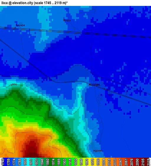
Below is the Elevation map of Ilıca, which displays elevation range with different colors. Scale of the first map is from 1745 to 2119 m (5725 to 6952 ft) with average elevation of 1801.6 meters (=5911 ft) [note 1]
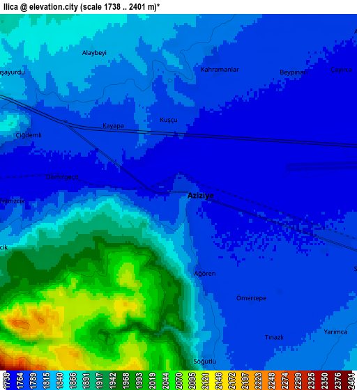
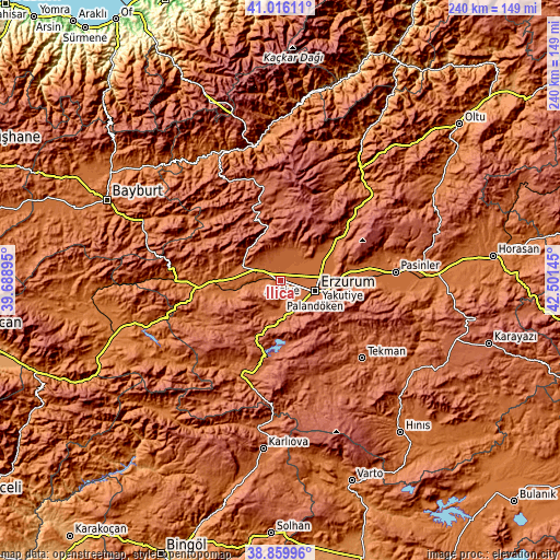
These maps also provides idea of topography and contour of this city, they are displayed at different zoom levels. More info about maps, scale and edge coordinates you can find below images.
| \ | Map #1 | Map #2 | Topo.Map |
| Scale [m] | 1745..2119 m | 1738..2401 m | × |
| Scale [ft] | 5725..6952 ft | 5702..7877 ft | × |
| Average | 1801.6 m = 5911 ft | 1832.9 m = 6013 ft | × |
| Width | 7.49 km = 4.7 mi | 14.98 km = 9.3 mi | 239.7 km = 148.9 mi |
| Height | 7.49 km = 4.7 mi | 14.98 km = 9.3 mi | 239.7 km = 148.9 mi |
| ↑Max Latitude | 39.980212° | 40.013878° | 41.01611° |
| Latitude at center | 39.94653° | 39.94653° | 39.94653° |
| ↓Min Latitude | 39.912831° | 39.879116° | 38.85996° |
| ← Min Longitude | 41.051255° | 41.007309° | 39.68895° |
| Longitude center | 41.0952° | 41.0952° | 41.0952° |
| →Max Longitude | 41.139145° | 41.183091° | 42.50145° |
Nearby cities:
Cities around Ilıca sort by population:
• Erzurum elevation 1914 m
16.1 km,  105°
105°
• Aşkale 1659 m
34.2 km,  265°
265°
• Kırık 2070 m
45 km,  340°
340°
• Çiftlik 1744 m
43.3 km,  245°
245°
• Çat 1894 m
39.3 km,  195°
195°
• Ovacık 2195 m
29.4 km, 343°
• Dumlu 1778 m
25.5 km,  60°
60°
• Kandilli 1745 m
22.5 km,  258°
258°
• Palandöken 1997 m
17.1 km, 112°
• Kazımkarabekir 1889 m
16.2 km,  102°
102°
• Yakutiye 1938 m
15.8 km, 109°
• Dadaşköy 1782 m
13.6 km,  90°
90°
Multilingual:
 En español:
Ilıca elevación 1768 m.
 En France:
Ilıca élévation 1768 m.


Sources and notes:
- [note 1] Map square and city borders are not equal. Map elevation data is calculated only from area inside that square.
- [src 1] Elevation data from geonames database provided with same terms of usage.
- [src 2] The elevation map of Ilıca is generated using elevation data from NASA's 3 arcsec (90m) resolution SRTM data.
- [src 3] Base (background) map © OpenStreetMap contributors tiles are generated by Geofabrik and OpenTopoMap.
Copyright & License:
This Ilıca Elevation Map is licensed under CC BY-SA. You may reuse any part from this page, if you give a proper credit by linking to this URL:
 More info on terms of use page.