Altpınar elevation
Altpınar (Ankara), Turkey elevation is 1062 meters and Altpınar elevation in feet is 3484 ft above sea level [src 1]. Altpınar is a populated place (feature code) with elevation that is 339 meters (1112 ft) bigger than average city elevation in Turkey.
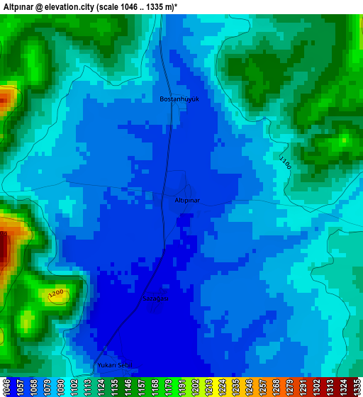
Below is the Elevation map of Altpınar, which displays elevation range with different colors. Scale of the first map is from 1046 to 1335 m (3432 to 4380 ft) with average elevation of 1098 meters (=3602 ft) [note 1]
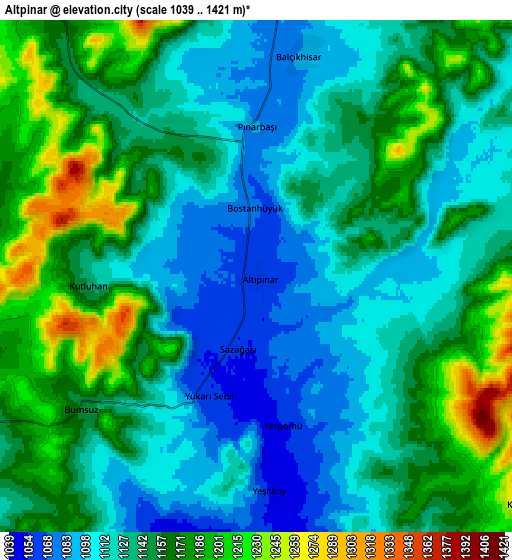
These maps also provides idea of topography and contour of this city, they are displayed at different zoom levels. More info about maps, scale and edge coordinates you can find below images.
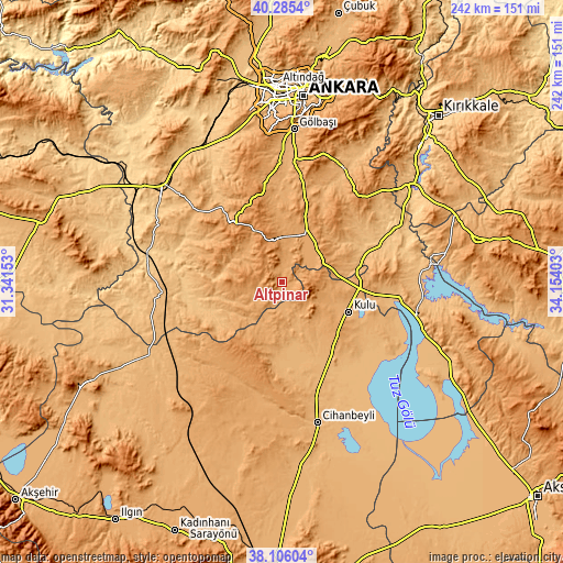
| \ | Map #1 | Map #2 | Topo.Map |
| Scale [m] | 1046..1335 m | 1039..1421 m | × |
| Scale [ft] | 3432..4380 ft | 3409..4662 ft | × |
| Average | 1098 m = 3602 ft | 1142.7 m = 3749 ft | × |
| Width | 7.57 km = 4.7 mi | 15.15 km = 9.4 mi | 242.3 km = 150.6 mi |
| Height | 7.57 km = 4.7 mi | 15.15 km = 9.4 mi | 242.3 km = 150.6 mi |
| ↑Max Latitude | 39.238215° | 39.272243° | 40.2854° |
| Latitude at center | 39.20417° | 39.20417° | 39.20417° |
| ↓Min Latitude | 39.170109° | 39.136031° | 38.10604° |
| ← Min Longitude | 32.703835° | 32.659889° | 31.34153° |
| Longitude center | 32.74778° | 32.74778° | 32.74778° |
| →Max Longitude | 32.791725° | 32.835671° | 34.15403° |
Nearby cities:
Cities around Altpınar sort by population:
• Polatlı elevation 855 m
66.6 km,  308°
308°
• Kulu 983 m
31.1 km,  112°
112°
• Cihanbeyli 977 m
62.3 km,  165°
165°
• Haymana 1210 m
33.3 km,  319°
319°
• Kuyulusebil 1072 m
64 km,  197°
197°
• Gölbaşı 990 m
65.4 km,  4°
4°
• Yenimehmetli 932 m
55.3 km,  295°
295°
• Bala 1314 m
50.6 km,  39°
39°
• Sülüklü 1031 m
50.2 km,  224°
224°
• İkizce 1120 m
44.1 km,  350°
350°
• Yeniceoba 964 m
37.4 km, 174°
• Yenice 1177 m
9.8 km, 323°
Multilingual:
 En español:
Altpınar elevación 1062 m.
 En France:
Altpınar élévation 1062 m.
 Auf Deutsch:
Altpınar höhe über dem Meeresspiegel ist 1062 m.

Sources and notes:
- [note 1] Map square and city borders are not equal. Map elevation data is calculated only from area inside that square.
- [src 1] Elevation data from geonames database provided with same terms of usage.
- [src 2] The elevation map of Altpınar is generated using elevation data from NASA's 3 arcsec (90m) resolution SRTM data.
- [src 3] Base (background) map © OpenStreetMap contributors tiles are generated by Geofabrik and OpenTopoMap.
Copyright & License:
This Altpınar Elevation Map is licensed under CC BY-SA. You may reuse any part from this page, if you give a proper credit by linking to this URL:
 More info on terms of use page.