güngören merter elevation
güngören merter (Istanbul), Turkey elevation is 51 meters and güngören merter elevation in feet is 167 ft above sea level [src 1]. güngören merter is a section of populated place (feature code) with elevation that is 672 meters (2205 ft) smaller than average city elevation in Turkey.
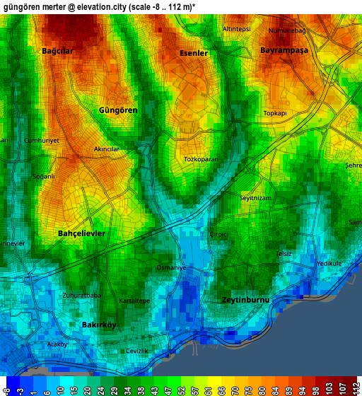
Below is the Elevation map of güngören merter, which displays elevation range with different colors. Scale of the first map is from -8 to 112 m (-26 to 367 ft) with average elevation of 44.2 meters (=145 ft) [note 1]
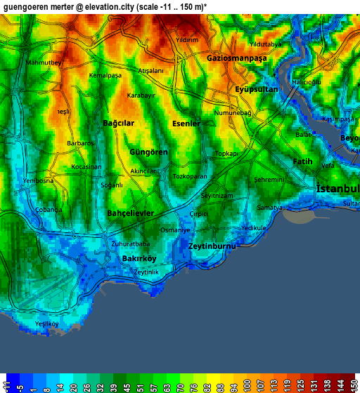
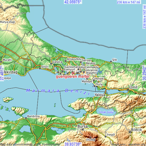
These maps also provides idea of topography and contour of this city, they are displayed at different zoom levels. More info about maps, scale and edge coordinates you can find below images.
| \ | Map #1 | Map #2 | Topo.Map |
| Scale [m] | -8..112 m | -11..150 m | × |
| Scale [ft] | -26..367 ft | -36..492 ft | × |
| Average | 44.2 m = 145 ft | 53.7 m = 176 ft | × |
| Width | 7.37 km = 4.6 mi | 14.75 km = 9.2 mi | 236 km = 146.6 mi |
| Height | 7.37 km = 4.6 mi | 14.75 km = 9.2 mi | 236 km = 146.6 mi |
| ↑Max Latitude | 41.040264° | 41.073401° | 42.05975° |
| Latitude at center | 41.00711° | 41.00711° | 41.00711° |
| ↓Min Latitude | 40.973939° | 40.940752° | 39.93739° |
| ← Min Longitude | 28.844005° | 28.800059° | 27.4817° |
| Longitude center | 28.88795° | 28.88795° | 28.88795° |
| →Max Longitude | 28.931895° | 28.975841° | 30.2942° |
Nearby cities:
Cities around güngören merter sort by population:
• Istanbul elevation 39 m
5.2 km,  81°
81°
• Bağcılar 105 m
4.4 km,  323°
323°
• Üsküdar 30 m
10.7 km, 80°
• Bahçelievler 73 m
2.4 km,  257°
257°
• Esenler 72 m
4.2 km,  346°
346°
• Sultangazi 144 m
11.2 km, 351°
• Şişli 119 m
10.2 km,  54°
54°
• Zeytinburnu 39 m
2 km,  136°
136°
• Başakşehir 107 m
12 km, 322°
• Eminönü 3 m
7.3 km, 80°
• Merter Keresteciler 61 m
0.7 km, 345°
• Mahmutbey 91 m
7.4 km,  314°
314°
Multilingual:
 En español:
güngören merter elevación 51 m.
 En France:
güngören merter élévation 51 m.
 Auf Deutsch:
güngören merter höhe über dem Meeresspiegel ist 51 m.

Sources and notes:
- [note 1] Map square and city borders are not equal. Map elevation data is calculated only from area inside that square.
- [src 1] Elevation data from geonames database provided with same terms of usage.
- [src 2] The elevation map of güngören merter is generated using elevation data from NASA's 3 arcsec (90m) resolution SRTM data.
- [src 3] Base (background) map © OpenStreetMap contributors tiles are generated by Geofabrik and OpenTopoMap.
Copyright & License:
This güngören merter Elevation Map is licensed under CC BY-SA. You may reuse any part from this page, if you give a proper credit by linking to this URL:
 More info on terms of use page.