Chorbane elevation
Chorbane (Al Mahdīyah), Tunisia elevation is 110 meters and Chorbane elevation in feet is 361 ft above sea level [src 1]. Chorbane is a populated place (feature code) with elevation that is 39 meters (128 ft) smaller than average city elevation in Tunisia.
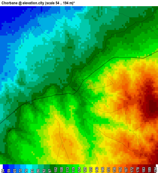
Below is the Elevation map of Chorbane, which displays elevation range with different colors. Scale of the first map is from 54 to 194 m (177 to 636 ft) with average elevation of 113.1 meters (=371 ft) [note 1]
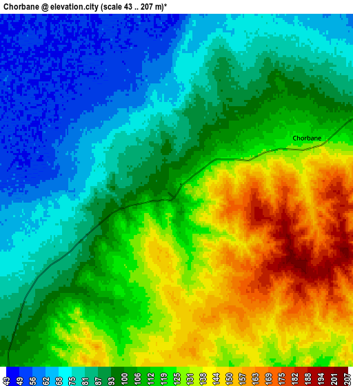
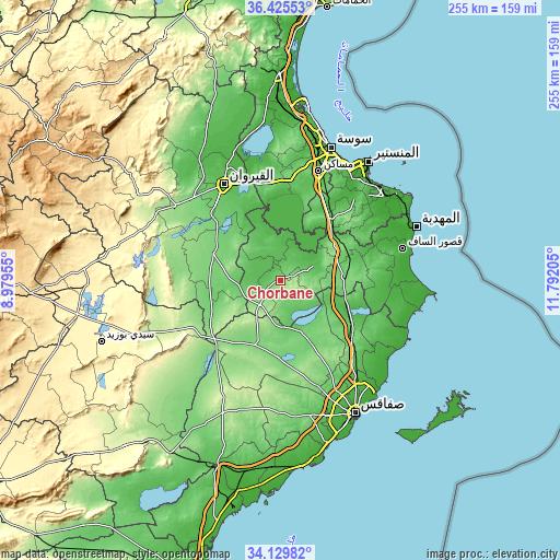
These maps also provides idea of topography and contour of this city, they are displayed at different zoom levels. More info about maps, scale and edge coordinates you can find below images.
| \ | Map #1 | Map #2 | Topo.Map |
| Scale [m] | 54..194 m | 43..207 m | × |
| Scale [ft] | 177..636 ft | 141..679 ft | × |
| Average | 113.1 m = 371 ft | 105.5 m = 346 ft | × |
| Width | 7.98 km = 5 mi | 15.95 km = 9.9 mi | 255.3 km = 158.6 mi |
| Height | 7.98 km = 5 mi | 15.95 km = 9.9 mi | 255.3 km = 158.6 mi |
| ↑Max Latitude | 35.321674° | 35.357522° | 36.42553° |
| Latitude at center | 35.28581° | 35.28581° | 35.28581° |
| ↓Min Latitude | 35.24993° | 35.214035° | 34.12982° |
| ← Min Longitude | 10.341855° | 10.297909° | 8.97955° |
| Longitude center | 10.3858° | 10.3858° | 10.3858° |
| →Max Longitude | 10.429745° | 10.473691° | 11.79205° |
Nearby cities:
Cities around Chorbane sort by population:
• Kairouan elevation 65 m
50.9 km,  328°
328°
• Msaken 47 m
52.4 km,  19°
19°
• Djemmal 30 m
50.3 km,  41°
41°
• El Jem 112 m
30.1 km,  86°
86°
• Ouardenine 63 m
53.8 km,  28°
28°
• Menzel Kamel 48 m
45.5 km, 34°
• Beni Hassane 51 m
49.5 km,  50°
50°
• Djebeniana 35 m
55.1 km,  120°
120°
• Sidi Alouane 58 m
51.2 km,  78°
78°
• Sidi Ben Nour 9 m
55.4 km,  60°
60°
• Mesdour 21 m
53.8 km, 35°
• Sidi el Hani 87 m
43.3 km,  351°
351°
Multilingual:
 En español:
Chorbane elevación 110 m.
 En France:
Chorbane élévation 110 m.
 Auf Deutsch:
Chorbane höhe über dem Meeresspiegel ist 110 m.

Sources and notes:
- [note 1] Map square and city borders are not equal. Map elevation data is calculated only from area inside that square.
- [src 1] Elevation data from geonames database provided with same terms of usage.
- [src 2] The elevation map of Chorbane is generated using elevation data from NASA's 3 arcsec (90m) resolution SRTM data.
- [src 3] Base (background) map © OpenStreetMap contributors tiles are generated by Geofabrik and OpenTopoMap.
Copyright & License:
This Chorbane Elevation Map is licensed under CC BY-SA. You may reuse any part from this page, if you give a proper credit by linking to this URL:
 More info on terms of use page.