Akdepe elevation
Akdepe (Daşoguz, Akdepe District), Turkmenistan elevation is 76 meters and Akdepe elevation in feet is 249 ft above sea level [src 1]. Akdepe is a seat of a second-order administrative division (feature code) with elevation that is 120 meters (394 ft) smaller than average city elevation in Turkmenistan.
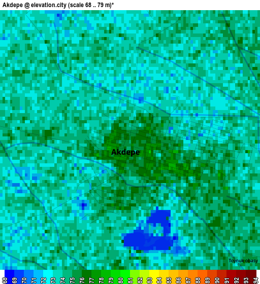
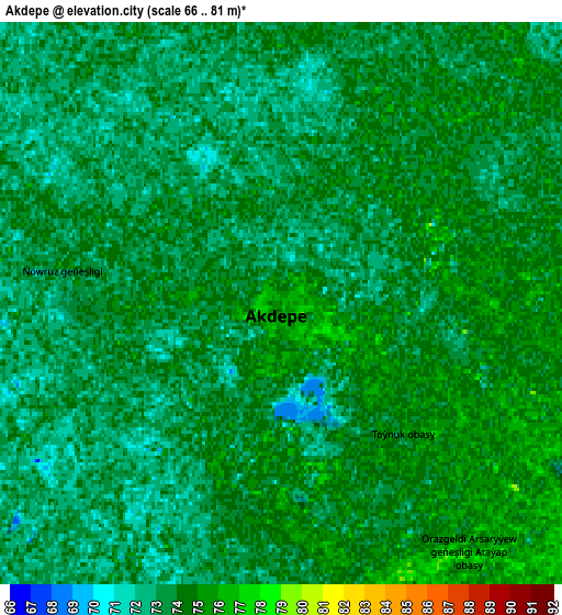
Below is the Elevation map of Akdepe, which displays elevation range with different colors. Scale of the first map is from 68 to 79 m (223 to 259 ft) with average elevation of 73.4 meters (=241 ft) [note 1]
These maps also provides idea of topography and contour of this city, they are displayed at different zoom levels. More info about maps, scale and edge coordinates you can find below images.
| \ | Map #1 | Map #2 | Topo.Map |
| Scale [m] | 68..79 m | 66..81 m | × |
| Scale [ft] | 223..259 ft | 217..266 ft | × |
| Average | 73.4 m = 241 ft | 73.4 m = 241 ft | × |
| Width | 7.26 km = 4.5 mi | 14.51 km = 9 mi | 232.2 km = 144.3 mi |
| Height | 7.26 km = 4.5 mi | 14.51 km = 9 mi | 232.2 km = 144.3 mi |
| ↑Max Latitude | 42.087751° | 42.120355° | 43.09068° |
| Latitude at center | 42.05513° | 42.05513° | 42.05513° |
| ↓Min Latitude | 42.022492° | 41.989838° | 41.00242° |
| ← Min Longitude | 59.334825° | 59.290879° | 57.97252° |
| Longitude center | 59.37877° | 59.37877° | 59.37877° |
| →Max Longitude | 59.422715° | 59.466661° | 60.78502° |
Nearby cities:
Cities around Akdepe sort by population:
• Daşoguz elevation 87 m
54.4 km,  116°
116°
• Köneürgench 71 m
35.5 km,  328°
328°
• Yylanly 80 m
33.3 km,  137°
137°
• Boldumsaz 81 m
25.4 km,  71°
71°
• Gazojak 123 m
194 km, 119°
• Tagta 86 m
63.3 km, 135°
Multilingual:
 En español:
Akdepe elevación 76 m.
 En France:
Akdepe élévation 76 m.


Sources and notes:
- [note 1] Map square and city borders are not equal. Map elevation data is calculated only from area inside that square.
- [src 1] Elevation data from geonames database provided with same terms of usage.
- [src 2] The elevation map of Akdepe is generated using elevation data from NASA's 3 arcsec (90m) resolution SRTM data.
- [src 3] Base (background) map © OpenStreetMap contributors tiles are generated by Geofabrik and OpenTopoMap.
Copyright & License:
This Akdepe Elevation Map is licensed under CC BY-SA. You may reuse any part from this page, if you give a proper credit by linking to this URL:
 More info on terms of use page.