Yylanly elevation
Yylanly (Daşoguz), Turkmenistan elevation is 80 meters and Yylanly elevation in feet is 262 ft above sea level [src 1]. Yylanly is a populated place (feature code) with elevation that is 116 meters (381 ft) smaller than average city elevation in Turkmenistan.
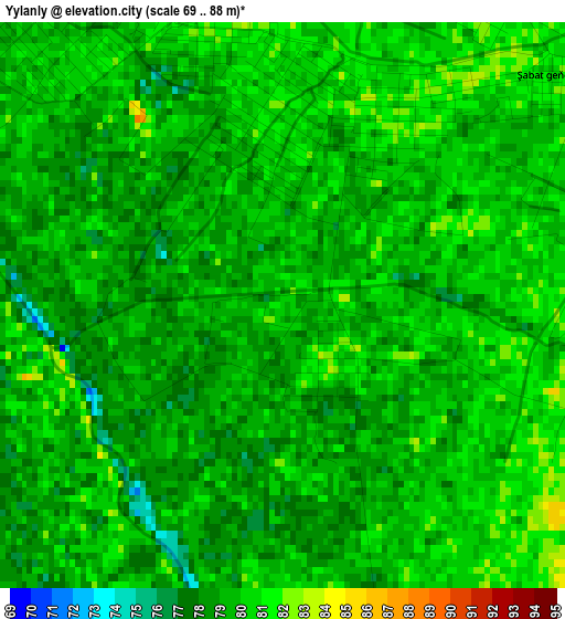
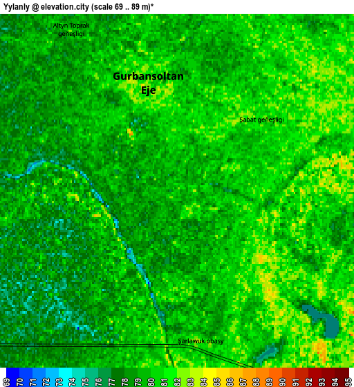
Below is the Elevation map of Yylanly, which displays elevation range with different colors. Scale of the first map is from 69 to 88 m (226 to 289 ft) with average elevation of 79.2 meters (=260 ft) [note 1]
These maps also provides idea of topography and contour of this city, they are displayed at different zoom levels. More info about maps, scale and edge coordinates you can find below images.
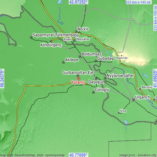
| \ | Map #1 | Map #2 | Topo.Map |
| Scale [m] | 69..88 m | 69..89 m | × |
| Scale [ft] | 226..289 ft | 226..292 ft | × |
| Average | 79.2 m = 260 ft | 79.2 m = 260 ft | × |
| Width | 7.28 km = 4.5 mi | 14.56 km = 9 mi | 233 km = 144.8 mi |
| Height | 7.28 km = 4.5 mi | 14.56 km = 9 mi | 233 km = 144.8 mi |
| ↑Max Latitude | 41.866065° | 41.898783° | 42.87252° |
| Latitude at center | 41.83333° | 41.83333° | 41.83333° |
| ↓Min Latitude | 41.800578° | 41.76781° | 40.77699° |
| ← Min Longitude | 59.606055° | 59.562109° | 58.24375° |
| Longitude center | 59.65° | 59.65° | 59.65° |
| →Max Longitude | 59.693945° | 59.737891° | 61.05625° |
Nearby cities:
Cities around Yylanly sort by population:
• Daşoguz elevation 87 m
26.2 km,  89°
89°
• Köneürgench 71 m
68.5 km,  323°
323°
• Boldumsaz 81 m
32.8 km,  3°
3°
• Gazojak 123 m
162.7 km,  116°
116°
• Tagta 86 m
30 km,  132°
132°
• Akdepe 76 m
33.3 km, 317°
Multilingual:
 En español:
Yylanly elevación 80 m.
 En France:
Yylanly élévation 80 m.


Sources and notes:
- [note 1] Map square and city borders are not equal. Map elevation data is calculated only from area inside that square.
- [src 1] Elevation data from geonames database provided with same terms of usage.
- [src 2] The elevation map of Yylanly is generated using elevation data from NASA's 3 arcsec (90m) resolution SRTM data.
- [src 3] Base (background) map © OpenStreetMap contributors tiles are generated by Geofabrik and OpenTopoMap.
Copyright & License:
This Yylanly Elevation Map is licensed under CC BY-SA. You may reuse any part from this page, if you give a proper credit by linking to this URL:
 More info on terms of use page.