Vose’ elevation
Vose’ (Khatlon), Tajikistan elevation is 472 meters and Vose’ elevation in feet is 1549 ft above sea level [src 1]. Vose’ is a seat of a second-order administrative division (feature code) with elevation that is 482 meters (1581 ft) smaller than average city elevation in Tajikistan.
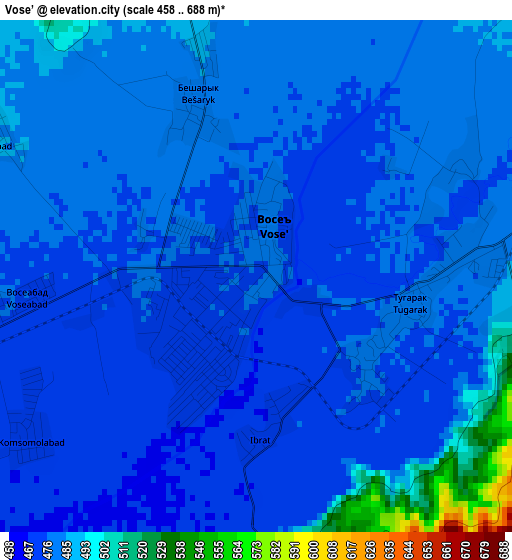
Below is the Elevation map of Vose’, which displays elevation range with different colors. Scale of the first map is from 458 to 688 m (1503 to 2257 ft) with average elevation of 480.2 meters (=1575 ft) [note 1]
These maps also provides idea of topography and contour of this city, they are displayed at different zoom levels. More info about maps, scale and edge coordinates you can find below images.
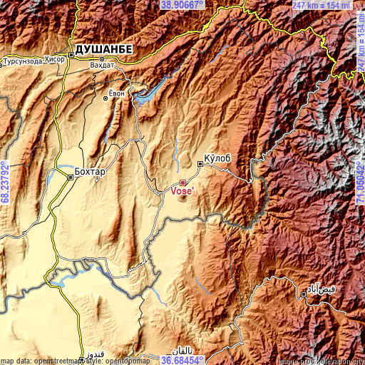
| \ | Map #1 | Map #2 | Topo.Map |
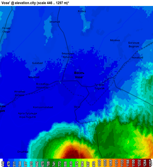
| Scale [m] | 458..688 m | 446..1297 m | × |
| Scale [ft] | 1503..2257 ft | 1463..4255 ft | × |
| Average | 480.2 m = 1575 ft | 551.3 m = 1809 ft | × |
| Width | 7.72 km = 4.8 mi | 15.44 km = 9.6 mi | 247.1 km = 153.5 mi |
| Height | 7.72 km = 4.8 mi | 15.44 km = 9.6 mi | 247.1 km = 153.5 mi |
| ↑Max Latitude | 37.838674° | 37.873371° | 38.90667° |
| Latitude at center | 37.80396° | 37.80396° | 37.80396° |
| ↓Min Latitude | 37.76923° | 37.734484° | 36.68454° |
| ← Min Longitude | 69.600225° | 69.556279° | 68.23792° |
| Longitude center | 69.64417° | 69.64417° | 69.64417° |
| →Max Longitude | 69.688115° | 69.732061° | 71.05042° |
Nearby cities:
Cities around Vose’ sort by population:
• Kŭlob elevation 609 m
17.4 km,  45°
45°
• Danghara 652 m
42 km,  320°
320°
• Farkhor 444 m
40.6 km,  211°
211°
• Chubek 514 m
21.7 km,  165°
165°
• Mŭ’minobod 1247 m
47.9 km, 45°
• Sovet 672 m
27.4 km,  349°
349°
• Kirov 445 m
69 km,  271°
271°
• Khovaling 1416 m
66.5 km,  25°
25°
• Sarband 476 m
63.8 km,  276°
276°
• Baljuvon 915 m
56.2 km,  2°
2°
• Shŭrobod 1979 m
35.8 km,  83°
83°
• Moskva 486 m
16 km,  184°
184°
Multilingual:
 En español:
Vose’ elevación 472 m.
 En France:
Vose’ élévation 472 m.


Sources and notes:
- [note 1] Map square and city borders are not equal. Map elevation data is calculated only from area inside that square.
- [src 1] Elevation data from geonames database provided with same terms of usage.
- [src 2] The elevation map of Vose’ is generated using elevation data from NASA's 3 arcsec (90m) resolution SRTM data.
- [src 3] Base (background) map © OpenStreetMap contributors tiles are generated by Geofabrik and OpenTopoMap.
Copyright & License:
This Vose’ Elevation Map is licensed under CC BY-SA. You may reuse any part from this page, if you give a proper credit by linking to this URL:
 More info on terms of use page.