Amnat Charoen elevation
Amnat Charoen, Thailand elevation is 161 meters and Amnat Charoen elevation in feet is 528 ft above sea level [src 1]. Amnat Charoen is a seat of a first-order administrative division (feature code) with elevation that is 36 meters (118 ft) bigger than average city elevation in Thailand.
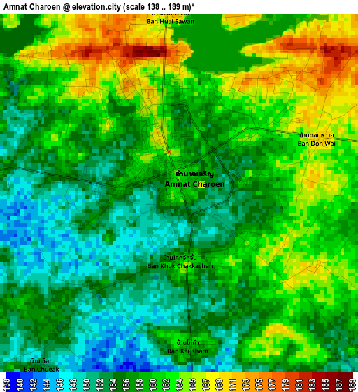
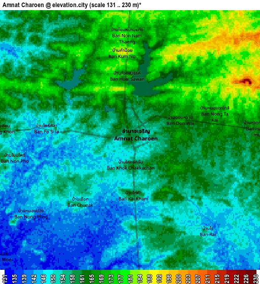
Below is the Elevation map of Amnat Charoen, which displays elevation range with different colors. Scale of the first map is from 138 to 189 m (453 to 620 ft) with average elevation of 158.4 meters (=520 ft) [note 1]
These maps also provides idea of topography and contour of this city, they are displayed at different zoom levels. More info about maps, scale and edge coordinates you can find below images.
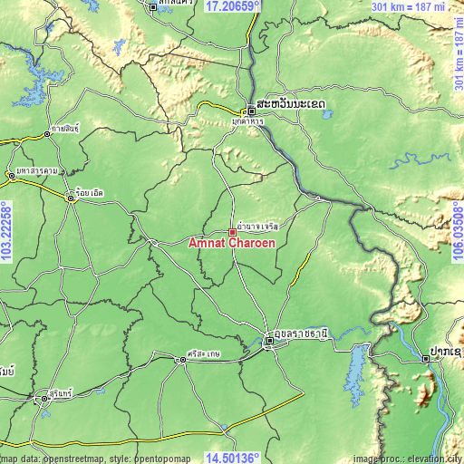
| \ | Map #1 | Map #2 | Topo.Map |
| Scale [m] | 138..189 m | 131..230 m | × |
| Scale [ft] | 453..620 ft | 430..755 ft | × |
| Average | 158.4 m = 520 ft | 158.8 m = 521 ft | × |
| Width | 9.4 km = 5.8 mi | 18.8 km = 11.7 mi | 300.8 km = 186.9 mi |
| Height | 9.4 km = 5.8 mi | 18.8 km = 11.7 mi | 300.8 km = 186.9 mi |
| ↑Max Latitude | 15.900778° | 15.943038° | 17.20659° |
| Latitude at center | 15.85851° | 15.85851° | 15.85851° |
| ↓Min Latitude | 15.816233° | 15.773947° | 14.50136° |
| ← Min Longitude | 104.584885° | 104.540939° | 103.22258° |
| Longitude center | 104.62883° | 104.62883° | 104.62883° |
| →Max Longitude | 104.672775° | 104.716721° | 106.03508° |
Nearby cities:
Cities around Amnat Charoen sort by population:
• Kham Khuean Kaeo elevation 132 m
41.2 km,  236°
236°
• Kut Khaopun 155 m
40.2 km,  100°
100°
• Muang Sam Sip 143 m
39.8 km,  164°
164°
• Loeng Nok Tha 164 m
39.6 km,  348°
348°
• Kut Chum 159 m
36.5 km,  302°
302°
• Thai Charoen 181 m
30.7 km,  318°
318°
• Phana 141 m
30.4 km,  130°
130°
• Pathum Ratchawongsa 182 m
29.8 km,  82°
82°
• Pa Tio 138 m
26.1 km,  263°
263°
• Hua Taphan 140 m
23.2 km,  219°
219°
• Senangkhanikhom 163 m
20.6 km,  12°
12°
• Lue Amnat 128 m
18.3 km,  173°
173°
Multilingual:
 En español:
Amnat Charoen elevación 161 m.
 En France:
Amnat Charoen élévation 161 m.
 Auf Deutsch:
Amnat Charoen höhe über dem Meeresspiegel ist 161 m.

Sources and notes:
- [note 1] Map square and city borders are not equal. Map elevation data is calculated only from area inside that square.
- [src 1] Elevation data from geonames database provided with same terms of usage.
- [src 2] The elevation map of Amnat Charoen is generated using elevation data from NASA's 3 arcsec (90m) resolution SRTM data.
- [src 3] Base (background) map © OpenStreetMap contributors tiles are generated by Geofabrik and OpenTopoMap.
Copyright & License:
This Amnat Charoen Elevation Map is licensed under CC BY-SA. You may reuse any part from this page, if you give a proper credit by linking to this URL:
 More info on terms of use page.