Aranyaprathet elevation
Aranyaprathet (Sa Kaeo), Thailand elevation is 48 meters and Aranyaprathet elevation in feet is 157 ft above sea level [src 1]. Aranyaprathet is a seat of a second-order administrative division (feature code) with elevation that is 77 meters (253 ft) smaller than average city elevation in Thailand.
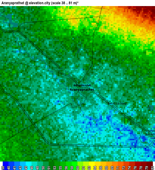
Below is the Elevation map of Aranyaprathet, which displays elevation range with different colors. Scale of the first map is from 38 to 81 m (125 to 266 ft) with average elevation of 51.9 meters (=170 ft) [note 1]
These maps also provides idea of topography and contour of this city, they are displayed at different zoom levels. More info about maps, scale and edge coordinates you can find below images.
| \ | Map #1 | Map #2 | Topo.Map |
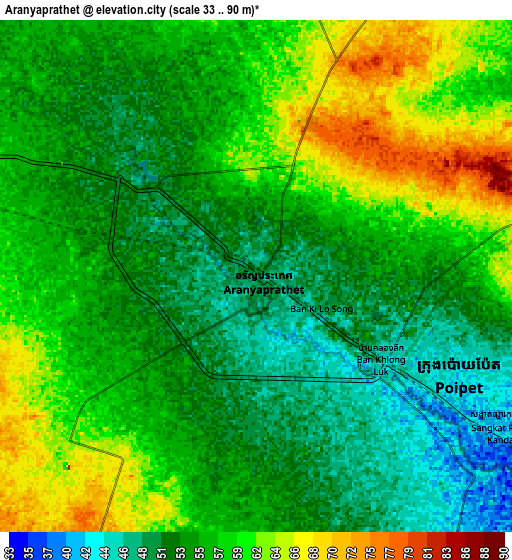
| Scale [m] | 38..81 m | 33..90 m | × |
| Scale [ft] | 125..266 ft | 108..295 ft | × |
| Average | 51.9 m = 170 ft | 55.8 m = 183 ft | × |
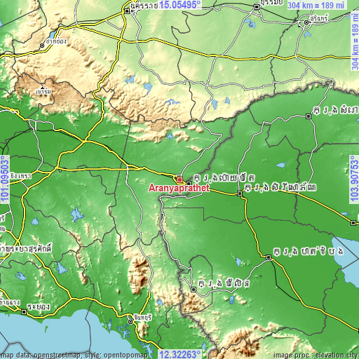
| Width | 9.49 km = 5.9 mi | 18.99 km = 11.8 mi | 303.8 km = 188.8 mi |
| Height | 9.49 km = 5.9 mi | 18.99 km = 11.8 mi | 303.8 km = 188.8 mi |
| ↑Max Latitude | 13.735452° | 13.778137° | 15.05495° |
| Latitude at center | 13.69276° | 13.69276° | 13.69276° |
| ↓Min Latitude | 13.65006° | 13.607352° | 12.32263° |
| ← Min Longitude | 102.457335° | 102.413389° | 101.09503° |
| Longitude center | 102.50128° | 102.50128° | 102.50128° |
| →Max Longitude | 102.545225° | 102.589171° | 103.90753° |
Nearby cities:
Cities around Aranyaprathet sort by population:
• Sa Kaeo elevation 41 m
48.3 km,  286°
286°
• Wang Nam Yen 112 m
40.5 km,  238°
238°
• Soeng Sang 266 m
81.7 km,  356°
356°
• Pa Kham 208 m
86.3 km,  16°
16°
• Non Din Daeng 245 m
74 km, 21°
• Soi Dao 242 m
70 km,  206°
206°
• Wang Sombun 119 m
49.8 km,  222°
222°
• Ta Phraya 76 m
47.6 km,  43°
43°
• Khao Chakan 62 m
44.8 km,  264°
264°
• Khlong Hat 150 m
34.6 km, 219°
• Khok Sung 66 m
20.8 km, 38°
• Watthana Nakhon 75 m
20.6 km, 286°
Multilingual:
 En español:
Aranyaprathet elevación 48 m.
 En France:
Amphoe Aranyaprathet élévation 48 m.
 Auf Deutsch:
Aranyaprathet höhe über dem Meeresspiegel ist 48 m.

Sources and notes:
- [note 1] Map square and city borders are not equal. Map elevation data is calculated only from area inside that square.
- [src 1] Elevation data from geonames database provided with same terms of usage.
- [src 2] The elevation map of Aranyaprathet is generated using elevation data from NASA's 3 arcsec (90m) resolution SRTM data.
- [src 3] Base (background) map © OpenStreetMap contributors tiles are generated by Geofabrik and OpenTopoMap.
Copyright & License:
This Aranyaprathet Elevation Map is licensed under CC BY-SA. You may reuse any part from this page, if you give a proper credit by linking to this URL:
 More info on terms of use page.