Ban Dung elevation
Ban Dung (Changwat Udon Thani), Thailand elevation is 178 meters and Ban Dung elevation in feet is 584 ft above sea level [src 1]. Ban Dung is a seat of a second-order administrative division (feature code) with elevation that is 53 meters (174 ft) bigger than average city elevation in Thailand.
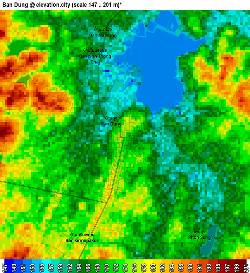
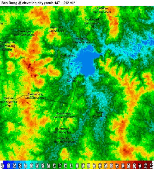
Below is the Elevation map of Ban Dung, which displays elevation range with different colors. Scale of the first map is from 147 to 201 m (482 to 659 ft) with average elevation of 169.6 meters (=556 ft) [note 1]
These maps also provides idea of topography and contour of this city, they are displayed at different zoom levels. More info about maps, scale and edge coordinates you can find below images.
| \ | Map #1 | Map #2 | Topo.Map |
| Scale [m] | 147..201 m | 147..212 m | × |
| Scale [ft] | 482..659 ft | 482..696 ft | × |
| Average | 169.6 m = 556 ft | 175.1 m = 574 ft | × |
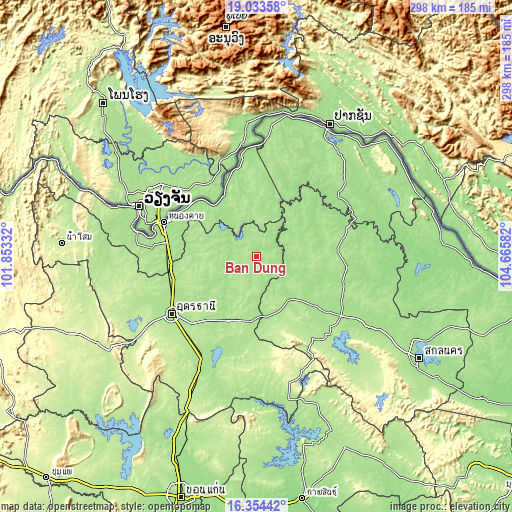
| Width | 9.31 km = 5.8 mi | 18.62 km = 11.6 mi | 297.9 km = 185.1 mi |
| Height | 9.31 km = 5.8 mi | 18.62 km = 11.6 mi | 297.9 km = 185.1 mi |
| ↑Max Latitude | 17.74086° | 17.782711° | 19.03358° |
| Latitude at center | 17.699° | 17.699° | 17.699° |
| ↓Min Latitude | 17.65713° | 17.61525° | 16.35442° |
| ← Min Longitude | 103.215625° | 103.171679° | 101.85332° |
| Longitude center | 103.25957° | 103.25957° | 103.25957° |
| →Max Longitude | 103.303515° | 103.347461° | 104.66582° |
Nearby cities:
Cities around Ban Dung sort by population:
• Sawang Daen Din elevation 169 m
32.5 km,  139°
139°
• Phon Charoen 170 m
38.5 km,  345°
345°
• Nong Han 173 m
41 km,  203°
203°
• Phon Phisai 167 m
40.7 km,  331°
331°
• Phonphisai 167 m
40.7 km, 331°
• Phen 180 m
37.4 km,  269°
269°
• Ban Muang 161 m
36.9 km,  62°
62°
• Fao Rai 186 m
35.8 km,  7°
7°
• Charoen Sin 175 m
32.6 km,  114°
114°
• Phibun Rak 182 m
26.8 km,  232°
232°
• Thung Fon 171 m
25.3 km,  179°
179°
• Sang Khom 172 m
22.7 km,  308°
308°
Multilingual:
 En español:
Ban Dung elevación 178 m.
 En France:
Ban Dung élévation 178 m.
 Auf Deutsch:
Ban Dung höhe über dem Meeresspiegel ist 178 m.

Sources and notes:
- [note 1] Map square and city borders are not equal. Map elevation data is calculated only from area inside that square.
- [src 1] Elevation data from geonames database provided with same terms of usage.
- [src 2] The elevation map of Ban Dung is generated using elevation data from NASA's 3 arcsec (90m) resolution SRTM data.
- [src 3] Base (background) map © OpenStreetMap contributors tiles are generated by Geofabrik and OpenTopoMap.
Copyright & License:
This Ban Dung Elevation Map is licensed under CC BY-SA. You may reuse any part from this page, if you give a proper credit by linking to this URL:
 More info on terms of use page.