Phon Charoen elevation
Phon Charoen (Nong Khai), Thailand elevation is 170 meters and Phon Charoen elevation in feet is 558 ft above sea level [src 1]. Phon Charoen is a populated place (feature code) with elevation that is 45 meters (148 ft) bigger than average city elevation in Thailand.
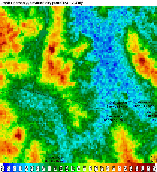
Below is the Elevation map of Phon Charoen, which displays elevation range with different colors. Scale of the first map is from 154 to 204 m (505 to 669 ft) with average elevation of 173.1 meters (=568 ft) [note 1]
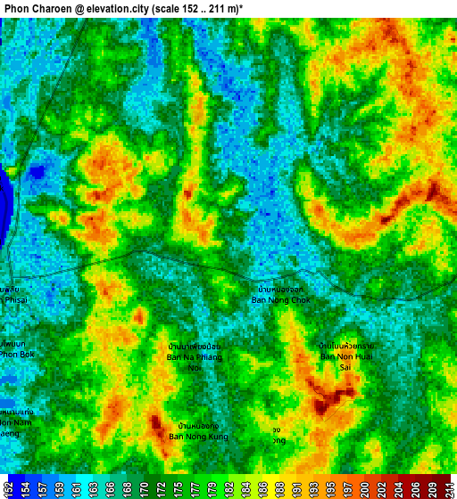
These maps also provides idea of topography and contour of this city, they are displayed at different zoom levels. More info about maps, scale and edge coordinates you can find below images.
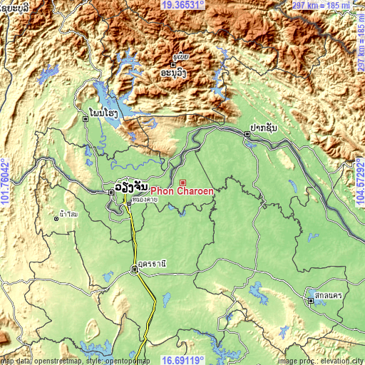
| \ | Map #1 | Map #2 | Topo.Map |
| Scale [m] | 154..204 m | 152..211 m | × |
| Scale [ft] | 505..669 ft | 499..692 ft | × |
| Average | 173.1 m = 568 ft | 175.2 m = 575 ft | × |
| Width | 9.29 km = 5.8 mi | 18.59 km = 11.6 mi | 297.3 km = 184.7 mi |
| Height | 9.29 km = 5.8 mi | 18.58 km = 11.5 mi | 297.4 km = 184.8 mi |
| ↑Max Latitude | 18.075112° | 18.116883° | 19.36531° |
| Latitude at center | 18.03333° | 18.03333° | 18.03333° |
| ↓Min Latitude | 17.991538° | 17.949737° | 16.69119° |
| ← Min Longitude | 103.122725° | 103.078779° | 101.76042° |
| Longitude center | 103.16667° | 103.16667° | 103.16667° |
| →Max Longitude | 103.210615° | 103.254561° | 104.57292° |
Nearby cities:
Cities around Phon Charoen sort by population:
• Nong Khai elevation 168 m
48.1 km,  249°
249°
• Ban Dung 178 m
38.5 km,  165°
165°
• Ban Muang 161 m
47.2 km,  115°
115°
• Phen 180 m
46.5 km,  216°
216°
• Pak Khat 166 m
33.6 km,  25°
25°
• Pakkhat 173 m
32.9 km, 26°
• So Phisai 173 m
29.6 km,  80°
80°
• Sang Khom 172 m
24.3 km,  198°
198°
• Rattanawapi 178 m
20.1 km,  3°
3°
• Fao Rai 186 m
14.6 km,  96°
96°
• Phon Phisai 167 m
9.6 km,  261°
261°
• Phonphisai 167 m
9.6 km, 261°
Multilingual:
 En español:
Phon Charoen elevación 170 m.
 En France:
Phon Charoen élévation 170 m.
 Auf Deutsch:
Phon Charoen höhe über dem Meeresspiegel ist 170 m.

Sources and notes:
- [note 1] Map square and city borders are not equal. Map elevation data is calculated only from area inside that square.
- [src 1] Elevation data from geonames database provided with same terms of usage.
- [src 2] The elevation map of Phon Charoen is generated using elevation data from NASA's 3 arcsec (90m) resolution SRTM data.
- [src 3] Base (background) map © OpenStreetMap contributors tiles are generated by Geofabrik and OpenTopoMap.
Copyright & License:
This Phon Charoen Elevation Map is licensed under CC BY-SA. You may reuse any part from this page, if you give a proper credit by linking to this URL:
 More info on terms of use page.