Kranuan elevation
Kranuan (Khon Kaen), Thailand elevation is 218 meters and Kranuan elevation in feet is 715 ft above sea level [src 1]. Kranuan is a seat of a second-order administrative division (feature code) with elevation that is 93 meters (305 ft) bigger than average city elevation in Thailand.
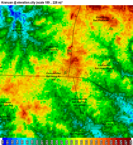
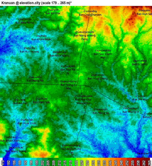
Below is the Elevation map of Kranuan, which displays elevation range with different colors. Scale of the first map is from 189 to 228 m (620 to 748 ft) with average elevation of 207.9 meters (=682 ft) [note 1]
These maps also provides idea of topography and contour of this city, they are displayed at different zoom levels. More info about maps, scale and edge coordinates you can find below images.
| \ | Map #1 | Map #2 | Topo.Map |
| Scale [m] | 189..228 m | 179..265 m | × |
| Scale [ft] | 620..748 ft | 587..869 ft | × |
| Average | 207.9 m = 682 ft | 207.4 m = 680 ft | × |
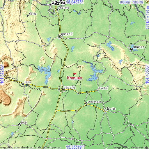
| Width | 9.36 km = 5.8 mi | 18.72 km = 11.6 mi | 299.5 km = 186.1 mi |
| Height | 9.36 km = 5.8 mi | 18.72 km = 11.6 mi | 299.5 km = 186.1 mi |
| ↑Max Latitude | 16.748806° | 16.790882° | 18.04875° |
| Latitude at center | 16.70672° | 16.70672° | 16.70672° |
| ↓Min Latitude | 16.664625° | 16.622521° | 15.35519° |
| ← Min Longitude | 103.034835° | 102.990889° | 101.67253° |
| Longitude center | 103.07878° | 103.07878° | 103.07878° |
| →Max Longitude | 103.122725° | 103.166671° | 104.48503° |
Nearby cities:
Cities around Kranuan sort by population:
• Khon Kaen elevation 167 m
39 km,  222°
222°
• Nong Kung Si 183 m
24.4 km,  104°
104°
• Yang Talat 148 m
46 km,  137°
137°
• Huai Mek 181 m
21.2 km,  127°
127°
• Kumphawapi 187 m
45.2 km,  351°
351°
• Non Sa-at 220 m
36.1 km,  326°
326°
• Si That 183 m
33.1 km,  26°
26°
• Chiang Yuen 177 m
33 km,  176°
176°
• Tha Khantho 178 m
31.4 km, 34°
• Nam Phong 172 m
23.8 km,  268°
268°
• Chuen Chom 200 m
19.8 km,  148°
148°
• Sam Sung 191 m
18.2 km, 179°
Multilingual:
 En español:
Kranuan elevación 218 m.
 En France:
Kranuan élévation 218 m.


Sources and notes:
- [note 1] Map square and city borders are not equal. Map elevation data is calculated only from area inside that square.
- [src 1] Elevation data from geonames database provided with same terms of usage.
- [src 2] The elevation map of Kranuan is generated using elevation data from NASA's 3 arcsec (90m) resolution SRTM data.
- [src 3] Base (background) map © OpenStreetMap contributors tiles are generated by Geofabrik and OpenTopoMap.
Copyright & License:
This Kranuan Elevation Map is licensed under CC BY-SA. You may reuse any part from this page, if you give a proper credit by linking to this URL:
 More info on terms of use page.