Kut Chap elevation
Kut Chap (Changwat Udon Thani), Thailand elevation is 197 meters and Kut Chap elevation in feet is 646 ft above sea level [src 1]. Kut Chap is a seat of a second-order administrative division (feature code) with elevation that is 72 meters (236 ft) bigger than average city elevation in Thailand.
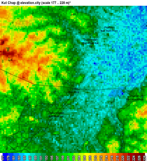
Below is the Elevation map of Kut Chap, which displays elevation range with different colors. Scale of the first map is from 177 to 228 m (581 to 748 ft) with average elevation of 195.6 meters (=642 ft) [note 1]
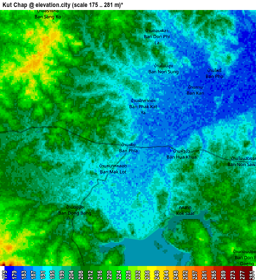
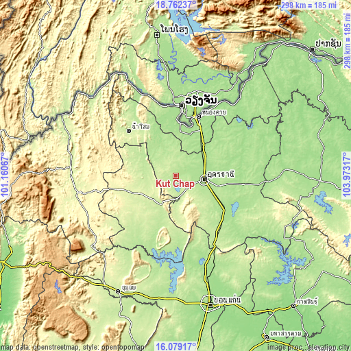
These maps also provides idea of topography and contour of this city, they are displayed at different zoom levels. More info about maps, scale and edge coordinates you can find below images.
| \ | Map #1 | Map #2 | Topo.Map |
| Scale [m] | 177..228 m | 175..281 m | × |
| Scale [ft] | 581..748 ft | 574..922 ft | × |
| Average | 195.6 m = 642 ft | 203.6 m = 668 ft | × |
| Width | 9.32 km = 5.8 mi | 18.65 km = 11.6 mi | 298.3 km = 185.4 mi |
| Height | 9.32 km = 5.8 mi | 18.65 km = 11.6 mi | 298.4 km = 185.4 mi |
| ↑Max Latitude | 17.467624° | 17.509538° | 18.76237° |
| Latitude at center | 17.4257° | 17.4257° | 17.4257° |
| ↓Min Latitude | 17.383767° | 17.341824° | 16.07917° |
| ← Min Longitude | 102.522975° | 102.479029° | 101.16067° |
| Longitude center | 102.56692° | 102.56692° | 102.56692° |
| →Max Longitude | 102.610865° | 102.654811° | 103.97317° |
Nearby cities:
Cities around Kut Chap sort by population:
• Udon Thani elevation 177 m
23.3 km,  92°
92°
• Tha Bo 182 m
47.2 km,  1°
1°
• Nong Bua Lamphu 217 m
28.1 km,  208°
208°
• Na Klang 253 m
42.2 km,  251°
251°
• Nong Wua So 239 m
29.3 km,  178°
178°
• Ban Na Muang 177 m
51.3 km,  113°
113°
• Phen 180 m
46.9 km,  50°
50°
• Nong Saeng 227 m
36.6 km,  141°
141°
• Suwannakhuha 225 m
34 km,  296°
296°
• Suwanna Khuha 225 m
34 km, 296°
• Sa Khrai 173 m
33.9 km,  35°
35°
• Ban Phue 187 m
30.7 km,  342°
342°
Multilingual:
 En español:
Kut Chap elevación 197 m.
 En France:
Kut Chap élévation 197 m.
 Auf Deutsch:
Kut Chap höhe über dem Meeresspiegel ist 197 m.

Sources and notes:
- [note 1] Map square and city borders are not equal. Map elevation data is calculated only from area inside that square.
- [src 1] Elevation data from geonames database provided with same terms of usage.
- [src 2] The elevation map of Kut Chap is generated using elevation data from NASA's 3 arcsec (90m) resolution SRTM data.
- [src 3] Base (background) map © OpenStreetMap contributors tiles are generated by Geofabrik and OpenTopoMap.
Copyright & License:
This Kut Chap Elevation Map is licensed under CC BY-SA. You may reuse any part from this page, if you give a proper credit by linking to this URL:
 More info on terms of use page.