Na Wa elevation
Na Wa (Nakhon Phanom), Thailand elevation is 160 meters and Na Wa elevation in feet is 525 ft above sea level [src 1]. Na Wa is a seat of a second-order administrative division (feature code) with elevation that is 35 meters (115 ft) bigger than average city elevation in Thailand.
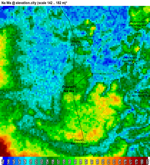
Below is the Elevation map of Na Wa, which displays elevation range with different colors. Scale of the first map is from 142 to 182 m (466 to 597 ft) with average elevation of 154.3 meters (=506 ft) [note 1]
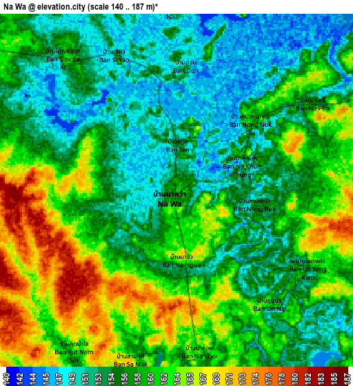
These maps also provides idea of topography and contour of this city, they are displayed at different zoom levels. More info about maps, scale and edge coordinates you can find below images.
| \ | Map #1 | Map #2 | Topo.Map |
| Scale [m] | 142..182 m | 140..187 m | × |
| Scale [ft] | 466..597 ft | 459..614 ft | × |
| Average | 154.3 m = 506 ft | 158 m = 518 ft | × |
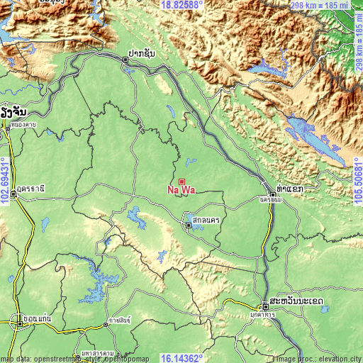
| Width | 9.32 km = 5.8 mi | 18.64 km = 11.6 mi | 298.2 km = 185.3 mi |
| Height | 9.32 km = 5.8 mi | 18.64 km = 11.6 mi | 298.3 km = 185.4 mi |
| ↑Max Latitude | 17.531609° | 17.573508° | 18.82588° |
| Latitude at center | 17.4897° | 17.4897° | 17.4897° |
| ↓Min Latitude | 17.447781° | 17.405853° | 16.14362° |
| ← Min Longitude | 104.056615° | 104.012669° | 102.69431° |
| Longitude center | 104.10056° | 104.10056° | 104.10056° |
| →Max Longitude | 104.144505° | 104.188451° | 105.50681° |
Nearby cities:
Cities around Na Wa sort by population:
• Sakon Nakhon elevation 165 m
36.9 km,  172°
172°
• Seka 158 m
51.2 km,  342°
342°
• Bueng Khong Long 181 m
52.7 km,  353°
353°
• Phang Khon 169 m
42.2 km,  254°
254°
• Wanon Niwat 165 m
40.2 km,  293°
293°
• Phon Na Kaeo 181 m
36 km,  146°
146°
• Nathom 162 m
32.9 km,  358°
358°
• Na Thom 162 m
32.8 km, 358°
• Phanna Nikhom 176 m
30.6 km,  240°
240°
• Kusuman 168 m
30.1 km,  125°
125°
• Si Songkhram 160 m
22.1 km,  46°
46°
• Akat Amnuai 155 m
17.3 km,  313°
313°
Multilingual:
 En español:
Na Wa elevación 160 m.
 En France:
Na Wa élévation 160 m.


Sources and notes:
- [note 1] Map square and city borders are not equal. Map elevation data is calculated only from area inside that square.
- [src 1] Elevation data from geonames database provided with same terms of usage.
- [src 2] The elevation map of Na Wa is generated using elevation data from NASA's 3 arcsec (90m) resolution SRTM data.
- [src 3] Base (background) map © OpenStreetMap contributors tiles are generated by Geofabrik and OpenTopoMap.
Copyright & License:
This Na Wa Elevation Map is licensed under CC BY-SA. You may reuse any part from this page, if you give a proper credit by linking to this URL:
 More info on terms of use page.