Phrai Bueng elevation
Phrai Bueng (Sisaket), Thailand elevation is 151 meters and Phrai Bueng elevation in feet is 495 ft above sea level [src 1]. Phrai Bueng is a seat of a second-order administrative division (feature code) with elevation that is 26 meters (85 ft) bigger than average city elevation in Thailand.
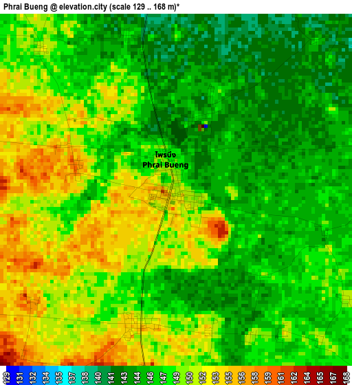
Below is the Elevation map of Phrai Bueng, which displays elevation range with different colors. Scale of the first map is from 129 to 168 m (423 to 551 ft) with average elevation of 147.6 meters (=484 ft) [note 1]
These maps also provides idea of topography and contour of this city, they are displayed at different zoom levels. More info about maps, scale and edge coordinates you can find below images.
| \ | Map #1 | Map #2 | Topo.Map |
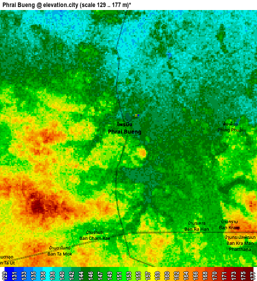
| Scale [m] | 129..168 m | 129..177 m | × |
| Scale [ft] | 423..551 ft | 423..581 ft | × |
| Average | 147.6 m = 484 ft | 148.8 m = 488 ft | × |
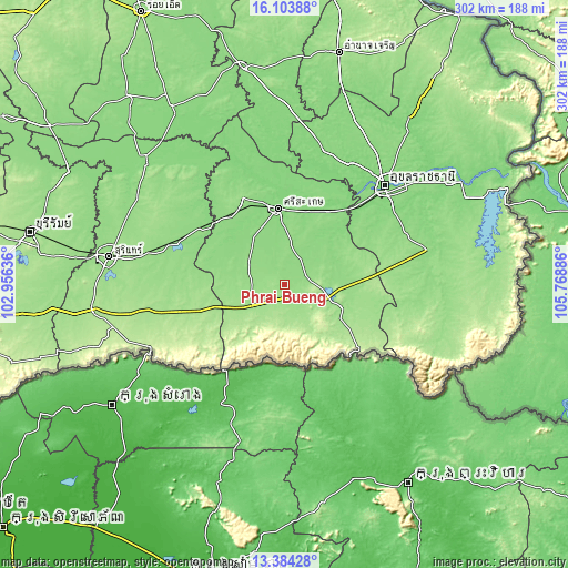
| Width | 9.45 km = 5.9 mi | 18.9 km = 11.7 mi | 302.4 km = 187.9 mi |
| Height | 9.45 km = 5.9 mi | 18.9 km = 11.7 mi | 302.4 km = 187.9 mi |
| ↑Max Latitude | 14.790823° | 14.833308° | 16.10388° |
| Latitude at center | 14.74833° | 14.74833° | 14.74833° |
| ↓Min Latitude | 14.705828° | 14.663319° | 13.38428° |
| ← Min Longitude | 104.318665° | 104.274719° | 102.95636° |
| Longitude center | 104.36261° | 104.36261° | 104.36261° |
| →Max Longitude | 104.406555° | 104.450501° | 105.76886° |
Nearby cities:
Cities around Phrai Bueng sort by population:
• Si Sa Ket elevation 134 m
40.9 km,  354°
354°
• Kantharalak 160 m
33.1 km,  111°
111°
• Prang Ku 142 m
36.7 km,  289°
289°
• Siao 144 m
33.5 km,  80°
80°
• Benchalak 144 m
33.5 km, 80°
• Phu Sing 193 m
33.4 km,  228°
228°
• Wang Hin 139 m
26.3 km,  327°
327°
• Nam Kliang 136 m
25.6 km,  39°
39°
• Khu Khan 155 m
18.1 km,  257°
257°
• Phayu 146 m
18.1 km,  9°
9°
• Khun Han 164 m
16 km,  155°
155°
• Si Rattana 144 m
12.5 km,  66°
66°
Multilingual:
 En español:
Phrai Bueng elevación 151 m.
 En France:
Phrai Bueng élévation 151 m.
 Auf Deutsch:
Phrai Bueng höhe über dem Meeresspiegel ist 151 m.

Sources and notes:
- [note 1] Map square and city borders are not equal. Map elevation data is calculated only from area inside that square.
- [src 1] Elevation data from geonames database provided with same terms of usage.
- [src 2] The elevation map of Phrai Bueng is generated using elevation data from NASA's 3 arcsec (90m) resolution SRTM data.
- [src 3] Base (background) map © OpenStreetMap contributors tiles are generated by Geofabrik and OpenTopoMap.
Copyright & License:
This Phrai Bueng Elevation Map is licensed under CC BY-SA. You may reuse any part from this page, if you give a proper credit by linking to this URL:
 More info on terms of use page.