Prasat elevation
Prasat (Surin), Thailand elevation is 171 meters and Prasat elevation in feet is 561 ft above sea level [src 1]. Prasat is a seat of a second-order administrative division (feature code) with elevation that is 46 meters (151 ft) bigger than average city elevation in Thailand.
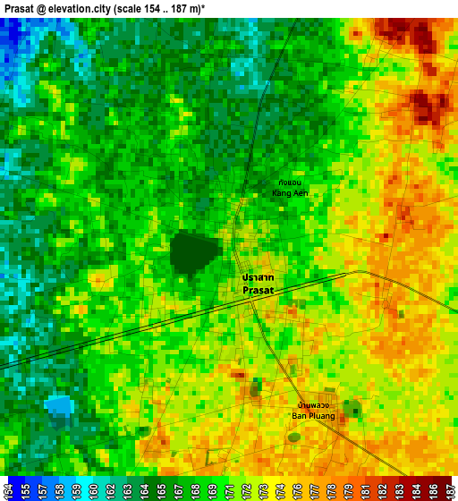
Below is the Elevation map of Prasat, which displays elevation range with different colors. Scale of the first map is from 154 to 187 m (505 to 614 ft) with average elevation of 169.9 meters (=557 ft) [note 1]
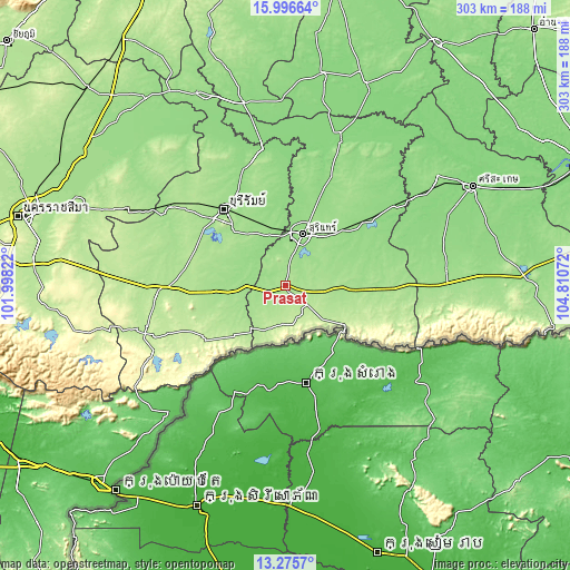
These maps also provides idea of topography and contour of this city, they are displayed at different zoom levels. More info about maps, scale and edge coordinates you can find below images.
| \ | Map #1 | Topo.Map |
| Scale [m] | 154..187 m | × |
| Scale [ft] | 505..614 ft | × |
| Average | 169.9 m = 557 ft | × |
| Width | 9.46 km = 5.9 mi | 302.5 km = 188 mi |
| Height | 9.46 km = 5.9 mi | 302.6 km = 188 mi |
| ↑Max Latitude | 14.682904° | 15.99664° |
| Latitude at center | 14.64039° | 14.64039° |
| ↓Min Latitude | 14.597867° | 13.2757° |
| ← Min Longitude | 103.360525° | 101.99822° |
| Longitude center | 103.40447° | 103.40447° |
| →Max Longitude | 103.448415° | 104.81072° |
Nearby cities:
Cities around Prasat sort by population:
• Surin elevation 150 m
28.5 km,  19°
19°
• Prakhon Chai 166 m
30.8 km,  262°
262°
• Sangkha 168 m
48.2 km,  90°
90°
• Khwao Sinarin 150 m
45 km,  26°
26°
• Huai Rat 162 m
42.4 km,  326°
326°
• Ban Kruat 195 m
40.7 km,  233°
233°
• Prakhon Chai 165 m
35.1 km, 264°
• Krasang 155 m
33.3 km,  341°
341°
• Lamduan 159 m
29.9 km,  72°
72°
• Kap Choeng 207 m
27.5 km,  132°
132°
• Phlapphla Chai 161 m
27.4 km,  291°
291°
• Phanom Dong Rak 193 m
24.1 km,  206°
206°
Multilingual:
 En español:
Prasat elevación 171 m.
 En France:
Prasat élévation 171 m.


Sources and notes:
- [note 1] Map square and city borders are not equal. Map elevation data is calculated only from area inside that square.
- [src 1] Elevation data from geonames database provided with same terms of usage.
- [src 2] The elevation map of Prasat is generated using elevation data from NASA's 3 arcsec (90m) resolution SRTM data.
- [src 3] Base (background) map © OpenStreetMap contributors tiles are generated by Geofabrik and OpenTopoMap.
Copyright & License:
This Prasat Elevation Map is licensed under CC BY-SA. You may reuse any part from this page, if you give a proper credit by linking to this URL:
 More info on terms of use page.