Roi Et elevation
Roi Et, Thailand elevation is 148 meters and Roi Et elevation in feet is 486 ft above sea level [src 1]. Roi Et is a seat of a first-order administrative division (feature code) with elevation that is 23 meters (75 ft) bigger than average city elevation in Thailand.
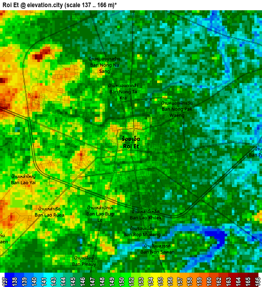
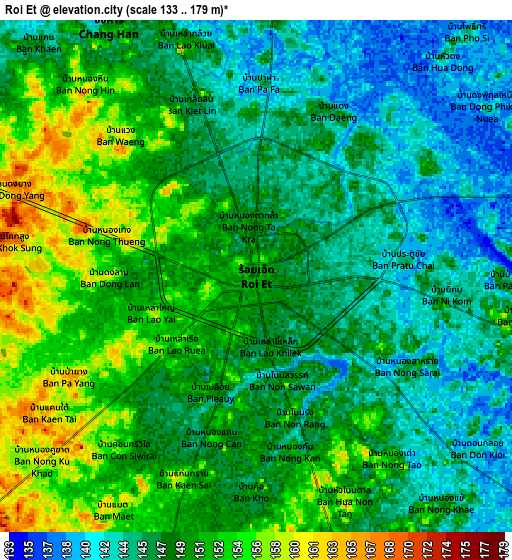
Below is the Elevation map of Roi Et, which displays elevation range with different colors. Scale of the first map is from 137 to 166 m (449 to 545 ft) with average elevation of 148.1 meters (=486 ft) [note 1]
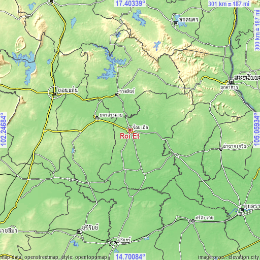
These maps also provides idea of topography and contour of this city, they are displayed at different zoom levels. More info about maps, scale and edge coordinates you can find below images.
| \ | Map #1 | Map #2 | Topo.Map |
| Scale [m] | 137..166 m | 133..179 m | × |
| Scale [ft] | 449..545 ft | 436..587 ft | × |
| Average | 148.1 m = 486 ft | 148.5 m = 487 ft | × |
| Width | 9.39 km = 5.8 mi | 18.78 km = 11.7 mi | 300.5 km = 186.7 mi |
| Height | 9.39 km = 5.8 mi | 18.78 km = 11.7 mi | 300.5 km = 186.7 mi |
| ↑Max Latitude | 16.098926° | 16.141144° | 17.40339° |
| Latitude at center | 16.0567° | 16.0567° | 16.0567° |
| ↓Min Latitude | 16.014465° | 15.97222° | 14.70084° |
| ← Min Longitude | 103.609145° | 103.565199° | 102.24684° |
| Longitude center | 103.65309° | 103.65309° | 103.65309° |
| →Max Longitude | 103.697035° | 103.740981° | 105.05934° |
Nearby cities:
Cities around Roi Et sort by population:
• Ban Selaphum elevation 133 m
32 km,  97°
97°
• Khong Chai 148 m
30.7 km,  317°
317°
• Selaphum 144 m
30.6 km, 95°
• Kae Dam 166 m
28.9 km,  262°
262°
• Mueang Suang 157 m
27.3 km,  162°
162°
• Rong Kham 147 m
25.7 km,  22°
22°
• Chaturaphak Phiman 145 m
25.6 km,  203°
203°
• Thung Khao Luang 131 m
23.5 km,  107°
107°
• Si Somdet 180 m
18.8 km,  249°
249°
• Chiang Khwan 139 m
16 km,  42°
42°
• Changhan 150 m
10.5 km,  330°
330°
• Thawat Buri 146 m
10.2 km, 101°
Multilingual:
 En español:
Roi Et elevación 148 m.
 En France:
Roi Et élévation 148 m.


Sources and notes:
- [note 1] Map square and city borders are not equal. Map elevation data is calculated only from area inside that square.
- [src 1] Elevation data from geonames database provided with same terms of usage.
- [src 2] The elevation map of Roi Et is generated using elevation data from NASA's 3 arcsec (90m) resolution SRTM data.
- [src 3] Base (background) map © OpenStreetMap contributors tiles are generated by Geofabrik and OpenTopoMap.
Copyright & License:
This Roi Et Elevation Map is licensed under CC BY-SA. You may reuse any part from this page, if you give a proper credit by linking to this URL:
 More info on terms of use page.