Massakory elevation
Massakory (Hadjer-Lamis), Chad elevation is 287 meters and Massakory elevation in feet is 942 ft above sea level [src 1]. Massakory is a seat of a first-order administrative division (feature code) with elevation that is 153 meters (502 ft) smaller than average city elevation in Chad.
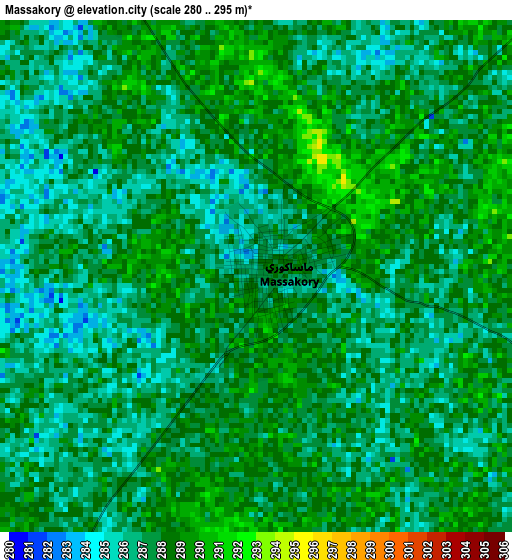
Below is the Elevation map of Massakory, which displays elevation range with different colors. Scale of the first map is from 280 to 295 m (919 to 968 ft) with average elevation of 287.2 meters (=942 ft) [note 1]
These maps also provides idea of topography and contour of this city, they are displayed at different zoom levels. More info about maps, scale and edge coordinates you can find below images.
| \ | Map #1 | Map #2 | Topo.Map |
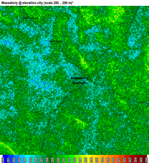
| Scale [m] | 280..295 m | 280..296 m | × |
| Scale [ft] | 919..968 ft | 919..971 ft | × |
| Average | 287.2 m = 942 ft | 287.9 m = 945 ft | × |
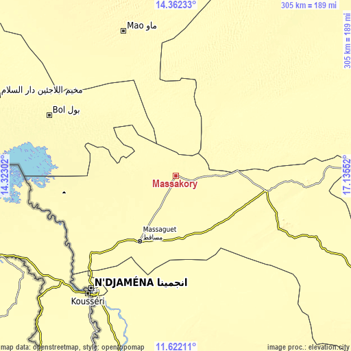
| Width | 9.52 km = 5.9 mi | 19.04 km = 11.8 mi | 304.7 km = 189.3 mi |
| Height | 9.52 km = 5.9 mi | 19.04 km = 11.8 mi | 304.7 km = 189.3 mi |
| ↑Max Latitude | 13.038816° | 13.081625° | 14.36233° |
| Latitude at center | 12.996° | 12.996° | 12.996° |
| ↓Min Latitude | 12.953177° | 12.910346° | 11.62211° |
| ← Min Longitude | 15.685325° | 15.641379° | 14.32302° |
| Longitude center | 15.72927° | 15.72927° | 15.72927° |
| →Max Longitude | 15.773215° | 15.817161° | 17.13552° |
Nearby cities:
Cities around Massakory sort by population:
• N'Djamena elevation 299 m
123.7 km,  216°
216°
• Ati 336 m
283.3 km,  85°
85°
• Bitkine 468 m
292.4 km,  112°
112°
• Mao 339 m
133.1 km,  340°
340°
• Massaguet 292 m
66 km,  208°
208°
• Dourbali 305 m
133.1 km,  173°
173°
• Moussoro 304 m
109.2 km,  48°
48°
• Bokoro 300 m
159.7 km,  115°
115°
• Ngama 326 m
206.3 km,  130°
130°
• Bol 293 m
121.8 km,  295°
295°
• Guelendeng 321 m
231.9 km,  184°
184°
• Massenya 327 m
183.4 km,  164°
164°
Multilingual:
 En español:
Massakory elevación 287 m.
 En France:
Massakory élévation 287 m.
 Auf Deutsch:
Massakory höhe über dem Meeresspiegel ist 287 m.

Sources and notes:
- [note 1] Map square and city borders are not equal. Map elevation data is calculated only from area inside that square.
- [src 1] Elevation data from geonames database provided with same terms of usage.
- [src 2] The elevation map of Massakory is generated using elevation data from NASA's 3 arcsec (90m) resolution SRTM data.
- [src 3] Base (background) map © OpenStreetMap contributors tiles are generated by Geofabrik and OpenTopoMap.
Copyright & License:
This Massakory Elevation Map is licensed under CC BY-SA. You may reuse any part from this page, if you give a proper credit by linking to this URL:
 More info on terms of use page.