As-Suwayda elevation
As-Suwayda, Syria elevation is 1068 meters and As-Suwayda elevation in feet is 3504 ft above sea level [src 1]. As-Suwayda is a seat of a first-order administrative division (feature code) with elevation that is 539 meters (1768 ft) bigger than average city elevation in Syria.
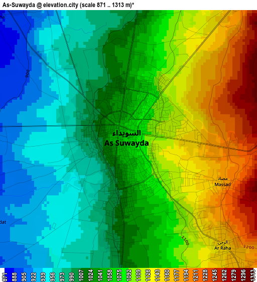
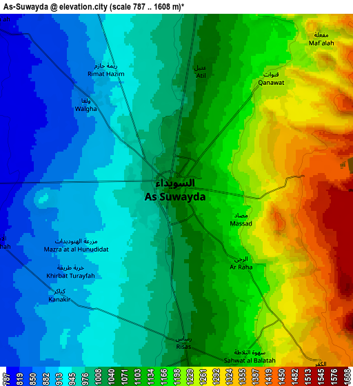
Below is the Elevation map of As-Suwayda, which displays elevation range with different colors. Scale of the first map is from 871 to 1313 m (2858 to 4308 ft) with average elevation of 1049.3 meters (=3443 ft) [note 1]
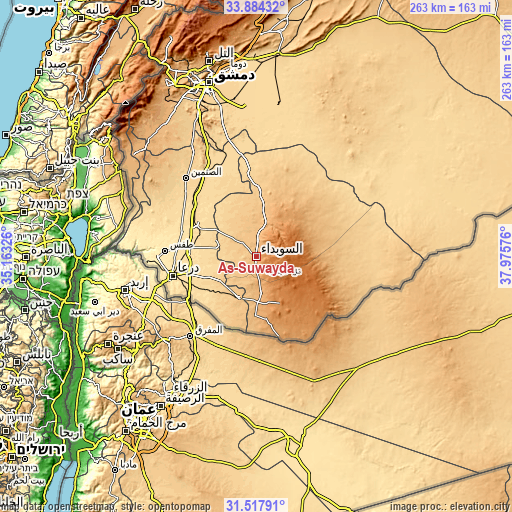
These maps also provides idea of topography and contour of this city, they are displayed at different zoom levels. More info about maps, scale and edge coordinates you can find below images.
| \ | Map #1 | Map #2 | Topo.Map |
| Scale [m] | 871..1313 m | 787..1608 m | × |
| Scale [ft] | 2858..4308 ft | 2582..5276 ft | × |
| Average | 1049.3 m = 3443 ft | 1070.1 m = 3511 ft | × |
| Width | 8.22 km = 5.1 mi | 16.45 km = 10.2 mi | 263.1 km = 163.5 mi |
| Height | 8.22 km = 5.1 mi | 16.45 km = 10.2 mi | 263.1 km = 163.5 mi |
| ↑Max Latitude | 32.745929° | 32.782883° | 33.88432° |
| Latitude at center | 32.70896° | 32.70896° | 32.70896° |
| ↓Min Latitude | 32.671976° | 32.634976° | 31.51791° |
| ← Min Longitude | 36.525565° | 36.481619° | 35.16326° |
| Longitude center | 36.56951° | 36.56951° | 36.56951° |
| →Max Longitude | 36.613455° | 36.657401° | 37.97576° |
Nearby cities:
Cities around As-Suwayda sort by population:
• Al Ḩarāk elevation 635 m
24.7 km,  280°
280°
• Shahbā 1083 m
17.2 km,  18°
18°
• Şalākhid 885 m
18.2 km,  0°
0°
• Buşrá ash Shām 844 m
22.5 km,  201°
201°
• Al Jīzah 650 m
28.4 km,  236°
236°
• Şalkhad 1383 m
27.5 km,  151°
151°
• Shaqqā 1193 m
24.1 km,  29°
29°
• Al Musayfirah 695 m
23.2 km,  248°
248°
• ‘Arīqah 804 m
21.7 km,  338°
338°
• Al Mushannaf 1514 m
19.5 km,  80°
80°
• Al Qurayyā 1059 m
18.6 km,  171°
171°
• Al Mazra‘ah 800 m
12 km,  313°
313°
Multilingual:
 En español:
As-Suwayda elevación 1068 m.
 En France:
Soueïda élévation 1068 m.
 Auf Deutsch:
As-Suwayda höhe über dem Meeresspiegel ist 1068 m.

Sources and notes:
- [note 1] Map square and city borders are not equal. Map elevation data is calculated only from area inside that square.
- [src 1] Elevation data from geonames database provided with same terms of usage.
- [src 2] The elevation map of As-Suwayda is generated using elevation data from NASA's 3 arcsec (90m) resolution SRTM data.
- [src 3] Base (background) map © OpenStreetMap contributors tiles are generated by Geofabrik and OpenTopoMap.
Copyright & License:
This As-Suwayda Elevation Map is licensed under CC BY-SA. You may reuse any part from this page, if you give a proper credit by linking to this URL:
 More info on terms of use page.