Ath Thawrah elevation
Ath Thawrah (Ar-Raqqah), Syria elevation is 342 meters and Ath Thawrah elevation in feet is 1122 ft above sea level [src 1]. Ath Thawrah is a seat of a second-order administrative division (feature code) with elevation that is 187 meters (614 ft) smaller than average city elevation in Syria.
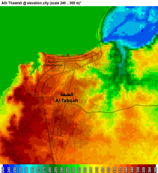
Below is the Elevation map of Ath Thawrah, which displays elevation range with different colors. Scale of the first map is from 240 to 369 m (787 to 1211 ft) with average elevation of 318 meters (=1043 ft) [note 1]
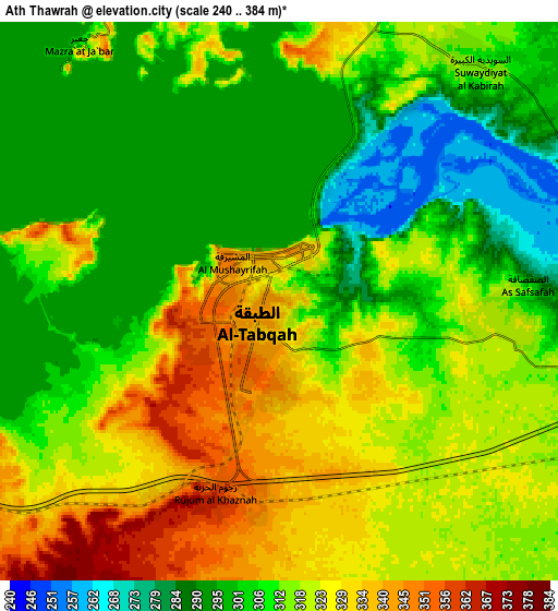
These maps also provides idea of topography and contour of this city, they are displayed at different zoom levels. More info about maps, scale and edge coordinates you can find below images.
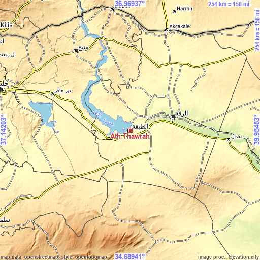
| \ | Map #1 | Map #2 | Topo.Map |
| Scale [m] | 240..369 m | 240..384 m | × |
| Scale [ft] | 787..1211 ft | 787..1260 ft | × |
| Average | 318 m = 1043 ft | 314.7 m = 1032 ft | × |
| Width | 7.92 km = 4.9 mi | 15.84 km = 9.8 mi | 253.5 km = 157.5 mi |
| Height | 7.92 km = 4.9 mi | 15.84 km = 9.8 mi | 253.5 km = 157.5 mi |
| ↑Max Latitude | 35.873198° | 35.908799° | 36.96937° |
| Latitude at center | 35.83758° | 35.83758° | 35.83758° |
| ↓Min Latitude | 35.801946° | 35.766297° | 34.68941° |
| ← Min Longitude | 38.504335° | 38.460389° | 37.14203° |
| Longitude center | 38.54828° | 38.54828° | 38.54828° |
| →Max Longitude | 38.592225° | 38.636171° | 39.95453° |
Nearby cities:
Cities around Ath Thawrah sort by population:
• Ar Raqqah elevation 259 m
43.3 km,  72°
72°
• Dayr Ḩāfir 349 m
83.5 km,  295°
295°
• Rasm al Ḩarmal 386 m
87.5 km, 301°
• Şirrīn ash Shamālīyah 353 m
86.5 km,  344°
344°
• Abū Qalqal 398 m
77.1 km,  330°
330°
• ‘Ayn ‘Īsá 340 m
67.1 km,  24°
24°
• Al Karāmah 244 m
65.9 km,  86°
86°
• Al Khafsah 355 m
64.5 km,  312°
312°
• As Sabkhah 251 m
64.5 km, 92°
• Maskanah 376 m
47.8 km,  287°
287°
• Al Jarnīyah 376 m
45.7 km,  321°
321°
• Al Manşūrah 269 m
17.5 km, 89°
Multilingual:
 En español:
Ath Thawrah elevación 342 m.
 En France:
Ath Thawrah élévation 342 m.
 Auf Deutsch:
Ath Thawrah höhe über dem Meeresspiegel ist 342 m.

Sources and notes:
- [note 1] Map square and city borders are not equal. Map elevation data is calculated only from area inside that square.
- [src 1] Elevation data from geonames database provided with same terms of usage.
- [src 2] The elevation map of Ath Thawrah is generated using elevation data from NASA's 3 arcsec (90m) resolution SRTM data.
- [src 3] Base (background) map © OpenStreetMap contributors tiles are generated by Geofabrik and OpenTopoMap.
Copyright & License:
This Ath Thawrah Elevation Map is licensed under CC BY-SA. You may reuse any part from this page, if you give a proper credit by linking to this URL:
 More info on terms of use page.