Tādif elevation
Tādif (Aleppo), Syria elevation is 440 meters and Tādif elevation in feet is 1444 ft above sea level [src 1]. Tādif is a seat of a third-order administrative division (feature code) with elevation that is 89 meters (292 ft) smaller than average city elevation in Syria.
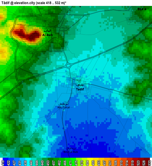
Below is the Elevation map of Tādif, which displays elevation range with different colors. Scale of the first map is from 418 to 532 m (1371 to 1745 ft) with average elevation of 445.6 meters (=1462 ft) [note 1]
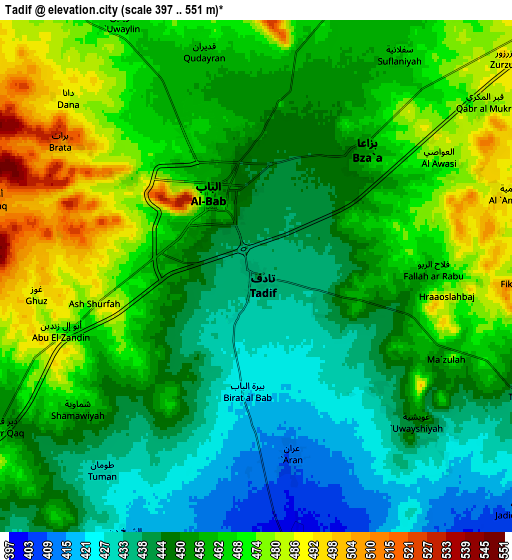
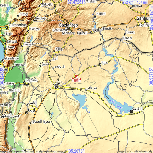
These maps also provides idea of topography and contour of this city, they are displayed at different zoom levels. More info about maps, scale and edge coordinates you can find below images.
| \ | Map #1 | Map #2 | Topo.Map |
| Scale [m] | 418..532 m | 397..551 m | × |
| Scale [ft] | 1371..1745 ft | 1302..1808 ft | × |
| Average | 445.6 m = 1462 ft | 456.1 m = 1496 ft | × |
| Width | 7.87 km = 4.9 mi | 15.74 km = 9.8 mi | 251.9 km = 156.5 mi |
| Height | 7.87 km = 4.9 mi | 15.74 km = 9.8 mi | 251.9 km = 156.5 mi |
| ↑Max Latitude | 36.383527° | 36.418898° | 37.47251° |
| Latitude at center | 36.34814° | 36.34814° | 36.34814° |
| ↓Min Latitude | 36.312737° | 36.277318° | 35.2073° |
| ← Min Longitude | 37.486955° | 37.443009° | 36.12465° |
| Longitude center | 37.5309° | 37.5309° | 37.5309° |
| →Max Longitude | 37.574845° | 37.618791° | 38.93715° |
Nearby cities:
Cities around Tādif sort by population:
• Aleppo elevation 401 m
36.9 km,  243°
243°
• Al Bāb 460 m
2.8 km,  331°
331°
• As Safīrah 337 m
33.3 km,  205°
205°
• Dayr Ḩāfir 349 m
26.5 km,  143°
143°
• Kafr Şaghīr 464 m
25.4 km,  255°
255°
• Şūrān 460 m
37.4 km,  310°
310°
• Māri‘ 450 m
33.4 km,  296°
296°
• Tchoban Bey 496 m
30.2 km,  345°
345°
• Akhtarīn 471 m
25.1 km,  315°
315°
• Al ‘Arīmah 527 m
22 km,  50°
50°
• Kuwayris Sharqī 356 m
20.2 km,  178°
178°
• Rasm al Ḩarmal 386 m
20.2 km,  124°
124°
Multilingual:
 En español:
Tādif elevación 440 m.
 En France:
Tādif élévation 440 m.


Sources and notes:
- [note 1] Map square and city borders are not equal. Map elevation data is calculated only from area inside that square.
- [src 1] Elevation data from geonames database provided with same terms of usage.
- [src 2] The elevation map of Tādif is generated using elevation data from NASA's 3 arcsec (90m) resolution SRTM data.
- [src 3] Base (background) map © OpenStreetMap contributors tiles are generated by Geofabrik and OpenTopoMap.
Copyright & License:
This Tādif Elevation Map is licensed under CC BY-SA. You may reuse any part from this page, if you give a proper credit by linking to this URL:
 More info on terms of use page.