Chirilagua elevation
Chirilagua (San Miguel), El Salvador elevation is 228 meters and Chirilagua elevation in feet is 748 ft above sea level [src 1]. Chirilagua is a populated place (feature code) with elevation that is 243 meters (797 ft) smaller than average city elevation in El Salvador.
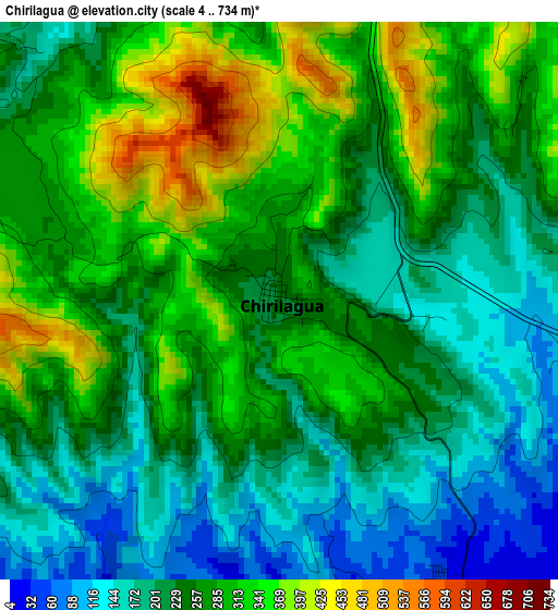
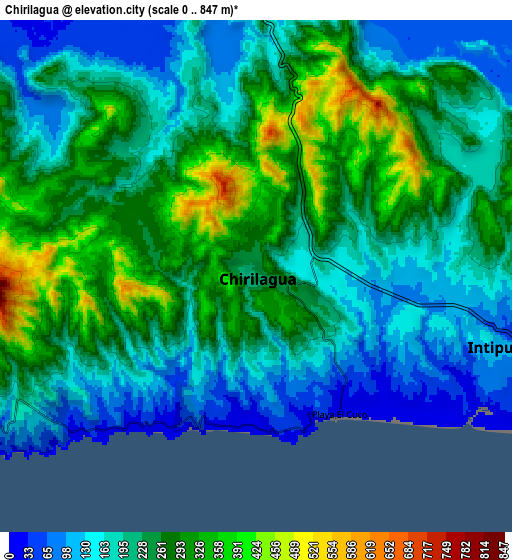
Below is the Elevation map of Chirilagua, which displays elevation range with different colors. Scale of the first map is from 4 to 734 m (13 to 2408 ft) with average elevation of 252.7 meters (=829 ft) [note 1]
These maps also provides idea of topography and contour of this city, they are displayed at different zoom levels. More info about maps, scale and edge coordinates you can find below images.
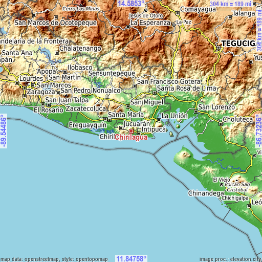
| \ | Map #1 | Map #2 | Topo.Map |
| Scale [m] | 4..734 m | 0..847 m | × |
| Scale [ft] | 13..2408 ft | 0..2779 ft | × |
| Average | 252.7 m = 829 ft | 226.6 m = 743 ft | × |
| Width | 9.51 km = 5.9 mi | 19.03 km = 11.8 mi | 304.4 km = 189.1 mi |
| Height | 9.51 km = 5.9 mi | 19.03 km = 11.8 mi | 304.4 km = 189.1 mi |
| ↑Max Latitude | 13.263057° | 13.305826° | 14.5853° |
| Latitude at center | 13.22028° | 13.22028° | 13.22028° |
| ↓Min Latitude | 13.177496° | 13.134704° | 11.84758° |
| ← Min Longitude | -88.182555° | -88.226501° | -89.54486° |
| Longitude center | -88.13861° | -88.13861° | -88.13861° |
| →Max Longitude | -88.094665° | -88.050719° | -86.73236° |
Nearby cities:
Cities around Chirilagua sort by population:
• San Miguel elevation 130 m
29.6 km,  350°
350°
• Usulután 105 m
36.7 km,  293°
293°
• La Unión 16 m
34.4 km,  67°
67°
• San Rafael Oriente 212 m
29.2 km,  308°
308°
• El Tránsito 119 m
27 km,  302°
302°
• Santa Elena 180 m
35.1 km, 301°
• San Alejo 177 m
30.2 km,  38°
38°
• Intipucá 108 m
9.5 km,  105°
105°
• Concepción Batres 108 m
28.6 km, 300°
• Conchagua 231 m
31.2 km, 71°
• Moncagua 231 m
36.8 km,  340°
340°
• Jucuarán 675 m
12.4 km, 287°
Multilingual:
 En español:
Chirilagua elevación 228 m.
 En France:
Chirilagua élévation 228 m.
 Auf Deutsch:
Chirilagua höhe über dem Meeresspiegel ist 228 m.

Sources and notes:
- [note 1] Map square and city borders are not equal. Map elevation data is calculated only from area inside that square.
- [src 1] Elevation data from geonames database provided with same terms of usage.
- [src 2] The elevation map of Chirilagua is generated using elevation data from NASA's 3 arcsec (90m) resolution SRTM data.
- [src 3] Base (background) map © OpenStreetMap contributors tiles are generated by Geofabrik and OpenTopoMap.
Copyright & License:
This Chirilagua Elevation Map is licensed under CC BY-SA. You may reuse any part from this page, if you give a proper credit by linking to this URL:
 More info on terms of use page.