Pajok elevation
Pajok (Imatong), South Sudan elevation is 823 meters and Pajok elevation in feet is 2700 ft above sea level [src 1]. Pajok is a populated place (feature code) with elevation that is 334 meters (1096 ft) bigger than average city elevation in South Sudan.
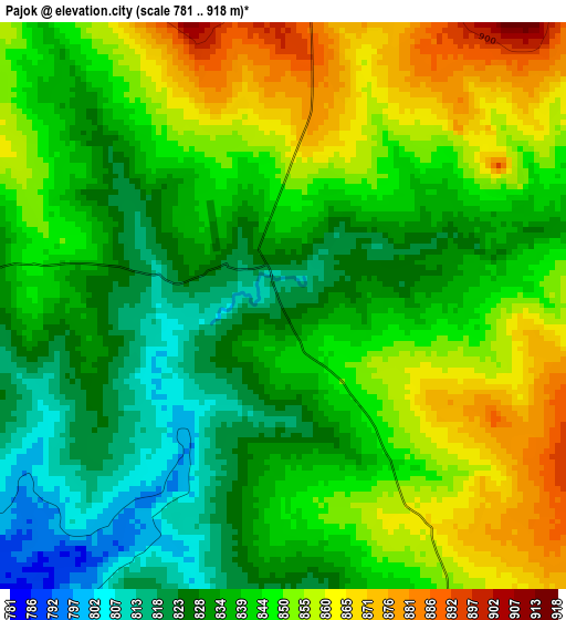
Below is the Elevation map of Pajok, which displays elevation range with different colors. Scale of the first map is from 781 to 918 m (2562 to 3012 ft) with average elevation of 842.2 meters (=2763 ft) [note 1]
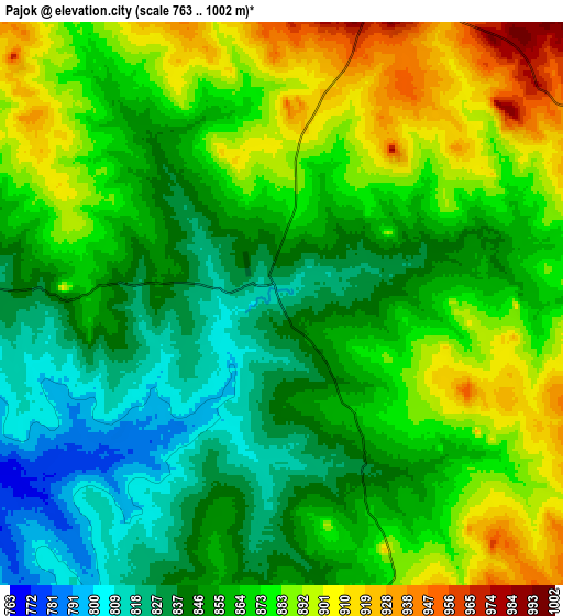
These maps also provides idea of topography and contour of this city, they are displayed at different zoom levels. More info about maps, scale and edge coordinates you can find below images.
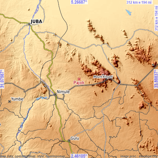
| \ | Map #1 | Map #2 | Topo.Map |
| Scale [m] | 781..918 m | 763..1002 m | × |
| Scale [ft] | 2562..3012 ft | 2503..3287 ft | × |
| Average | 842.2 m = 2763 ft | 864.4 m = 2836 ft | × |
| Width | 9.75 km = 6.1 mi | 19.5 km = 12.1 mi | 312 km = 193.9 mi |
| Height | 9.75 km = 6.1 mi | 19.5 km = 12.1 mi | 312 km = 193.9 mi |
| ↑Max Latitude | 3.908964° | 3.952806° | 5.26687° |
| Latitude at center | 3.86512° | 3.86512° | 3.86512° |
| ↓Min Latitude | 3.821274° | 3.777425° | 2.46105° |
| ← Min Longitude | 32.438175° | 32.394229° | 31.07587° |
| Longitude center | 32.48212° | 32.48212° | 32.48212° |
| →Max Longitude | 32.526065° | 32.570011° | 33.88837° |
Nearby cities:
Cities around Pajok sort by population:
• Juba elevation 518 m
148.3 km,  317°
317°
• Yei 836 m
201.9 km,  277°
277°
• Bor 429 m
280 km,  338°
338°
• Torit 617 m
61.6 km,  9°
9°
• Maridi 727 m
353.9 km,  289°
289°
• Kapoeta 668 m
159.1 km,  50°
50°
• Akobo 413 m
440.3 km, 7°
• Yirol 444 m
370.9 km, 323°
• Pibor 422 m
334 km, 12°
• Mundri 560 m
290.4 km,  304°
304°
• Terekeka 445 m
193.3 km, 335°
Multilingual:
 En español:
Pajok elevación 823 m.
 En France:
Pajok élévation 823 m.


Sources and notes:
- [note 1] Map square and city borders are not equal. Map elevation data is calculated only from area inside that square.
- [src 1] Elevation data from geonames database provided with same terms of usage.
- [src 2] The elevation map of Pajok is generated using elevation data from NASA's 3 arcsec (90m) resolution SRTM data.
- [src 3] Base (background) map © OpenStreetMap contributors tiles are generated by Geofabrik and OpenTopoMap.
Copyright & License:
This Pajok Elevation Map is licensed under CC BY-SA. You may reuse any part from this page, if you give a proper credit by linking to this URL:
 More info on terms of use page.