Dhuusamarreeb elevation
Dhuusamarreeb (Galguduud), Somalia elevation is 254 meters and Dhuusamarreeb elevation in feet is 833 ft above sea level [src 1]. Dhuusamarreeb is a seat of a first-order administrative division (feature code) with elevation that is 36 meters (118 ft) smaller than average city elevation in Somalia.
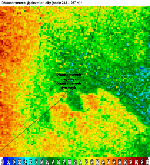
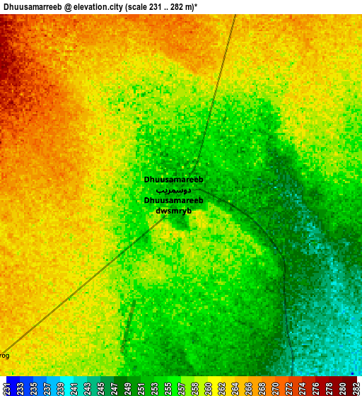
Below is the Elevation map of Dhuusamarreeb, which displays elevation range with different colors. Scale of the first map is from 243 to 267 m (797 to 876 ft) with average elevation of 256.3 meters (=841 ft) [note 1]
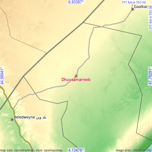
These maps also provides idea of topography and contour of this city, they are displayed at different zoom levels. More info about maps, scale and edge coordinates you can find below images.
| \ | Map #1 | Map #2 | Topo.Map |
| Scale [m] | 243..267 m | 231..282 m | × |
| Scale [ft] | 797..876 ft | 758..925 ft | × |
| Average | 256.3 m = 841 ft | 258.3 m = 847 ft | × |
| Width | 9.73 km = 6 mi | 19.45 km = 12.1 mi | 311.2 km = 193.4 mi |
| Height | 9.73 km = 6 mi | 19.45 km = 12.1 mi | 311.3 km = 193.4 mi |
| ↑Max Latitude | 5.579709° | 5.623444° | 6.93387° |
| Latitude at center | 5.53597° | 5.53597° | 5.53597° |
| ↓Min Latitude | 5.492228° | 5.448483° | 4.13476° |
| ← Min Longitude | 46.342715° | 46.298769° | 44.98041° |
| Longitude center | 46.38666° | 46.38666° | 46.38666° |
| →Max Longitude | 46.430605° | 46.474551° | 47.79291° |
Nearby cities:
Cities around Dhuusamarreeb sort by population:
• Gaalkacyo elevation 288 m
179.3 km,  40°
40°
• Beledweyne 182 m
158.4 km,  235°
235°
• Ceeldheer 20 m
207.2 km,  154°
154°
• Buulobarde 150 m
207.9 km,  205°
205°
• Hobyo 5 m
237.8 km,  94°
94°
• Jalalaqsi 129 m
255.5 km,  199°
199°
• Ceelbuur 153 m
98 km,  164°
164°
• Mahaddayweyne 114 m
300.3 km, 198°
• Cadale 7 m
308.7 km,  181°
181°
• Tayeeglow 410 m
267.6 km,  230°
230°
• Xarardheere 226 m
190.1 km,  121°
121°
• Adado 311 m
71.8 km,  21°
21°
Multilingual:
 En español:
Dhuusamarreeb elevación 254 m.
 En France:
Dhuusamarreeb élévation 254 m.
 Auf Deutsch:
Dhuusamarreeb höhe über dem Meeresspiegel ist 254 m.

Sources and notes:
- [note 1] Map square and city borders are not equal. Map elevation data is calculated only from area inside that square.
- [src 1] Elevation data from geonames database provided with same terms of usage.
- [src 2] The elevation map of Dhuusamarreeb is generated using elevation data from NASA's 3 arcsec (90m) resolution SRTM data.
- [src 3] Base (background) map © OpenStreetMap contributors tiles are generated by Geofabrik and OpenTopoMap.
Copyright & License:
This Dhuusamarreeb Elevation Map is licensed under CC BY-SA. You may reuse any part from this page, if you give a proper credit by linking to this URL:
 More info on terms of use page.