Banská Štiavnica elevation
Banská Štiavnica (Banskobystrický kraj, Okres Banská Štiavnica), Slovakia elevation is 522 meters and Banská Štiavnica elevation in feet is 1713 ft above sea level [src 1]. Banská Štiavnica is a seat of a second-order administrative division (feature code) with elevation that is 202 meters (663 ft) bigger than average city elevation in Slovakia.
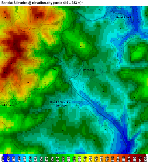
Below is the Elevation map of Banská Štiavnica, which displays elevation range with different colors. Scale of the first map is from 419 to 933 m (1375 to 3061 ft) with average elevation of 606.4 meters (=1990 ft) [note 1]
These maps also provides idea of topography and contour of this city, they are displayed at different zoom levels. More info about maps, scale and edge coordinates you can find below images.
| \ | Map #1 | Map #2 | Topo.Map |
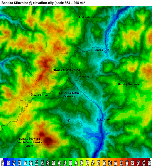
| Scale [m] | 419..933 m | 363..998 m | × |
| Scale [ft] | 1375..3061 ft | 1191..3274 ft | × |
| Average | 606.4 m = 1990 ft | 630.6 m = 2069 ft | × |
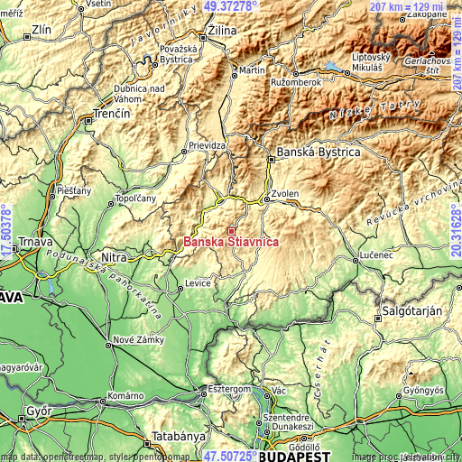
| Width | 6.48 km = 4 mi | 12.96 km = 8.1 mi | 207.4 km = 128.9 mi |
| Height | 6.48 km = 4 mi | 12.96 km = 8.1 mi | 207.4 km = 128.9 mi |
| ↑Max Latitude | 48.47772° | 48.506844° | 49.37278° |
| Latitude at center | 48.44858° | 48.44858° | 48.44858° |
| ↓Min Latitude | 48.419423° | 48.390249° | 47.50725° |
| ← Min Longitude | 18.866085° | 18.822139° | 17.50378° |
| Longitude center | 18.91003° | 18.91003° | 18.91003° |
| →Max Longitude | 18.953975° | 18.997921° | 20.31628° |
Nearby cities:
Cities around Banská Štiavnica sort by population:
• Zvolen elevation 297 m
22.7 km,  52°
52°
• Levice 162 m
34.2 km,  220°
220°
• Žiar nad Hronom 279 m
16.5 km,  344°
344°
• Handlová 424 m
32.9 km, 340°
• Krupina 270 m
15.4 km,  132°
132°
• Nová Baňa 231 m
20.1 km,  261°
261°
• Žarnovica 230 m
14.8 km,  284°
284°
• Kremnica 566 m
28.5 km,  1°
1°
• Tlmače 174 m
33.1 km,  237°
237°
• Kováčová 310 m
22.1 km,  39°
39°
• Dudince 138 m
30.9 km,  183°
183°
• Svätý Anton 421 m
3.9 km,  145°
145°
Multilingual:
 En español:
Banská Štiavnica elevación 522 m.
 En France:
Banská Štiavnica élévation 522 m.
 Auf Deutsch:
Banská Štiavnica höhe über dem Meeresspiegel ist 522 m.

Sources and notes:
- [note 1] Map square and city borders are not equal. Map elevation data is calculated only from area inside that square.
- [src 1] Elevation data from geonames database provided with same terms of usage.
- [src 2] The elevation map of Banská Štiavnica is generated using elevation data from NASA's 3 arcsec (90m) resolution SRTM data.
- [src 3] Base (background) map © OpenStreetMap contributors tiles are generated by Geofabrik and OpenTopoMap.
Copyright & License:
This Banská Štiavnica Elevation Map is licensed under CC BY-SA. You may reuse any part from this page, if you give a proper credit by linking to this URL:
 More info on terms of use page.