Levice elevation
Levice (Nitriansky kraj, Okres Levice), Slovakia elevation is 162 meters and Levice elevation in feet is 531 ft above sea level [src 1]. Levice is a seat of a second-order administrative division (feature code) with elevation that is 158 meters (518 ft) smaller than average city elevation in Slovakia.
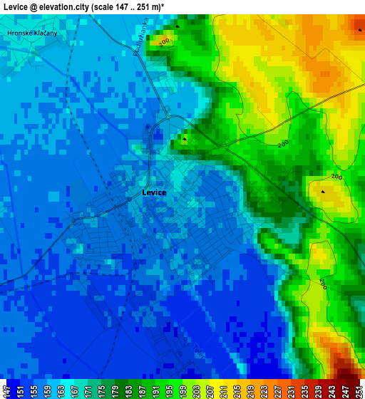
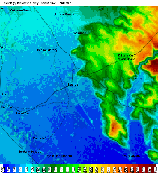
Below is the Elevation map of Levice, which displays elevation range with different colors. Scale of the first map is from 147 to 251 m (482 to 823 ft) with average elevation of 171.9 meters (=564 ft) [note 1]
These maps also provides idea of topography and contour of this city, they are displayed at different zoom levels. More info about maps, scale and edge coordinates you can find below images.
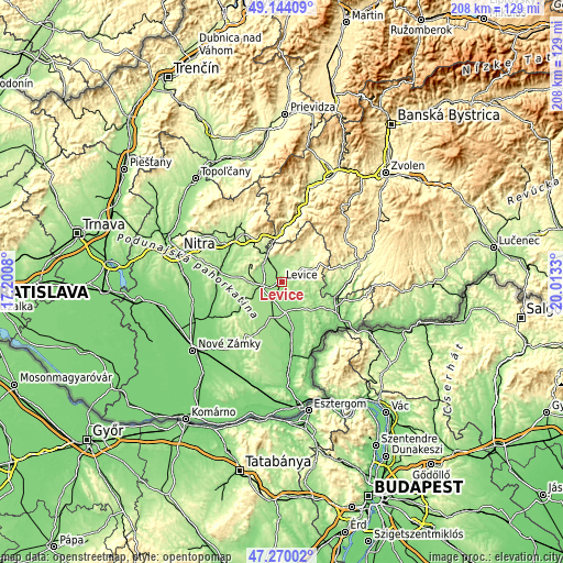
| \ | Map #1 | Map #2 | Topo.Map |
| Scale [m] | 147..251 m | 142..280 m | × |
| Scale [ft] | 482..823 ft | 466..919 ft | × |
| Average | 171.9 m = 564 ft | 173.1 m = 568 ft | × |
| Width | 6.51 km = 4 mi | 13.02 km = 8.1 mi | 208.4 km = 129.5 mi |
| Height | 6.51 km = 4 mi | 13.02 km = 8.1 mi | 208.4 km = 129.5 mi |
| ↑Max Latitude | 48.244904° | 48.274161° | 49.14409° |
| Latitude at center | 48.21563° | 48.21563° | 48.21563° |
| ↓Min Latitude | 48.18634° | 48.157032° | 47.27002° |
| ← Min Longitude | 18.563105° | 18.519159° | 17.2008° |
| Longitude center | 18.60705° | 18.60705° | 18.60705° |
| →Max Longitude | 18.650995° | 18.694941° | 20.0133° |
Nearby cities:
Cities around Levice sort by population:
• Zlaté Moravce elevation 197 m
24.3 km,  321°
321°
• Šurany 122 m
34.5 km,  245°
245°
• Banská Štiavnica 522 m
34.2 km,  40°
40°
• Vráble 143 m
22.3 km,  278°
278°
• Šahy 143 m
29.9 km,  121°
121°
• Želiezovce 135 m
18.7 km,  169°
169°
• Nová Baňa 231 m
23.2 km,  6°
6°
• Žarnovica 230 m
30.6 km,  15°
15°
• Tlmače 174 m
9.9 km,  325°
325°
• Dudince 138 m
21.4 km,  103°
103°
• Svätý Anton 421 m
33.5 km,  47°
47°
• Komárno 160 m
24.2 km,  242°
242°
Multilingual:
 En español:
Levice elevación 162 m.
 En France:
Levice élévation 162 m.


Sources and notes:
- [note 1] Map square and city borders are not equal. Map elevation data is calculated only from area inside that square.
- [src 1] Elevation data from geonames database provided with same terms of usage.
- [src 2] The elevation map of Levice is generated using elevation data from NASA's 3 arcsec (90m) resolution SRTM data.
- [src 3] Base (background) map © OpenStreetMap contributors tiles are generated by Geofabrik and OpenTopoMap.
Copyright & License:
This Levice Elevation Map is licensed under CC BY-SA. You may reuse any part from this page, if you give a proper credit by linking to this URL:
 More info on terms of use page.