Hrastje elevation
Hrastje (Šenčur), Slovenia elevation is 370 meters and Hrastje elevation in feet is 1214 ft above sea level [src 1]. Hrastje is a populated place (feature code) with elevation that is 56 meters (184 ft) bigger than average city elevation in Slovenia.
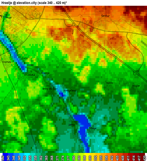
Below is the Elevation map of Hrastje, which displays elevation range with different colors. Scale of the first map is from 340 to 420 m (1115 to 1378 ft) with average elevation of 378.3 meters (=1241 ft) [note 1]
These maps also provides idea of topography and contour of this city, they are displayed at different zoom levels. More info about maps, scale and edge coordinates you can find below images.
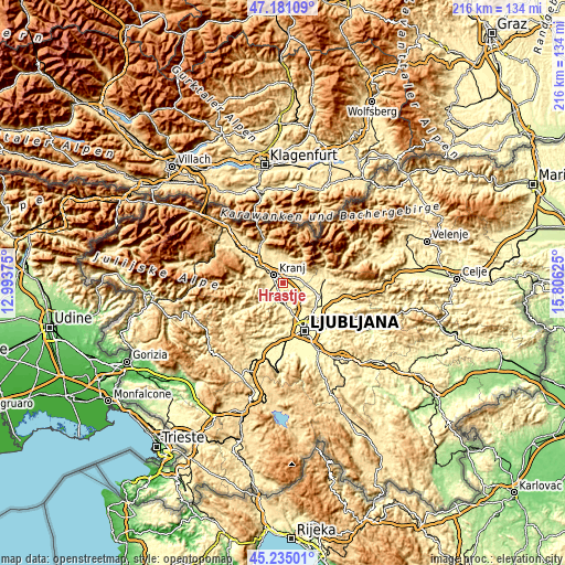
| \ | Map #1 | Topo.Map |
| Scale [m] | 340..420 m | × |
| Scale [ft] | 1115..1378 ft | × |
| Average | 378.3 m = 1241 ft | × |
| Width | 6.76 km = 4.2 mi | 216.4 km = 134.5 mi |
| Height | 6.76 km = 4.2 mi | 216.4 km = 134.5 mi |
| ↑Max Latitude | 46.247069° | 47.18109° |
| Latitude at center | 46.21667° | 46.21667° |
| ↓Min Latitude | 46.186254° | 45.23501° |
| ← Min Longitude | 14.356055° | 12.99375° |
| Longitude center | 14.4° | 14.4° |
| →Max Longitude | 14.443945° | 15.80625° |
Nearby cities:
Cities around Hrastje sort by population:
• Kranj elevation 387 m
4.2 km,  305°
305°
• Medvode 318 m
8.3 km,  174°
174°
• Šenčur 408 m
3.6 km,  25°
25°
• Britof 415 m
4.9 km,  351°
351°
• Naklo 408 m
8.9 km, 314°
• Kokrica 403 m
6.7 km,  333°
333°
• Cerklje na Gorenjskem 409 m
8 km,  58°
58°
• Vodice 338 m
7.9 km,  112°
112°
• Mlaka pri Kranju 410 m
8.3 km, 332°
• Zgornje Bitnje 386 m
4.9 km,  274°
274°
• Zgornje Pirniče 343 m
8.6 km,  163°
163°
• Sv. Duh 361 m
6.3 km,  234°
234°
Multilingual:
 En español:
Hrastje elevación 370 m.
 En France:
Hrastje élévation 370 m.


Sources and notes:
- [note 1] Map square and city borders are not equal. Map elevation data is calculated only from area inside that square.
- [src 1] Elevation data from geonames database provided with same terms of usage.
- [src 2] The elevation map of Hrastje is generated using elevation data from NASA's 3 arcsec (90m) resolution SRTM data.
- [src 3] Base (background) map © OpenStreetMap contributors tiles are generated by Geofabrik and OpenTopoMap.
Copyright & License:
This Hrastje Elevation Map is licensed under CC BY-SA. You may reuse any part from this page, if you give a proper credit by linking to this URL:
 More info on terms of use page.