Borlänge elevation
Borlänge (Dalarna, Borlänge Kommun), Sweden elevation is 124 meters and Borlänge elevation in feet is 407 ft above sea level [src 1]. Borlänge is a seat of a second-order administrative division (feature code) with elevation that is 49 meters (161 ft) bigger than average city elevation in Sweden.
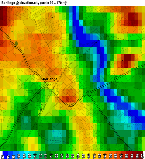
Below is the Elevation map of Borlänge, which displays elevation range with different colors. Scale of the first map is from 92 to 170 m (302 to 558 ft) with average elevation of 129.9 meters (=426 ft) [note 1]
These maps also provides idea of topography and contour of this city, they are displayed at different zoom levels. More info about maps, scale and edge coordinates you can find below images.
| \ | Map #1 | Map #2 | Topo.Map |
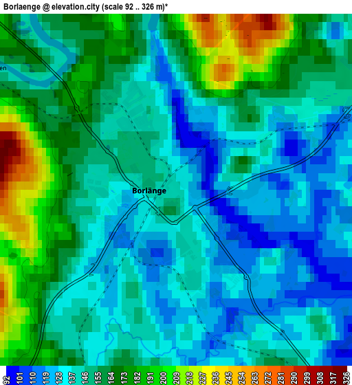
| Scale [m] | 92..170 m | 92..326 m | × |
| Scale [ft] | 302..558 ft | 302..1070 ft | × |
| Average | 129.9 m = 426 ft | 150.9 m = 495 ft | × |
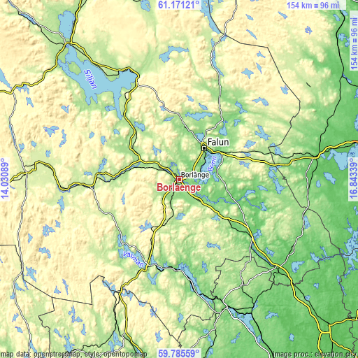
| Width | 4.81 km = 3 mi | 9.63 km = 6 mi | 154.1 km = 95.8 mi |
| Height | 4.81 km = 3 mi | 9.63 km = 6 mi | 154 km = 95.7 mi |
| ↑Max Latitude | 60.507442° | 60.529069° | 61.17121° |
| Latitude at center | 60.4858° | 60.4858° | 60.4858° |
| ↓Min Latitude | 60.464144° | 60.442473° | 59.78559° |
| ← Min Longitude | 15.393195° | 15.349249° | 14.03089° |
| Longitude center | 15.43714° | 15.43714° | 15.43714° |
| →Max Longitude | 15.481085° | 15.525031° | 16.84339° |
Nearby cities:
Cities around Borlänge sort by population:
• Falun elevation 97 m
16.7 km,  38°
38°
• Säter 151 m
23.1 km,  131°
131°
• Smedby 177 m
31.8 km,  318°
318°
• Insjön 200 m
28.3 km, 318°
• Djurås 172 m
18.6 km,  296°
296°
• Bjursås 177 m
28 km,  1°
1°
• Mockfjärd 177 m
25.8 km,  273°
273°
• Enbacka 118 m
12.1 km, 134°
• Grycksbo 159 m
22.6 km,  6°
6°
• Romme 149 m
6.8 km,  149°
149°
• Gagnef 172 m
23.3 km, 302°
• Ornäs 108 m
6.3 km,  65°
65°
Multilingual:
 En español:
Borlänge elevación 124 m.
 En France:
Borlänge élévation 124 m.
 Auf Deutsch:
Borlänge höhe über dem Meeresspiegel ist 124 m.

Sources and notes:
- [note 1] Map square and city borders are not equal. Map elevation data is calculated only from area inside that square.
- [src 1] Elevation data from geonames database provided with same terms of usage.
- [src 2] The elevation map of Borlänge is generated using GMTED2010 database with 7.5 arcsec (225m) resolution.
- [src 3] Base (background) map © OpenStreetMap contributors tiles are generated by Geofabrik and OpenTopoMap.
Copyright & License:
This Borlänge Elevation Map is licensed under CC BY-SA. You may reuse any part from this page, if you give a proper credit by linking to this URL:
 More info on terms of use page.