Järna elevation
Järna (Stockholm, Södertälje Kommun), Sweden elevation is 42 meters and Järna elevation in feet is 138 ft above sea level [src 1]. Järna is a populated place (feature code) with elevation that is 33 meters (108 ft) smaller than average city elevation in Sweden.
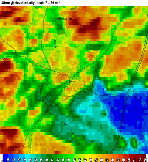
Below is the Elevation map of Järna, which displays elevation range with different colors. Scale of the first map is from 7 to 76 m (23 to 249 ft) with average elevation of 40.8 meters (=134 ft) [note 1]
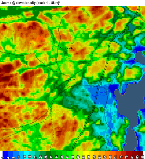
These maps also provides idea of topography and contour of this city, they are displayed at different zoom levels. More info about maps, scale and edge coordinates you can find below images.
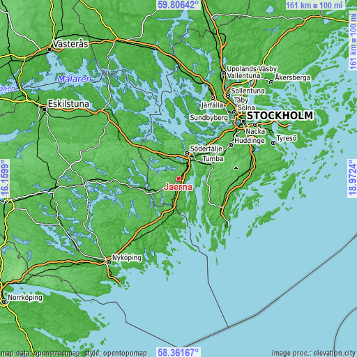
| \ | Map #1 | Map #2 | Topo.Map |
| Scale [m] | 7..76 m | 1..88 m | × |
| Scale [ft] | 23..249 ft | 3..289 ft | × |
| Average | 40.8 m = 134 ft | 46 m = 151 ft | × |
| Width | 5.02 km = 3.1 mi | 10.04 km = 6.2 mi | 160.6 km = 99.8 mi |
| Height | 5.02 km = 3.1 mi | 10.04 km = 6.2 mi | 160.6 km = 99.8 mi |
| ↑Max Latitude | 59.114216° | 59.136767° | 59.80642° |
| Latitude at center | 59.09165° | 59.09165° | 59.09165° |
| ↓Min Latitude | 59.069069° | 59.046474° | 58.36167° |
| ← Min Longitude | 17.522205° | 17.478259° | 16.1599° |
| Longitude center | 17.56615° | 17.56615° | 17.56615° |
| →Max Longitude | 17.610095° | 17.654041° | 18.9724° |
Nearby cities:
Cities around Järna sort by population:
• Södertälje elevation 29 m
12 km,  16°
16°
• Tumba 25 m
19.3 km,  52°
52°
• Nykvarn 46 m
12.2 km,  321°
321°
• Trosa 8 m
21.8 km,  182°
182°
• Gnesta 19 m
15.3 km,  251°
251°
• Vagnhärad 19 m
16.8 km,  195°
195°
• Eriksberg 72 m
22 km,  40°
40°
• Vårsta 31 m
15.5 km,  58°
58°
• Pershagen 33 m
8.6 km, 35°
• Hölö 47 m
8.5 km,  192°
192°
• Mölnbo 57 m
9.7 km,  241°
241°
• Rönninge 27 m
15.4 km, 38°
Multilingual:
 En español:
Järna elevación 42 m.
 En France:
Järna élévation 42 m.


Sources and notes:
- [note 1] Map square and city borders are not equal. Map elevation data is calculated only from area inside that square.
- [src 1] Elevation data from geonames database provided with same terms of usage.
- [src 2] The elevation map of Järna is generated using elevation data from NASA's 3 arcsec (90m) resolution SRTM data.
- [src 3] Base (background) map © OpenStreetMap contributors tiles are generated by Geofabrik and OpenTopoMap.
Copyright & License:
This Järna Elevation Map is licensed under CC BY-SA. You may reuse any part from this page, if you give a proper credit by linking to this URL:
 More info on terms of use page.