Rönninge elevation
Rönninge (Stockholm, Salems Kommun), Sweden elevation is 27 meters and Rönninge elevation in feet is 89 ft above sea level [src 1]. Rönninge is a seat of a second-order administrative division (feature code) with elevation that is 48 meters (157 ft) smaller than average city elevation in Sweden.
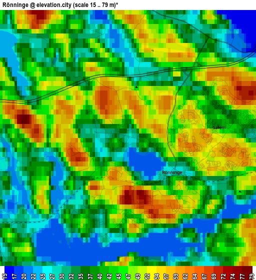
Below is the Elevation map of Rönninge, which displays elevation range with different colors. Scale of the first map is from 15 to 79 m (49 to 259 ft) with average elevation of 41 meters (=135 ft) [note 1]
These maps also provides idea of topography and contour of this city, they are displayed at different zoom levels. More info about maps, scale and edge coordinates you can find below images.
| \ | Map #1 | Topo.Map |
| Scale [m] | 15..79 m | × |
| Scale [ft] | 49..259 ft | × |
| Average | 41 m = 135 ft | × |
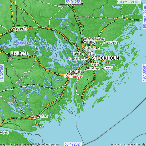
| Width | 5 km = 3.1 mi | 160.1 km = 99.5 mi |
| Height | 5 km = 3.1 mi | 160.1 km = 99.5 mi |
| ↑Max Latitude | 59.222494° | 59.9125° |
| Latitude at center | 59.2° | 59.2° |
| ↓Min Latitude | 59.177491° | 58.47232° |
| ← Min Longitude | 17.689385° | 16.32708° |
| Longitude center | 17.73333° | 17.73333° |
| →Max Longitude | 17.777275° | 19.13958° |
Nearby cities:
Cities around Rönninge sort by population:
• Huddinge elevation 33 m
14.7 km,  73°
73°
• Södertälje 29 m
6.2 km,  265°
265°
• Tumba 25 m
5.7 km,  91°
91°
• Tullinge 58 m
9.5 km, 90°
• Ekerö 13 m
11.1 km,  23°
23°
• Alby 32 m
7.8 km,  61°
61°
• Segeltorp 41 m
14 km,  53°
53°
• Vårby 32 m
11.3 km, 49°
• Fittja 31 m
9 km, 53°
• Eriksberg 72 m
6.7 km, 45°
• Vårsta 31 m
5.3 km,  136°
136°
• Pershagen 33 m
6.8 km,  222°
222°
Multilingual:
 En español:
Rönninge elevación 27 m.
 En France:
Rönninge élévation 27 m.


Sources and notes:
- [note 1] Map square and city borders are not equal. Map elevation data is calculated only from area inside that square.
- [src 1] Elevation data from geonames database provided with same terms of usage.
- [src 2] The elevation map of Rönninge is generated using elevation data from NASA's 3 arcsec (90m) resolution SRTM data.
- [src 3] Base (background) map © OpenStreetMap contributors tiles are generated by Geofabrik and OpenTopoMap.
Copyright & License:
This Rönninge Elevation Map is licensed under CC BY-SA. You may reuse any part from this page, if you give a proper credit by linking to this URL:
 More info on terms of use page.