Az Zulfī elevation
Az Zulfī (Ar Riyāḑ), Saudi Arabia elevation is 620 meters and Az Zulfī elevation in feet is 2034 ft above sea level [src 1]. Az Zulfī is a populated place (feature code) with elevation that is 100 meters (328 ft) bigger than average city elevation in Saudi Arabia.
Below is the Elevation map of Az Zulfī, which displays elevation range with different colors. Scale of the first map is from 602 to 718 m (1975 to 2356 ft) with average elevation of 634.8 meters (=2083 ft) [note 1]
These maps also provides idea of topography and contour of this city, they are displayed at different zoom levels. More info about maps, scale and edge coordinates you can find below images.
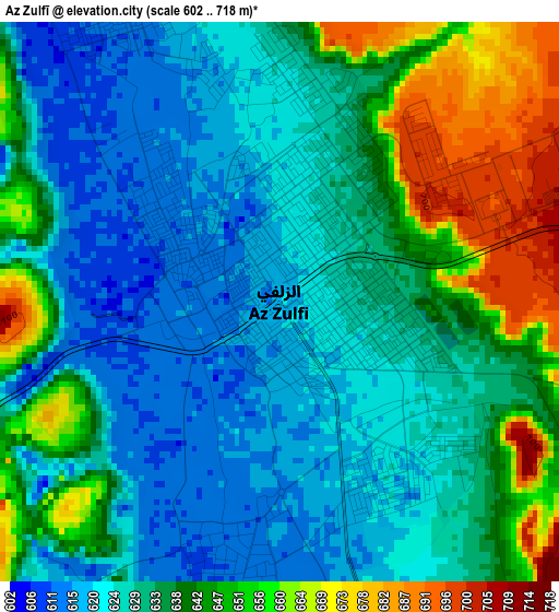
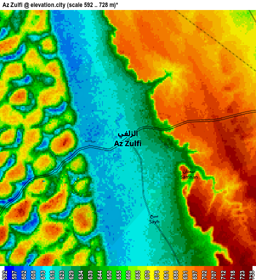
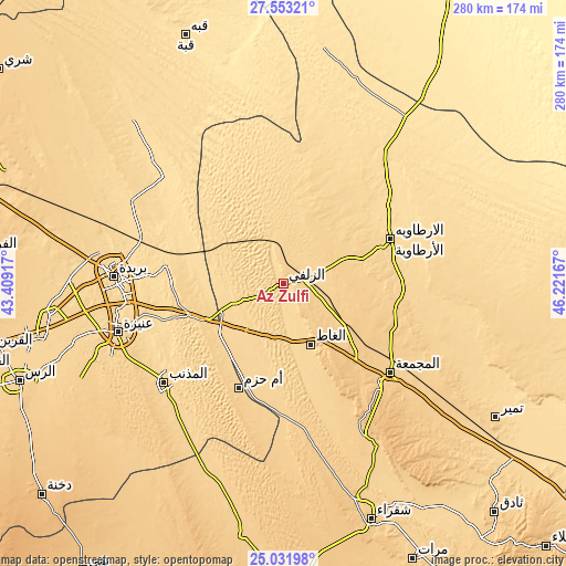
| \ | Map #1 | Map #2 | Topo.Map |
| Scale [m] | 602..718 m | 592..728 m | × |
| Scale [ft] | 1975..2356 ft | 1942..2388 ft | × |
| Average | 634.8 m = 2083 ft | 657.5 m = 2157 ft | × |
| Width | 8.76 km = 5.4 mi | 17.52 km = 10.9 mi | 280.3 km = 174.2 mi |
| Height | 8.76 km = 5.4 mi | 17.52 km = 10.9 mi | 280.3 km = 174.2 mi |
| ↑Max Latitude | 26.33884° | 26.378216° | 27.55321° |
| Latitude at center | 26.29945° | 26.29945° | 26.29945° |
| ↓Min Latitude | 26.260047° | 26.22063° | 25.03198° |
| ← Min Longitude | 44.771475° | 44.727529° | 43.40917° |
| Longitude center | 44.81542° | 44.81542° | 44.81542° |
| →Max Longitude | 44.859365° | 44.903311° | 46.22167° |
Nearby cities:
Cities around Az Zulfī sort by population:
• Buraydah elevation 606 m
83.8 km,  272°
272°
• Ar Rass 691 m
140 km,  250°
250°
• Al Mithnab 632 m
76.8 km,  230°
230°
• Al Bukayrīyah 668 m
116.8 km,  261°
261°
• Tanūmah 587 m
111.9 km,  322°
322°
• Sājir 732 m
126.1 km,  189°
189°
• Al Arţāwīyah 614 m
57.7 km,  66°
66°
• Marāt 692 m
151 km,  154°
154°
• Tumayr 648 m
124.4 km,  122°
122°
• Al Fuwayliq 755 m
156.6 km,  275°
275°
• Unaizah 654 m
88.2 km, 254°
• Al Majma‘ah 712 m
69.2 km,  128°
128°
Multilingual:
 En español:
Az Zulfī elevación 620 m.
 En France:
Az Zulfī élévation 620 m.
 Auf Deutsch:
Az Zulfī höhe über dem Meeresspiegel ist 620 m.

Sources and notes:
- [note 1] Map square and city borders are not equal. Map elevation data is calculated only from area inside that square.
- [src 1] Elevation data from geonames database provided with same terms of usage.
- [src 2] The elevation map of Az Zulfī is generated using elevation data from NASA's 3 arcsec (90m) resolution SRTM data.
- [src 3] Base (background) map © OpenStreetMap contributors tiles are generated by Geofabrik and OpenTopoMap.
Copyright & License:
This Az Zulfī Elevation Map is licensed under CC BY-SA. You may reuse any part from this page, if you give a proper credit by linking to this URL:
 More info on terms of use page.