Ust’-Charyshskaya Pristan’ elevation
Ust’-Charyshskaya Pristan’ (Altai Krai), Russia elevation is 180 meters and Ust’-Charyshskaya Pristan’ elevation in feet is 591 ft above sea level [src 1]. Ust’-Charyshskaya Pristan’ is a populated place (feature code) with elevation that is 19 meters (62 ft) smaller than average city elevation in Russia.
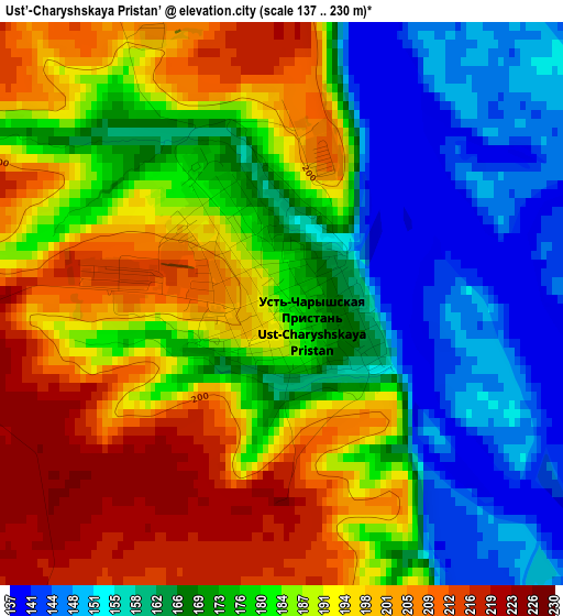
Below is the Elevation map of Ust’-Charyshskaya Pristan’, which displays elevation range with different colors. Scale of the first map is from 137 to 230 m (449 to 755 ft) with average elevation of 180.5 meters (=592 ft) [note 1]
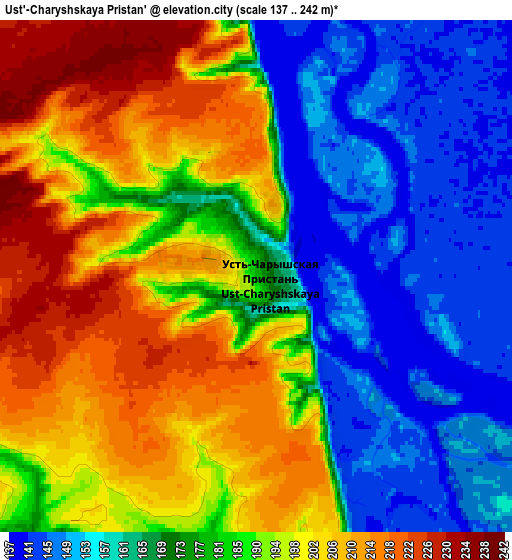
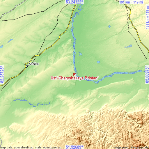
These maps also provides idea of topography and contour of this city, they are displayed at different zoom levels. More info about maps, scale and edge coordinates you can find below images.
| \ | Map #1 | Map #2 | Topo.Map |
| Scale [m] | 137..230 m | 137..242 m | × |
| Scale [ft] | 449..755 ft | 449..794 ft | × |
| Average | 180.5 m = 592 ft | 182.1 m = 597 ft | × |
| Width | 5.96 km = 3.7 mi | 11.93 km = 7.4 mi | 190.8 km = 118.6 mi |
| Height | 5.96 km = 3.7 mi | 11.93 km = 7.4 mi | 190.8 km = 118.6 mi |
| ↑Max Latitude | 52.420209° | 52.447001° | 53.24322° |
| Latitude at center | 52.3934° | 52.3934° | 52.3934° |
| ↓Min Latitude | 52.366575° | 52.339733° | 51.52689° |
| ← Min Longitude | 83.619555° | 83.575609° | 82.25725° |
| Longitude center | 83.6635° | 83.6635° | 83.6635° |
| →Max Longitude | 83.707445° | 83.751391° | 85.06975° |
Nearby cities:
Cities around Ust’-Charyshskaya Pristan’ sort by population:
• Aleysk elevation 176 m
60.7 km,  280°
280°
• Topchikha 200 m
60 km,  322°
322°
• Ust’-Kalmanka 167 m
38.9 km,  218°
218°
• Nagornyy 151 m
45.4 km,  350°
350°
• Bystryy Istok 155 m
49.2 km,  92°
92°
• Kalmanka 156 m
56.8 km, 351°
• Zonal’noye 221 m
91.1 km,  70°
70°
• Sokolovo 199 m
77.8 km,  78°
78°
• Bobrovka 135 m
89 km,  9°
9°
• Petropavlovskoye 205 m
46.9 km,  139°
139°
• Sychëvka 207 m
85 km,  116°
116°
• Anton’yevka 222 m
49 km,  154°
154°
Multilingual:
 En español:
Ust’-Charyshskaya Pristan’ elevación 180 m.
 En France:
Ust’-Charyshskaya Pristan’ élévation 180 m.
 Auf Deutsch:
Ust’-Charyshskaya Pristan’ höhe über dem Meeresspiegel ist 180 m.
 На русском:
Усть-Чарышская Пристань высота над уровнем моря 180 м
Sources and notes:
- [note 1] Map square and city borders are not equal. Map elevation data is calculated only from area inside that square.
- [src 1] Elevation data from geonames database provided with same terms of usage.
- [src 2] The elevation map of Ust’-Charyshskaya Pristan’ is generated using elevation data from NASA's 3 arcsec (90m) resolution SRTM data.
- [src 3] Base (background) map © OpenStreetMap contributors tiles are generated by Geofabrik and OpenTopoMap.
Copyright & License:
This Ust’-Charyshskaya Pristan’ Elevation Map is licensed under CC BY-SA. You may reuse any part from this page, if you give a proper credit by linking to this URL:
 More info on terms of use page.