Uvel’skiy elevation
Uvel’skiy (Chelyabinsk), Russia elevation is 235 meters and Uvel’skiy elevation in feet is 771 ft above sea level [src 1]. Uvel’skiy is a populated place (feature code) with elevation that is 36 meters (118 ft) bigger than average city elevation in Russia.
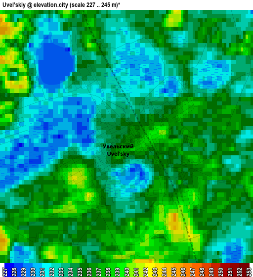
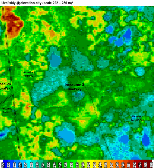
Below is the Elevation map of Uvel’skiy, which displays elevation range with different colors. Scale of the first map is from 227 to 245 m (745 to 804 ft) with average elevation of 234.2 meters (=768 ft) [note 1]
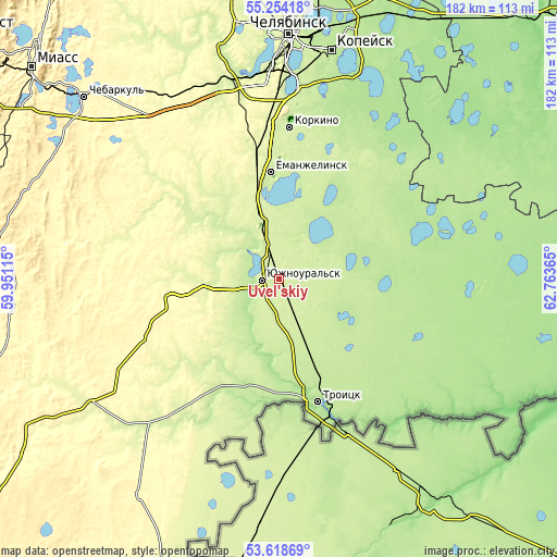
These maps also provides idea of topography and contour of this city, they are displayed at different zoom levels. More info about maps, scale and edge coordinates you can find below images.
| \ | Map #1 | Map #2 | Topo.Map |
| Scale [m] | 227..245 m | 222..256 m | × |
| Scale [ft] | 745..804 ft | 728..840 ft | × |
| Average | 234.2 m = 768 ft | 235.1 m = 771 ft | × |
| Width | 5.68 km = 3.5 mi | 11.37 km = 7.1 mi | 181.8 km = 113 mi |
| Height | 5.68 km = 3.5 mi | 11.37 km = 7.1 mi | 181.8 km = 113 mi |
| ↑Max Latitude | 54.470146° | 54.495676° | 55.25418° |
| Latitude at center | 54.4446° | 54.4446° | 54.4446° |
| ↓Min Latitude | 54.419038° | 54.393461° | 53.61869° |
| ← Min Longitude | 61.313455° | 61.269509° | 59.95115° |
| Longitude center | 61.3574° | 61.3574° | 61.3574° |
| →Max Longitude | 61.401345° | 61.445291° | 62.76365° |
Nearby cities:
Cities around Uvel’skiy sort by population:
• Troitsk elevation 177 m
41.1 km,  159°
159°
• Korkino 241 m
49.7 km,  2°
2°
• Yuzhnoural’sk 238 m
6.7 km,  267°
267°
• Yemanzhelinsk 232 m
34.6 km,  356°
356°
• Plast 308 m
36.2 km,  256°
256°
• Roza 232 m
52.9 km,  7°
7°
• Krasnogorskiy 246 m
19.4 km,  335°
335°
• Yetkul’ 228 m
44.5 km,  19°
19°
• Yemanzhelinka 240 m
39.8 km,  354°
354°
• Koyelga 235 m
37.2 km,  308°
308°
• Bobrovka 181 m
50.9 km,  150°
150°
• Selezyan 197 m
59.4 km,  30°
30°
Multilingual:
 En español:
Uvel’skiy elevación 235 m.
 En France:
Uvel’skiy élévation 235 m.
 Auf Deutsch:
Uvel’skiy höhe über dem Meeresspiegel ist 235 m.

Sources and notes:
- [note 1] Map square and city borders are not equal. Map elevation data is calculated only from area inside that square.
- [src 1] Elevation data from geonames database provided with same terms of usage.
- [src 2] The elevation map of Uvel’skiy is generated using elevation data from NASA's 3 arcsec (90m) resolution SRTM data.
- [src 3] Base (background) map © OpenStreetMap contributors tiles are generated by Geofabrik and OpenTopoMap.
Copyright & License:
This Uvel’skiy Elevation Map is licensed under CC BY-SA. You may reuse any part from this page, if you give a proper credit by linking to this URL:
 More info on terms of use page.