Agryz elevation
Agryz (Tatarstan Republic), Russia elevation is 93 meters and Agryz elevation in feet is 305 ft above sea level [src 1]. Agryz is a populated place (feature code) with elevation that is 106 meters (348 ft) smaller than average city elevation in Russia.
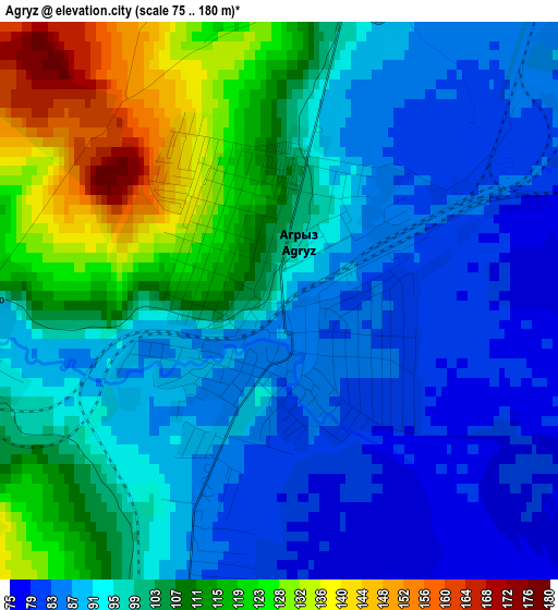
Below is the Elevation map of Agryz, which displays elevation range with different colors. Scale of the first map is from 75 to 180 m (246 to 591 ft) with average elevation of 100.3 meters (=329 ft) [note 1]
These maps also provides idea of topography and contour of this city, they are displayed at different zoom levels. More info about maps, scale and edge coordinates you can find below images.
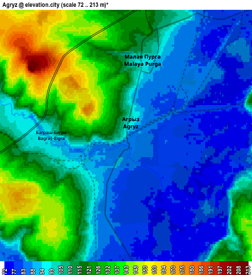
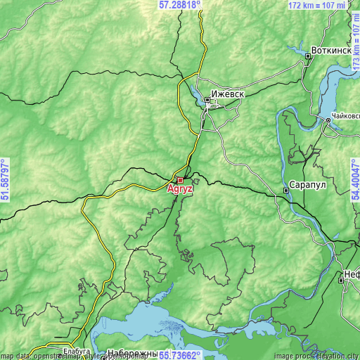
| \ | Map #1 | Map #2 | Topo.Map |
| Scale [m] | 75..180 m | 72..213 m | × |
| Scale [ft] | 246..591 ft | 236..699 ft | × |
| Average | 100.3 m = 329 ft | 107.3 m = 352 ft | × |
| Width | 5.39 km = 3.3 mi | 10.78 km = 6.7 mi | 172.5 km = 107.2 mi |
| Height | 5.39 km = 3.3 mi | 10.78 km = 6.7 mi | 172.5 km = 107.2 mi |
| ↑Max Latitude | 56.544574° | 56.568793° | 57.28818° |
| Latitude at center | 56.52034° | 56.52034° | 56.52034° |
| ↓Min Latitude | 56.49609° | 56.471825° | 55.73662° |
| ← Min Longitude | 52.950275° | 52.906329° | 51.58797° |
| Longitude center | 52.99422° | 52.99422° | 52.99422° |
| →Max Longitude | 53.038165° | 53.082111° | 54.40047° |
Nearby cities:
Cities around Agryz sort by population:
• Izhevsk elevation 166 m
38.8 km,  19°
19°
• Sarapul 117 m
49.6 km,  95°
95°
• Mozhga 152 m
47.8 km,  259°
259°
• Malaya Purga 114 m
4.1 km,  8°
8°
• Alnashi 120 m
48.8 km,  220°
220°
• Sigayevo 86 m
49.2 km, 102°
• Vavozh 137 m
70.9 km,  293°
293°
• Karakulino 112 m
71.6 km,  142°
142°
• Khokhryaki 158 m
48.3 km, 24°
• Pirogovo 98 m
30.3 km, 18°
• Kiyasovo 168 m
20.7 km,  157°
157°
• Pychas 154 m
34 km,  266°
266°
Multilingual:
 En español:
Agriz elevación 93 m.
 En France:
Agryz élévation 93 m.


Sources and notes:
- [note 1] Map square and city borders are not equal. Map elevation data is calculated only from area inside that square.
- [src 1] Elevation data from geonames database provided with same terms of usage.
- [src 2] The elevation map of Agryz is generated using elevation data from NASA's 3 arcsec (90m) resolution SRTM data.
- [src 3] Base (background) map © OpenStreetMap contributors tiles are generated by Geofabrik and OpenTopoMap.
Copyright & License:
This Agryz Elevation Map is licensed under CC BY-SA. You may reuse any part from this page, if you give a proper credit by linking to this URL:
 More info on terms of use page.