Russkiy Aktash elevation
Russkiy Aktash (Tatarstan Republic), Russia elevation is 88 meters and Russkiy Aktash elevation in feet is 289 ft above sea level [src 1]. Russkiy Aktash is a populated place (feature code) with elevation that is 111 meters (364 ft) smaller than average city elevation in Russia.
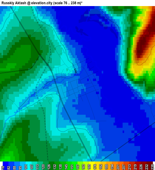
Below is the Elevation map of Russkiy Aktash, which displays elevation range with different colors. Scale of the first map is from 76 to 238 m (249 to 781 ft) with average elevation of 107.6 meters (=353 ft) [note 1]
These maps also provides idea of topography and contour of this city, they are displayed at different zoom levels. More info about maps, scale and edge coordinates you can find below images.
| \ | Map #1 | Map #2 | Topo.Map |
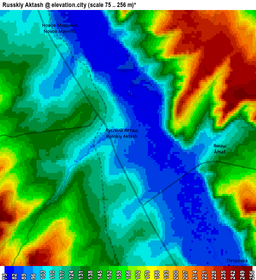
| Scale [m] | 76..238 m | 75..256 m | × |
| Scale [ft] | 249..781 ft | 246..840 ft | × |
| Average | 107.6 m = 353 ft | 134.5 m = 441 ft | × |
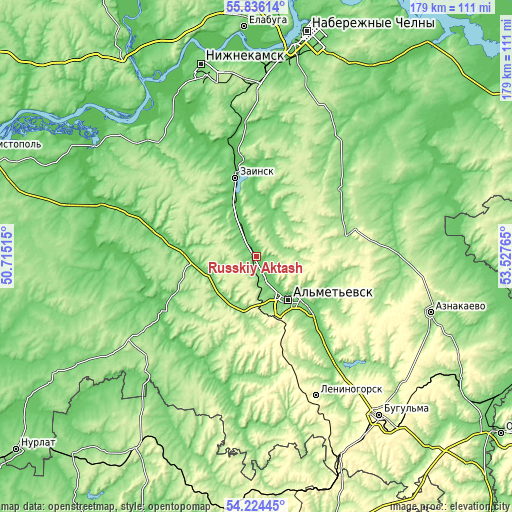
| Width | 5.6 km = 3.5 mi | 11.2 km = 7 mi | 179.2 km = 111.3 mi |
| Height | 5.6 km = 3.5 mi | 11.2 km = 7 mi | 179.2 km = 111.3 mi |
| ↑Max Latitude | 55.063574° | 55.088732° | 55.83614° |
| Latitude at center | 55.0384° | 55.0384° | 55.0384° |
| ↓Min Latitude | 55.01321° | 54.988005° | 54.22445° |
| ← Min Longitude | 52.077455° | 52.033509° | 50.71515° |
| Longitude center | 52.1214° | 52.1214° | 52.1214° |
| →Max Longitude | 52.165345° | 52.209291° | 53.52765° |
Nearby cities:
Cities around Russkiy Aktash sort by population:
• Nizhnekamsk elevation 119 m
69.1 km,  344°
344°
• Al’met’yevsk 121 m
19.4 km,  140°
140°
• Leninogorsk 223 m
53.1 km,  155°
155°
• Zainsk 109 m
31.4 km,  353°
353°
• Dzhalil’ 288 m
39.2 km,  92°
92°
• Nizhnyaya Maktama 110 m
27.6 km,  134°
134°
• Aktyubinskiy 307 m
50.3 km,  119°
119°
• Sarmanovo 130 m
38.3 km,  50°
50°
• Cheremshan 139 m
57.4 km,  223°
223°
• Karabash 144 m
48.5 km, 142°
• Novosheshminsk 63 m
56.6 km,  273°
273°
• Shugurovo 129 m
58.9 km,  179°
179°
Multilingual:
 En español:
Russkiy Aktash elevación 88 m.
 En France:
Russkiy Aktash élévation 88 m.
 Auf Deutsch:
Russkiy Aktash höhe über dem Meeresspiegel ist 88 m.

Sources and notes:
- [note 1] Map square and city borders are not equal. Map elevation data is calculated only from area inside that square.
- [src 1] Elevation data from geonames database provided with same terms of usage.
- [src 2] The elevation map of Russkiy Aktash is generated using elevation data from NASA's 3 arcsec (90m) resolution SRTM data.
- [src 3] Base (background) map © OpenStreetMap contributors tiles are generated by Geofabrik and OpenTopoMap.
Copyright & License:
This Russkiy Aktash Elevation Map is licensed under CC BY-SA. You may reuse any part from this page, if you give a proper credit by linking to this URL:
 More info on terms of use page.