Atig elevation
Atig (Sverdlovsk), Russia elevation is 338 meters and Atig elevation in feet is 1109 ft above sea level [src 1]. Atig is a populated place (feature code) with elevation that is 139 meters (456 ft) bigger than average city elevation in Russia.
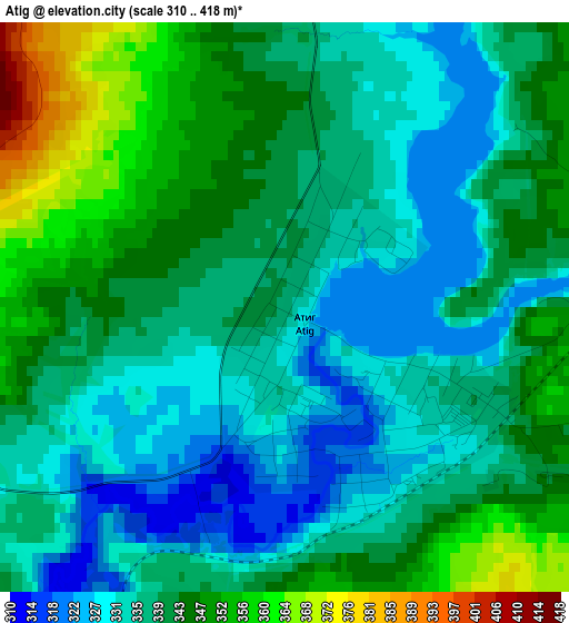
Below is the Elevation map of Atig, which displays elevation range with different colors. Scale of the first map is from 310 to 418 m (1017 to 1371 ft) with average elevation of 339.7 meters (=1115 ft) [note 1]
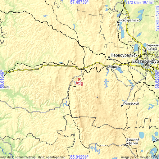
These maps also provides idea of topography and contour of this city, they are displayed at different zoom levels. More info about maps, scale and edge coordinates you can find below images.
| \ | Map #1 | Map #2 | Topo.Map |
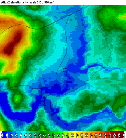
| Scale [m] | 310..418 m | 310..516 m | × |
| Scale [ft] | 1017..1371 ft | 1017..1693 ft | × |
| Average | 339.7 m = 1115 ft | 361.4 m = 1186 ft | × |
| Width | 5.37 km = 3.3 mi | 10.73 km = 6.7 mi | 171.7 km = 106.7 mi |
| Height | 5.37 km = 3.3 mi | 10.73 km = 6.7 mi | 171.7 km = 106.7 mi |
| ↑Max Latitude | 56.717194° | 56.741302° | 57.45739° |
| Latitude at center | 56.69307° | 56.69307° | 56.69307° |
| ↓Min Latitude | 56.668931° | 56.644776° | 55.91291° |
| ← Min Longitude | 59.378765° | 59.334819° | 58.01646° |
| Longitude center | 59.42271° | 59.42271° | 59.42271° |
| →Max Longitude | 59.466655° | 59.510601° | 60.82896° |
Nearby cities:
Cities around Atig sort by population:
• Pervoural’sk elevation 352 m
39.5 km,  53°
53°
• Revda 311 m
33.2 km,  68°
68°
• Talitsa 332 m
42 km,  60°
60°
• Degtyarsk 350 m
40.6 km,  88°
88°
• Nizhniye Sergi 316 m
8.1 km,  244°
244°
• Bisert’ 292 m
29.3 km,  309°
309°
• Mikhaylovsk 257 m
34.1 km,  212°
212°
• Verkhniye Sergi 347 m
9.6 km,  122°
122°
• Bilimbay 306 m
38.9 km,  37°
37°
• Novoutkinsk 276 m
34.3 km,  13°
13°
• Kuzino 326 m
36.6 km,  1°
1°
• Druzhinino 353 m
12.1 km,  27°
27°
Multilingual:
 En español:
Atig elevación 338 m.
 En France:
Atig élévation 338 m.


Sources and notes:
- [note 1] Map square and city borders are not equal. Map elevation data is calculated only from area inside that square.
- [src 1] Elevation data from geonames database provided with same terms of usage.
- [src 2] The elevation map of Atig is generated using elevation data from NASA's 3 arcsec (90m) resolution SRTM data.
- [src 3] Base (background) map © OpenStreetMap contributors tiles are generated by Geofabrik and OpenTopoMap.
Copyright & License:
This Atig Elevation Map is licensed under CC BY-SA. You may reuse any part from this page, if you give a proper credit by linking to this URL:
 More info on terms of use page.