Belgorod elevation
Belgorod (Belgorod Oblast, Belgorodskiy Rayon), Russia elevation is 173 meters and Belgorod elevation in feet is 568 ft above sea level [src 1]. Belgorod is a seat of a first-order administrative division (feature code) with elevation that is 26 meters (85 ft) smaller than average city elevation in Russia.
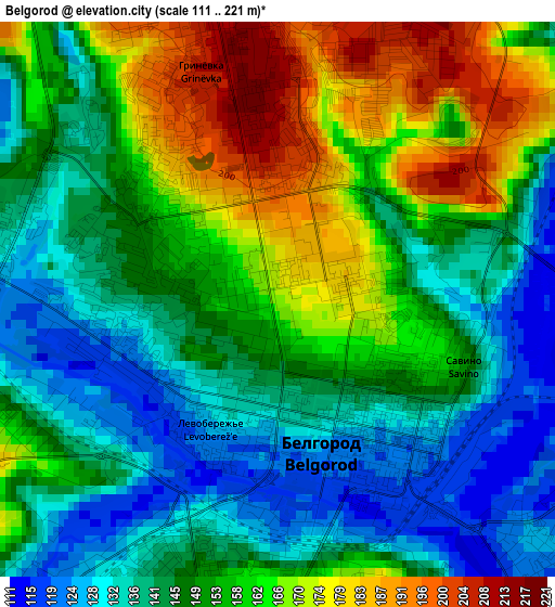
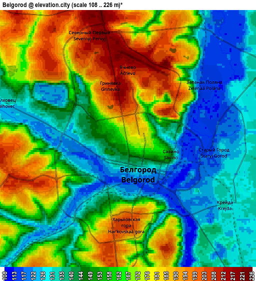
Below is the Elevation map of Belgorod, which displays elevation range with different colors. Scale of the first map is from 111 to 221 m (364 to 725 ft) with average elevation of 151.4 meters (=497 ft) [note 1]
These maps also provides idea of topography and contour of this city, they are displayed at different zoom levels. More info about maps, scale and edge coordinates you can find below images.
| \ | Map #1 | Map #2 | Topo.Map |
| Scale [m] | 111..221 m | 108..226 m | × |
| Scale [ft] | 364..725 ft | 354..741 ft | × |
| Average | 151.4 m = 497 ft | 156.9 m = 515 ft | × |
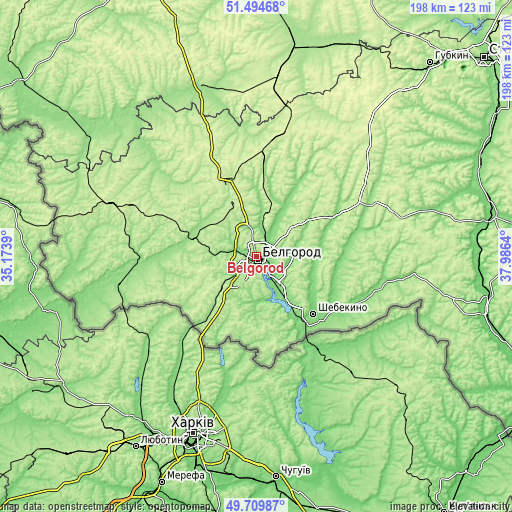
| Width | 6.2 km = 3.9 mi | 12.4 km = 7.7 mi | 198.5 km = 123.3 mi |
| Height | 6.2 km = 3.9 mi | 12.4 km = 7.7 mi | 198.4 km = 123.3 mi |
| ↑Max Latitude | 50.638619° | 50.666481° | 51.49468° |
| Latitude at center | 50.61074° | 50.61074° | 50.61074° |
| ↓Min Latitude | 50.582845° | 50.554933° | 49.70987° |
| ← Min Longitude | 36.536205° | 36.492259° | 35.1739° |
| Longitude center | 36.58015° | 36.58015° | 36.58015° |
| →Max Longitude | 36.624095° | 36.668041° | 37.9864° |
Nearby cities:
Cities around Belgorod sort by population:
• Shebekino elevation 113 m
32.5 km,  133°
133°
• Stroitel’ 240 m
20.6 km,  340°
340°
• Razumnoye 126 m
11.2 km,  139°
139°
• Borisovka 140 m
39.9 km,  268°
268°
• Tomarovka 151 m
25.8 km,  288°
288°
• Severnyy 211 m
7.6 km,  345°
345°
• Mayskiy 180 m
13.2 km,  220°
220°
• Maslova Pristan’ 118 m
19.7 km,  149°
149°
• Novaya Tavolzhanka 111 m
33.8 km, 148°
• Bessonovka 201 m
21.8 km,  244°
244°
• Yakovlevo 200 m
29.3 km, 341°
• Gorod Shebekino 105 m
32.1 km, 132°
Multilingual:
 En español:
Bélgorod elevación 173 m.
 En France:
Belgorod élévation 173 m.
 Auf Deutsch:
Belgorod höhe über dem Meeresspiegel ist 173 m.

Sources and notes:
- [note 1] Map square and city borders are not equal. Map elevation data is calculated only from area inside that square.
- [src 1] Elevation data from geonames database provided with same terms of usage.
- [src 2] The elevation map of Belgorod is generated using elevation data from NASA's 3 arcsec (90m) resolution SRTM data.
- [src 3] Base (background) map © OpenStreetMap contributors tiles are generated by Geofabrik and OpenTopoMap.
Copyright & License:
This Belgorod Elevation Map is licensed under CC BY-SA. You may reuse any part from this page, if you give a proper credit by linking to this URL:
 More info on terms of use page.