Burayevo elevation
Burayevo (Bashkortostan Republic), Russia elevation is 119 meters and Burayevo elevation in feet is 390 ft above sea level [src 1]. Burayevo is a populated place (feature code) with elevation that is 80 meters (262 ft) smaller than average city elevation in Russia.
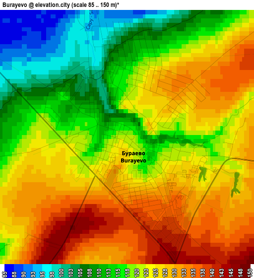
Below is the Elevation map of Burayevo, which displays elevation range with different colors. Scale of the first map is from 85 to 150 m (279 to 492 ft) with average elevation of 121.4 meters (=398 ft) [note 1]
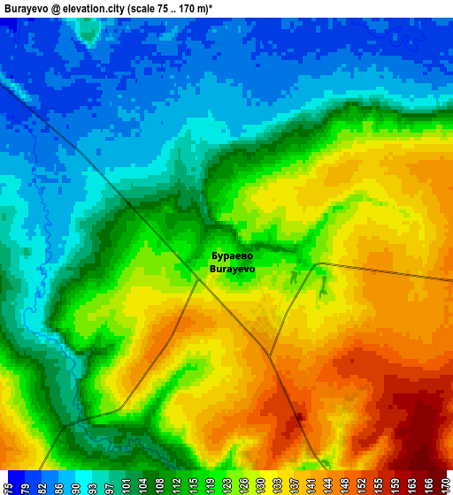
These maps also provides idea of topography and contour of this city, they are displayed at different zoom levels. More info about maps, scale and edge coordinates you can find below images.
| \ | Map #1 | Map #2 | Topo.Map |
| Scale [m] | 85..150 m | 75..170 m | × |
| Scale [ft] | 279..492 ft | 246..558 ft | × |
| Average | 121.4 m = 398 ft | 115 m = 377 ft | × |
| Width | 5.49 km = 3.4 mi | 10.97 km = 6.8 mi | 175.6 km = 109.1 mi |
| Height | 5.49 km = 3.4 mi | 10.97 km = 6.8 mi | 175.6 km = 109.1 mi |
| ↑Max Latitude | 55.865357° | 55.890009° | 56.62231° |
| Latitude at center | 55.84069° | 55.84069° | 55.84069° |
| ↓Min Latitude | 55.816007° | 55.791308° | 55.04304° |
| ← Min Longitude | 55.364395° | 55.320449° | 54.00209° |
| Longitude center | 55.40834° | 55.40834° | 55.40834° |
| →Max Longitude | 55.452285° | 55.496231° | 56.81459° |
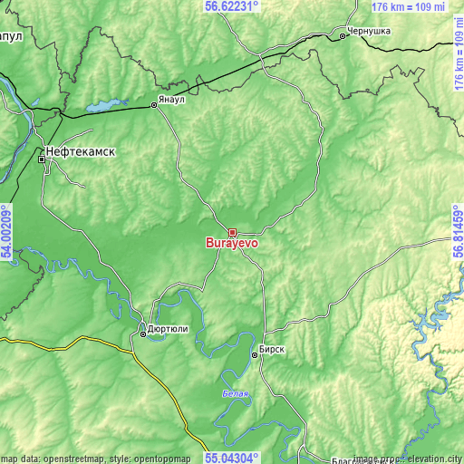
Nearby cities:
Cities around Burayevo sort by population:
• Neftekamsk elevation 108 m
76.4 km,  291°
291°
• Birsk 150 m
47.4 km,  169°
169°
• Dyurtyuli 86 m
51.5 km,  221°
221°
• Yanaul 99 m
56.6 km,  328°
328°
• Kuyeda 130 m
66.6 km,  9°
9°
• Krasnokholmskiy 106 m
27.8 km,  305°
305°
• Askino 169 m
77.9 km,  69°
69°
• Verkhniye Tatyshly 159 m
57.3 km,  29°
29°
• Starobaltachevo 111 m
37 km,  61°
61°
• Amzya 68 m
77.2 km,  304°
304°
• Kaltasy 126 m
40.3 km, 290°
• Semiletka 162 m
73 km, 223°
Multilingual:
 En español:
Burayevo elevación 119 m.
 En France:
Burayevo élévation 119 m.
 Auf Deutsch:
Burayevo höhe über dem Meeresspiegel ist 119 m.

Sources and notes:
- [note 1] Map square and city borders are not equal. Map elevation data is calculated only from area inside that square.
- [src 1] Elevation data from geonames database provided with same terms of usage.
- [src 2] The elevation map of Burayevo is generated using elevation data from NASA's 3 arcsec (90m) resolution SRTM data.
- [src 3] Base (background) map © OpenStreetMap contributors tiles are generated by Geofabrik and OpenTopoMap.
Copyright & License:
This Burayevo Elevation Map is licensed under CC BY-SA. You may reuse any part from this page, if you give a proper credit by linking to this URL:
 More info on terms of use page.