Neftekamsk elevation
Neftekamsk (Bashkortostan Republic), Russia elevation is 108 meters and Neftekamsk elevation in feet is 354 ft above sea level [src 1]. Neftekamsk is a populated place (feature code) with elevation that is 91 meters (299 ft) smaller than average city elevation in Russia.
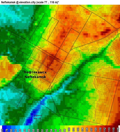
Below is the Elevation map of Neftekamsk, which displays elevation range with different colors. Scale of the first map is from 77 to 116 m (253 to 381 ft) with average elevation of 96.9 meters (=318 ft) [note 1]
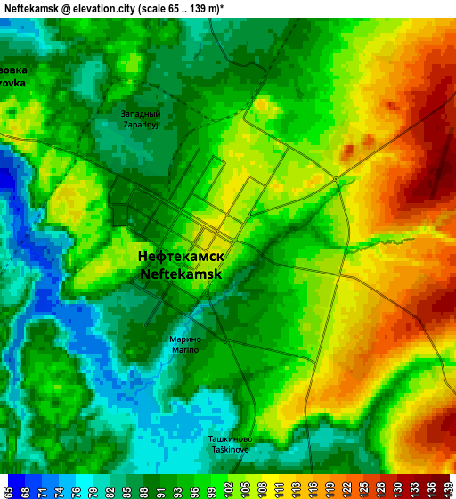
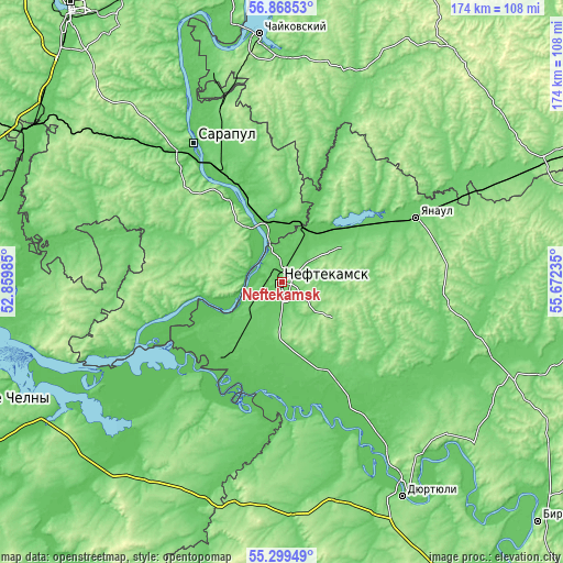
These maps also provides idea of topography and contour of this city, they are displayed at different zoom levels. More info about maps, scale and edge coordinates you can find below images.
| \ | Map #1 | Map #2 | Topo.Map |
| Scale [m] | 77..116 m | 65..139 m | × |
| Scale [ft] | 253..381 ft | 213..456 ft | × |
| Average | 96.9 m = 318 ft | 97.8 m = 321 ft | × |
| Width | 5.45 km = 3.4 mi | 10.9 km = 6.8 mi | 174.5 km = 108.4 mi |
| Height | 5.45 km = 3.4 mi | 10.9 km = 6.8 mi | 174.4 km = 108.4 mi |
| ↑Max Latitude | 56.116508° | 56.141° | 56.86853° |
| Latitude at center | 56.092° | 56.092° | 56.092° |
| ↓Min Latitude | 56.067477° | 56.042938° | 55.29949° |
| ← Min Longitude | 54.222155° | 54.178209° | 52.85985° |
| Longitude center | 54.2661° | 54.2661° | 54.2661° |
| →Max Longitude | 54.310045° | 54.353991° | 55.67235° |
Nearby cities:
Cities around Neftekamsk sort by population:
• Sarapul elevation 117 m
51.6 km,  325°
325°
• Yanaul 99 m
46.1 km,  63°
63°
• Agidel’ 82 m
29 km,  225°
225°
• Kambarka 78 m
19.8 km,  349°
349°
• Aktanysh 67 m
42.7 km,  195°
195°
• Krasnokholmskiy 106 m
49.9 km,  103°
103°
• Nikolo-Berëzovka 70 m
7.7 km,  297°
297°
• Sigayevo 86 m
47.5 km,  320°
320°
• Karakulino 112 m
35.9 km,  255°
255°
• Amzya 68 m
17.5 km,  24°
24°
• Kaltasy 126 m
36.1 km,  112°
112°
• Kama 74 m
26 km,  335°
335°
Multilingual:
 En español:
Neftekamsk elevación 108 m.
 En France:
Neftekamsk élévation 108 m.
 Auf Deutsch:
Neftekamsk höhe über dem Meeresspiegel ist 108 m.

Sources and notes:
- [note 1] Map square and city borders are not equal. Map elevation data is calculated only from area inside that square.
- [src 1] Elevation data from geonames database provided with same terms of usage.
- [src 2] The elevation map of Neftekamsk is generated using elevation data from NASA's 3 arcsec (90m) resolution SRTM data.
- [src 3] Base (background) map © OpenStreetMap contributors tiles are generated by Geofabrik and OpenTopoMap.
Copyright & License:
This Neftekamsk Elevation Map is licensed under CC BY-SA. You may reuse any part from this page, if you give a proper credit by linking to this URL:
 More info on terms of use page.