Dzhalka elevation
Dzhalka (Chechnya), Russia elevation is 84 meters and Dzhalka elevation in feet is 276 ft above sea level [src 1]. Dzhalka is a populated place (feature code) with elevation that is 115 meters (377 ft) smaller than average city elevation in Russia.
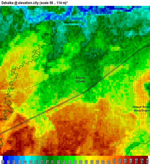
Below is the Elevation map of Dzhalka, which displays elevation range with different colors. Scale of the first map is from 58 to 114 m (190 to 374 ft) with average elevation of 87 meters (=285 ft) [note 1]
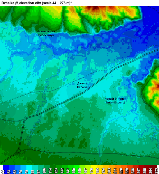
These maps also provides idea of topography and contour of this city, they are displayed at different zoom levels. More info about maps, scale and edge coordinates you can find below images.
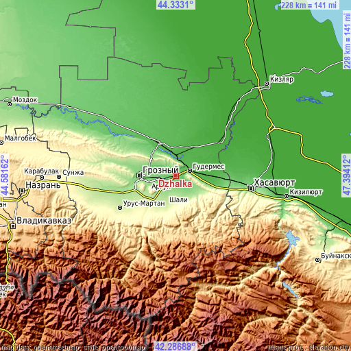
| \ | Map #1 | Map #2 | Topo.Map |
| Scale [m] | 58..114 m | 44..273 m | × |
| Scale [ft] | 190..374 ft | 144..896 ft | × |
| Average | 87 m = 285 ft | 98.6 m = 323 ft | × |
| Width | 7.11 km = 4.4 mi | 14.22 km = 8.8 mi | 227.5 km = 141.4 mi |
| Height | 7.11 km = 4.4 mi | 14.22 km = 8.8 mi | 227.5 km = 141.4 mi |
| ↑Max Latitude | 43.350564° | 43.382511° | 44.3331° |
| Latitude at center | 43.3186° | 43.3186° | 43.3186° |
| ↓Min Latitude | 43.286619° | 43.254622° | 42.28688° |
| ← Min Longitude | 45.943925° | 45.899979° | 44.58162° |
| Longitude center | 45.98787° | 45.98787° | 45.98787° |
| →Max Longitude | 46.031815° | 46.075761° | 47.39412° |
Nearby cities:
Cities around Dzhalka sort by population:
• Gudermes elevation 58 m
10.4 km,  70°
70°
• Argun 111 m
9.5 km,  255°
255°
• Kurchaloy 169 m
15.3 km,  147°
147°
• Avtury 248 m
17.3 km,  176°
176°
• Tsotsin-Yurt 133 m
8.6 km,  173°
173°
• Mesker-Yurt 135 m
9.9 km,  221°
221°
• Mayrtup 189 m
17.3 km,  137°
137°
• Germenchuk 188 m
15.7 km,  200°
200°
• Khankala 127 m
18.9 km, 264°
• Ilaskhan-Yurt 121 m
10.2 km,  115°
115°
• Petropavlovskaya 113 m
14.7 km,  297°
297°
• Belgatoy 199 m
19.1 km, 221°
Multilingual:
 En español:
Dzhalka elevación 84 m.
 En France:
Dzhalka élévation 84 m.


Sources and notes:
- [note 1] Map square and city borders are not equal. Map elevation data is calculated only from area inside that square.
- [src 1] Elevation data from geonames database provided with same terms of usage.
- [src 2] The elevation map of Dzhalka is generated using elevation data from NASA's 3 arcsec (90m) resolution SRTM data.
- [src 3] Base (background) map © OpenStreetMap contributors tiles are generated by Geofabrik and OpenTopoMap.
Copyright & License:
This Dzhalka Elevation Map is licensed under CC BY-SA. You may reuse any part from this page, if you give a proper credit by linking to this URL:
 More info on terms of use page.