Iksha elevation
Iksha (Moscow Oblast), Russia elevation is 195 meters and Iksha elevation in feet is 640 ft above sea level [src 1]. Iksha is a populated place (feature code) with elevation that is 4 meters (13 ft) smaller than average city elevation in Russia.
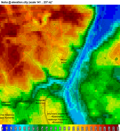
Below is the Elevation map of Iksha, which displays elevation range with different colors. Scale of the first map is from 141 to 237 m (463 to 778 ft) with average elevation of 192.2 meters (=631 ft) [note 1]
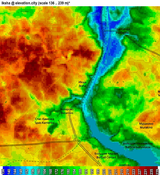
These maps also provides idea of topography and contour of this city, they are displayed at different zoom levels. More info about maps, scale and edge coordinates you can find below images.
| \ | Map #1 | Map #2 | Topo.Map |
| Scale [m] | 141..237 m | 136..239 m | × |
| Scale [ft] | 463..778 ft | 446..784 ft | × |
| Average | 192.2 m = 631 ft | 194.6 m = 638 ft | × |
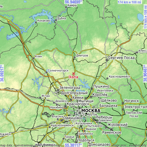
| Width | 5.44 km = 3.4 mi | 10.88 km = 6.8 mi | 174.1 km = 108.2 mi |
| Height | 5.44 km = 3.4 mi | 10.88 km = 6.8 mi | 174.1 km = 108.2 mi |
| ↑Max Latitude | 56.196497° | 56.220938° | 56.94695° |
| Latitude at center | 56.17204° | 56.17204° | 56.17204° |
| ↓Min Latitude | 56.147568° | 56.12308° | 55.38117° |
| ← Min Longitude | 37.454475° | 37.410529° | 36.09217° |
| Longitude center | 37.49842° | 37.49842° | 37.49842° |
| →Max Longitude | 37.542365° | 37.586311° | 38.90467° |
Nearby cities:
Cities around Iksha sort by population:
• Lobnya elevation 192 m
18.1 km,  183°
183°
• Dmitrov 138 m
19.3 km,  4°
4°
• Yakhroma 130 m
14.3 km,  356°
356°
• Nekrasovskiy 196 m
8.7 km, 179°
• Sheremet’yevskiy 180 m
21.8 km, 180°
• Dedenëvo 168 m
8 km,  8°
8°
• Marfino 184 m
11.7 km,  161°
161°
• Lugovaya 207 m
13.6 km, 183°
• Yel’digino 179 m
20.7 km,  107°
107°
• Podosinki 161 m
5.1 km,  36°
36°
• Poselok Turisticheskogo pansionata "Klyazminskoe vodohranilische" 172 m
22.4 km,  151°
151°
• Yermolino 197 m
2.6 km,  189°
189°
Multilingual:
 En español:
Iksha elevación 195 m.
 En France:
Iksha élévation 195 m.


Sources and notes:
- [note 1] Map square and city borders are not equal. Map elevation data is calculated only from area inside that square.
- [src 1] Elevation data from geonames database provided with same terms of usage.
- [src 2] The elevation map of Iksha is generated using elevation data from NASA's 3 arcsec (90m) resolution SRTM data.
- [src 3] Base (background) map © OpenStreetMap contributors tiles are generated by Geofabrik and OpenTopoMap.
Copyright & License:
This Iksha Elevation Map is licensed under CC BY-SA. You may reuse any part from this page, if you give a proper credit by linking to this URL:
 More info on terms of use page.