Sheremet’yevskiy elevation
Sheremet’yevskiy (Moscow Oblast), Russia elevation is 180 meters and Sheremet’yevskiy elevation in feet is 591 ft above sea level [src 1]. Sheremet’yevskiy is a populated place (feature code) with elevation that is 19 meters (62 ft) smaller than average city elevation in Russia.
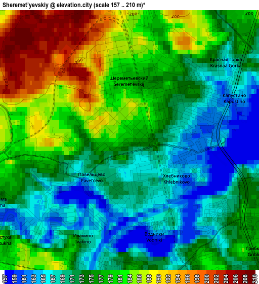
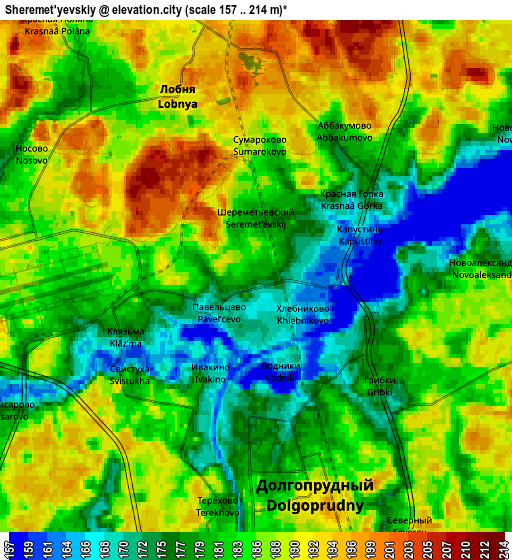
Below is the Elevation map of Sheremet’yevskiy, which displays elevation range with different colors. Scale of the first map is from 157 to 210 m (515 to 689 ft) with average elevation of 176.7 meters (=580 ft) [note 1]
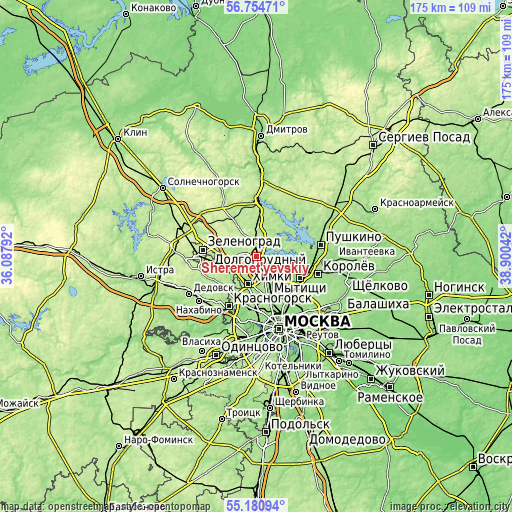
These maps also provides idea of topography and contour of this city, they are displayed at different zoom levels. More info about maps, scale and edge coordinates you can find below images.
| \ | Map #1 | Map #2 | Topo.Map |
| Scale [m] | 157..210 m | 157..214 m | × |
| Scale [ft] | 515..689 ft | 515..702 ft | × |
| Average | 176.7 m = 580 ft | 183.4 m = 602 ft | × |
| Width | 5.47 km = 3.4 mi | 10.94 km = 6.8 mi | 175 km = 108.7 mi |
| Height | 5.47 km = 3.4 mi | 10.94 km = 6.8 mi | 175 km = 108.7 mi |
| ↑Max Latitude | 56.000411° | 56.024977° | 56.75471° |
| Latitude at center | 55.97583° | 55.97583° | 55.97583° |
| ↓Min Latitude | 55.951233° | 55.92662° | 55.18094° |
| ← Min Longitude | 37.450225° | 37.406279° | 36.08792° |
| Longitude center | 37.49417° | 37.49417° | 37.49417° |
| →Max Longitude | 37.538115° | 37.582061° | 38.90042° |
Nearby cities:
Cities around Sheremet’yevskiy sort by population:
• Khimki elevation 185 m
9.6 km,  204°
204°
• Severnyy 186 m
5.6 km,  142°
142°
• Vostochnoe Degunino 174 m
11.4 km,  159°
159°
• Lianozovo 168 m
10.4 km,  146°
146°
• Dolgoprudnyy 173 m
3 km,  170°
170°
• Lobnya 192 m
3.8 km,  348°
348°
• Vagonoremont 177 m
9.1 km, 157°
• Novopodrezkovo 190 m
10.2 km,  246°
246°
• Marfino 184 m
11.5 km,  20°
20°
• Lugovaya 207 m
8.3 km,  355°
355°
• Povedniki 195 m
6.6 km,  95°
95°
• Poselok Turisticheskogo pansionata "Klyazminskoe vodohranilische" 172 m
11.3 km,  79°
79°
Multilingual:
 En español:
Sheremet’yevskiy elevación 180 m.
 En France:
Sheremet’yevskiy élévation 180 m.
 Auf Deutsch:
Sheremet’yevskiy höhe über dem Meeresspiegel ist 180 m.

Sources and notes:
- [note 1] Map square and city borders are not equal. Map elevation data is calculated only from area inside that square.
- [src 1] Elevation data from geonames database provided with same terms of usage.
- [src 2] The elevation map of Sheremet’yevskiy is generated using elevation data from NASA's 3 arcsec (90m) resolution SRTM data.
- [src 3] Base (background) map © OpenStreetMap contributors tiles are generated by Geofabrik and OpenTopoMap.
Copyright & License:
This Sheremet’yevskiy Elevation Map is licensed under CC BY-SA. You may reuse any part from this page, if you give a proper credit by linking to this URL:
 More info on terms of use page.