Kaluga elevation
Kaluga, Russia elevation is 200 meters and Kaluga elevation in feet is 656 ft above sea level [src 1]. Kaluga is a seat of a first-order administrative division (feature code) with elevation that is 1 meters (3 ft) bigger than average city elevation in Russia.
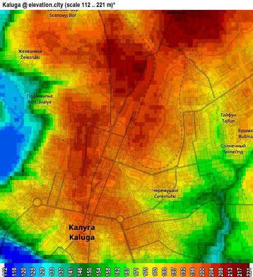
Below is the Elevation map of Kaluga, which displays elevation range with different colors. Scale of the first map is from 112 to 221 m (367 to 725 ft) with average elevation of 182.2 meters (=598 ft) [note 1]
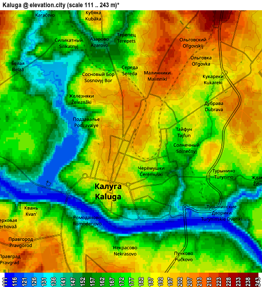
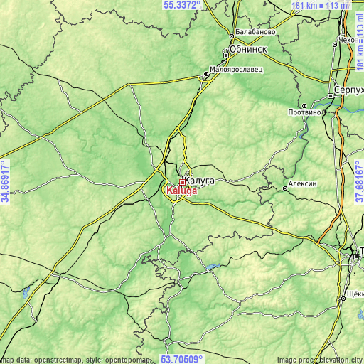
These maps also provides idea of topography and contour of this city, they are displayed at different zoom levels. More info about maps, scale and edge coordinates you can find below images.
| \ | Map #1 | Map #2 | Topo.Map |
| Scale [m] | 112..221 m | 111..243 m | × |
| Scale [ft] | 367..725 ft | 364..797 ft | × |
| Average | 182.2 m = 598 ft | 176.1 m = 578 ft | × |
| Width | 5.67 km = 3.5 mi | 11.34 km = 7 mi | 181.5 km = 112.8 mi |
| Height | 5.67 km = 3.5 mi | 11.34 km = 7 mi | 181.5 km = 112.8 mi |
| ↑Max Latitude | 54.554793° | 54.58027° | 55.3372° |
| Latitude at center | 54.5293° | 54.5293° | 54.5293° |
| ↓Min Latitude | 54.503791° | 54.478266° | 53.70509° |
| ← Min Longitude | 36.231475° | 36.187529° | 34.86917° |
| Longitude center | 36.27542° | 36.27542° | 36.27542° |
| →Max Longitude | 36.319365° | 36.363311° | 37.68167° |
Nearby cities:
Cities around Kaluga sort by population:
• Tovarkovo elevation 160 m
27.2 km,  306°
306°
• Vorotynsk 134 m
18.6 km,  232°
232°
• Polotnyanyy Zavod 152 m
29.2 km,  317°
317°
• Detchino 161 m
31.2 km,  3°
3°
• Ferzikovo 230 m
31.1 km,  92°
92°
• Babynino 210 m
36 km,  245°
245°
• Kurovskoye 163 m
17.7 km,  274°
274°
• Peremyshl’ 148 m
30.5 km,  194°
194°
• Zhiletovo 198 m
24.4 km, 318°
• Pyatovskiy 193 m
22.7 km, 321°
• Mstikhino 154 m
10.1 km,  289°
289°
• Dvortsy 132 m
20.4 km,  298°
298°
Multilingual:
 En español:
Kaluga elevación 200 m.
 En France:
Kalouga élévation 200 m.


Sources and notes:
- [note 1] Map square and city borders are not equal. Map elevation data is calculated only from area inside that square.
- [src 1] Elevation data from geonames database provided with same terms of usage.
- [src 2] The elevation map of Kaluga is generated using elevation data from NASA's 3 arcsec (90m) resolution SRTM data.
- [src 3] Base (background) map © OpenStreetMap contributors tiles are generated by Geofabrik and OpenTopoMap.
Copyright & License:
This Kaluga Elevation Map is licensed under CC BY-SA. You may reuse any part from this page, if you give a proper credit by linking to this URL:
 More info on terms of use page.