Kideksha elevation
Kideksha (Vladimir), Russia elevation is 112 meters and Kideksha elevation in feet is 367 ft above sea level [src 1]. Kideksha is a populated place (feature code) with elevation that is 87 meters (285 ft) smaller than average city elevation in Russia.
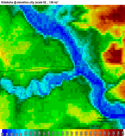
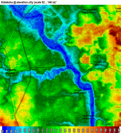
Below is the Elevation map of Kideksha, which displays elevation range with different colors. Scale of the first map is from 92 to 136 m (302 to 446 ft) with average elevation of 108.8 meters (=357 ft) [note 1]
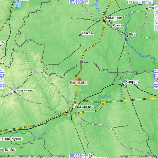
These maps also provides idea of topography and contour of this city, they are displayed at different zoom levels. More info about maps, scale and edge coordinates you can find below images.
| \ | Map #1 | Map #2 | Topo.Map |
| Scale [m] | 92..136 m | 92..146 m | × |
| Scale [ft] | 302..446 ft | 302..479 ft | × |
| Average | 108.8 m = 357 ft | 113.2 m = 371 ft | × |
| Width | 5.4 km = 3.4 mi | 10.81 km = 6.7 mi | 173 km = 107.5 mi |
| Height | 5.4 km = 3.4 mi | 10.81 km = 6.7 mi | 172.9 km = 107.4 mi |
| ↑Max Latitude | 56.448106° | 56.472386° | 57.19361° |
| Latitude at center | 56.42381° | 56.42381° | 56.42381° |
| ↓Min Latitude | 56.399498° | 56.375171° | 55.63811° |
| ← Min Longitude | 40.477515° | 40.433569° | 39.11521° |
| Longitude center | 40.52146° | 40.52146° | 40.52146° |
| →Max Longitude | 40.565405° | 40.609351° | 41.92771° |
Nearby cities:
Cities around Kideksha sort by population:
• Vladimir elevation 140 m
32.9 km,  193°
193°
• Kameshkovo 99 m
31 km,  104°
104°
• Suzdal’ 119 m
4.6 km,  268°
268°
• Stavrovo 116 m
45.1 km,  224°
224°
• Gavrilov Posad 123 m
28.8 km,  301°
301°
• Orgtrud 114 m
27.4 km,  167°
167°
• Bogolyubovo 131 m
25.9 km,  179°
179°
• Kommunar 101 m
35 km, 187°
• Petrovskiy 117 m
27.2 km,  333°
333°
• Nerl’ 123 m
27.8 km,  343°
343°
• Novki 93 m
35.4 km, 100°
• Novoye Leushino 130 m
42.6 km,  359°
359°
Multilingual:
 En español:
Kideksha elevación 112 m.
 En France:
Kideksha élévation 112 m.
 Auf Deutsch:
Kideksha höhe über dem Meeresspiegel ist 112 m.

Sources and notes:
- [note 1] Map square and city borders are not equal. Map elevation data is calculated only from area inside that square.
- [src 1] Elevation data from geonames database provided with same terms of usage.
- [src 2] The elevation map of Kideksha is generated using elevation data from NASA's 3 arcsec (90m) resolution SRTM data.
- [src 3] Base (background) map © OpenStreetMap contributors tiles are generated by Geofabrik and OpenTopoMap.
Copyright & License:
This Kideksha Elevation Map is licensed under CC BY-SA. You may reuse any part from this page, if you give a proper credit by linking to this URL:
 More info on terms of use page.