Konyshevka elevation
Konyshevka (Kursk), Russia elevation is 225 meters and Konyshevka elevation in feet is 738 ft above sea level [src 1]. Konyshevka is a populated place (feature code) with elevation that is 26 meters (85 ft) bigger than average city elevation in Russia.
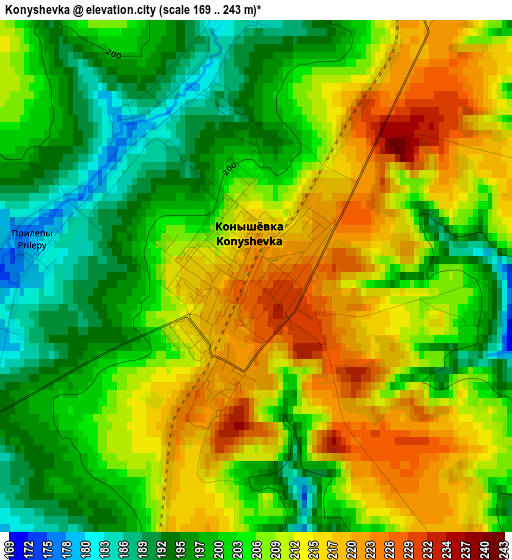
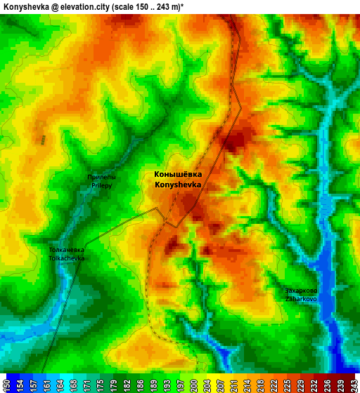
Below is the Elevation map of Konyshevka, which displays elevation range with different colors. Scale of the first map is from 169 to 243 m (554 to 797 ft) with average elevation of 206.1 meters (=676 ft) [note 1]
These maps also provides idea of topography and contour of this city, they are displayed at different zoom levels. More info about maps, scale and edge coordinates you can find below images.
| \ | Map #1 | Map #2 | Topo.Map |
| Scale [m] | 169..243 m | 150..243 m | × |
| Scale [ft] | 554..797 ft | 492..797 ft | × |
| Average | 206.1 m = 676 ft | 197.7 m = 649 ft | × |
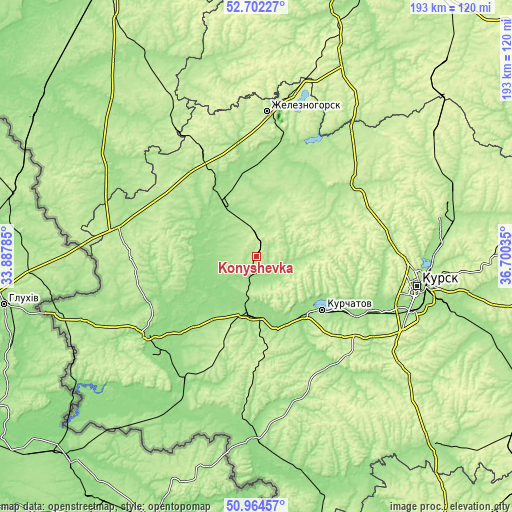
| Width | 6.04 km = 3.8 mi | 12.08 km = 7.5 mi | 193.2 km = 120 mi |
| Height | 6.04 km = 3.8 mi | 12.08 km = 7.5 mi | 193.2 km = 120 mi |
| ↑Max Latitude | 51.868943° | 51.896069° | 52.70227° |
| Latitude at center | 51.8418° | 51.8418° | 51.8418° |
| ↓Min Latitude | 51.814641° | 51.787465° | 50.96457° |
| ← Min Longitude | 35.250155° | 35.206209° | 33.88785° |
| Longitude center | 35.2941° | 35.2941° | 35.2941° |
| →Max Longitude | 35.338045° | 35.381991° | 36.70035° |
Nearby cities:
Cities around Konyshevka sort by population:
• Zheleznogorsk elevation 199 m
54.6 km,  5°
5°
• Kurchatov 166 m
31.9 km,  129°
129°
• L’govskiy 158 m
23.5 km,  182°
182°
• Ryl’sk 172 m
52.2 km,  233°
233°
• Korenëvo 146 m
54.7 km,  209°
209°
• Fatezh 200 m
47.7 km,  54°
54°
• Pryamitsyno 159 m
48.5 km,  115°
115°
• Khomutovka 193 m
51 km,  279°
279°
• Voroshnëvo 165 m
54 km,  112°
112°
• Mikhaylovka 185 m
43.7 km, 7°
• Ivanino 153 m
29.4 km,  138°
138°
• Pervoavgustovskiy 210 m
45.8 km,  339°
339°
Multilingual:
 En español:
Konyshevka elevación 225 m.
 En France:
Konyshevka élévation 225 m.
 Auf Deutsch:
Konyshevka höhe über dem Meeresspiegel ist 225 m.

Sources and notes:
- [note 1] Map square and city borders are not equal. Map elevation data is calculated only from area inside that square.
- [src 1] Elevation data from geonames database provided with same terms of usage.
- [src 2] The elevation map of Konyshevka is generated using elevation data from NASA's 3 arcsec (90m) resolution SRTM data.
- [src 3] Base (background) map © OpenStreetMap contributors tiles are generated by Geofabrik and OpenTopoMap.
Copyright & License:
This Konyshevka Elevation Map is licensed under CC BY-SA. You may reuse any part from this page, if you give a proper credit by linking to this URL:
 More info on terms of use page.