Presnenskiy elevation
Presnenskiy (Moscow), Russia elevation is 120 meters and Presnenskiy elevation in feet is 394 ft above sea level [src 1]. Presnenskiy is a section of populated place (feature code) with elevation that is 79 meters (259 ft) smaller than average city elevation in Russia.
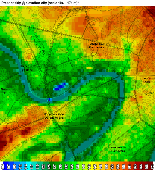
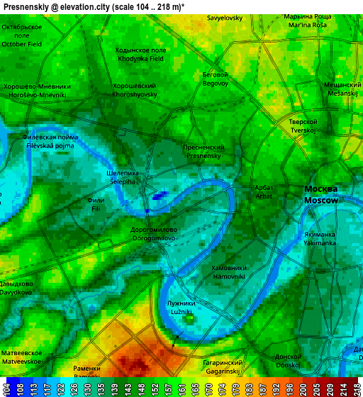
Below is the Elevation map of Presnenskiy, which displays elevation range with different colors. Scale of the first map is from 104 to 171 m (341 to 561 ft) with average elevation of 138.8 meters (=455 ft) [note 1]
These maps also provides idea of topography and contour of this city, they are displayed at different zoom levels. More info about maps, scale and edge coordinates you can find below images.
| \ | Map #1 | Map #2 | Topo.Map |
| Scale [m] | 104..171 m | 104..218 m | × |
| Scale [ft] | 341..561 ft | 341..715 ft | × |
| Average | 138.8 m = 455 ft | 146.9 m = 482 ft | × |
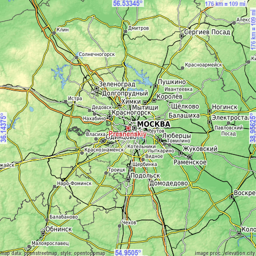
| Width | 5.5 km = 3.4 mi | 11 km = 6.8 mi | 176 km = 109.4 mi |
| Height | 5.5 km = 3.4 mi | 11 km = 6.8 mi | 176 km = 109.4 mi |
| ↑Max Latitude | 55.774725° | 55.799434° | 56.53345° |
| Latitude at center | 55.75° | 55.75° | 55.75° |
| ↓Min Latitude | 55.72526° | 55.700503° | 54.9505° |
| ← Min Longitude | 37.506055° | 37.462109° | 36.14375° |
| Longitude center | 37.55° | 37.55° | 37.55° |
| →Max Longitude | 37.593945° | 37.637891° | 38.95625° |
Nearby cities:
Cities around Presnenskiy sort by population:
• Moscow elevation 144 m
4.1 km,  86°
86°
• Khoroshëvo-Mnevniki 148 m
6.2 km,  307°
307°
• Novyye Cherëmushki 160 m
5.9 km,  159°
159°
• Fili 166 m
4.4 km,  267°
267°
• Dorogomilovo 127 m
1 km, 90°
• Sokol 159 m
5.9 km,  339°
339°
• Zamoskvorech’ye 128 m
5.5 km,  109°
109°
• Davydkovo 136 m
6 km,  233°
233°
• Leninskiye Gory 175 m
5.7 km,  169°
169°
• Vorob’yovo 177 m
3.9 km,  195°
195°
• Luzhniki 161 m
3.8 km,  176°
176°
• Kastanayevo 134 m
4.9 km,  220°
220°
Multilingual:
 En español:
Presnenskiy elevación 120 m.
 En France:
Presnenskiy élévation 120 m.
 Auf Deutsch:
Presnenskiy höhe über dem Meeresspiegel ist 120 m.
 На русском:
Красная Пресня, Пресненский высота над уровнем моря 120 м
Sources and notes:
- [note 1] Map square and city borders are not equal. Map elevation data is calculated only from area inside that square.
- [src 1] Elevation data from geonames database provided with same terms of usage.
- [src 2] The elevation map of Presnenskiy is generated using elevation data from NASA's 3 arcsec (90m) resolution SRTM data.
- [src 3] Base (background) map © OpenStreetMap contributors tiles are generated by Geofabrik and OpenTopoMap.
Copyright & License:
This Presnenskiy Elevation Map is licensed under CC BY-SA. You may reuse any part from this page, if you give a proper credit by linking to this URL:
 More info on terms of use page.