Meshcherino elevation
Meshcherino (Moscow Oblast), Russia elevation is 126 meters and Meshcherino elevation in feet is 413 ft above sea level [src 1]. Meshcherino is a populated place (feature code) with elevation that is 73 meters (240 ft) smaller than average city elevation in Russia.
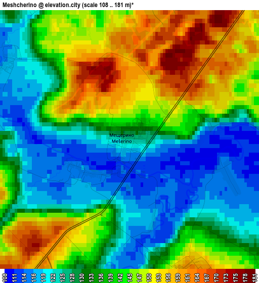
Below is the Elevation map of Meshcherino, which displays elevation range with different colors. Scale of the first map is from 108 to 181 m (354 to 594 ft) with average elevation of 136.8 meters (=449 ft) [note 1]
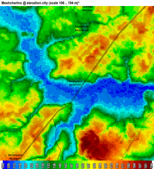
These maps also provides idea of topography and contour of this city, they are displayed at different zoom levels. More info about maps, scale and edge coordinates you can find below images.
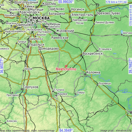
| \ | Map #1 | Map #2 | Topo.Map |
| Scale [m] | 108..181 m | 106..194 m | × |
| Scale [ft] | 354..594 ft | 348..636 ft | × |
| Average | 136.8 m = 449 ft | 144.7 m = 475 ft | × |
| Width | 5.58 km = 3.5 mi | 11.16 km = 6.9 mi | 178.5 km = 110.9 mi |
| Height | 5.58 km = 3.5 mi | 11.16 km = 6.9 mi | 178.5 km = 110.9 mi |
| ↑Max Latitude | 55.220745° | 55.245804° | 55.99026° |
| Latitude at center | 55.19567° | 55.19567° | 55.19567° |
| ↓Min Latitude | 55.170579° | 55.145473° | 54.3849° |
| ← Min Longitude | 38.316075° | 38.272129° | 36.95377° |
| Longitude center | 38.36002° | 38.36002° | 38.36002° |
| →Max Longitude | 38.403965° | 38.447911° | 39.76627° |
Nearby cities:
Cities around Meshcherino sort by population:
• Voskresensk elevation 124 m
23 km,  53°
53°
• Bronnitsy 131 m
25.8 km,  346°
346°
• Lopatinskiy 122 m
28.1 km, 54°
• Mikhnëvo 173 m
26.9 km,  253°
253°
• Troitskoye 150 m
16 km,  43°
43°
• Malino 157 m
15.1 km,  231°
231°
• Il’inskoye 172 m
26.2 km,  283°
283°
• Peski 114 m
25.6 km,  84°
84°
• Sychëvo 145 m
27 km,  123°
123°
• Raduzhnyy 114 m
24.3 km,  105°
105°
• Biorki 182 m
22.4 km,  135°
135°
• Pervomayskiy 163 m
24.1 km,  126°
126°
Multilingual:
 En español:
Meshcherino elevación 126 m.
 En France:
Meshcherino élévation 126 m.
 Auf Deutsch:
Meshcherino höhe über dem Meeresspiegel ist 126 m.

Sources and notes:
- [note 1] Map square and city borders are not equal. Map elevation data is calculated only from area inside that square.
- [src 1] Elevation data from geonames database provided with same terms of usage.
- [src 2] The elevation map of Meshcherino is generated using elevation data from NASA's 3 arcsec (90m) resolution SRTM data.
- [src 3] Base (background) map © OpenStreetMap contributors tiles are generated by Geofabrik and OpenTopoMap.
Copyright & License:
This Meshcherino Elevation Map is licensed under CC BY-SA. You may reuse any part from this page, if you give a proper credit by linking to this URL:
 More info on terms of use page.