Navoloki elevation
Navoloki (Ivanovo), Russia elevation is 122 meters and Navoloki elevation in feet is 400 ft above sea level [src 1]. Navoloki is a populated place (feature code) with elevation that is 77 meters (253 ft) smaller than average city elevation in Russia.
Below is the Elevation map of Navoloki, which displays elevation range with different colors. Scale of the first map is from 80 to 144 m (262 to 472 ft) with average elevation of 112.2 meters (=368 ft) [note 1]
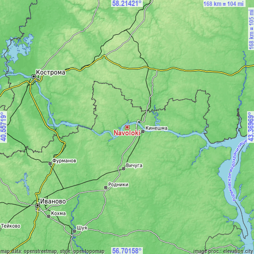
These maps also provides idea of topography and contour of this city, they are displayed at different zoom levels. More info about maps, scale and edge coordinates you can find below images.
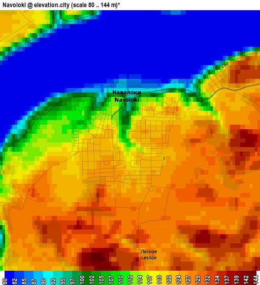
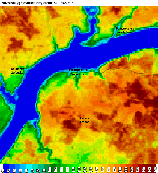
| \ | Map #1 | Map #2 | Topo.Map |
| Scale [m] | 80..144 m | 80..145 m | × |
| Scale [ft] | 262..472 ft | 262..476 ft | × |
| Average | 112.2 m = 368 ft | 114.4 m = 375 ft | × |
| Width | 5.26 km = 3.3 mi | 10.51 km = 6.5 mi | 168.2 km = 104.5 mi |
| Height | 5.26 km = 3.3 mi | 10.51 km = 6.5 mi | 168.2 km = 104.5 mi |
| ↑Max Latitude | 57.489346° | 57.512957° | 58.21421° |
| Latitude at center | 57.46572° | 57.46572° | 57.46572° |
| ↓Min Latitude | 57.442078° | 57.418421° | 56.70158° |
| ← Min Longitude | 41.919495° | 41.875549° | 40.55719° |
| Longitude center | 41.96344° | 41.96344° | 41.96344° |
| →Max Longitude | 42.007385° | 42.051331° | 43.36969° |
Nearby cities:
Cities around Navoloki sort by population:
• Kineshma elevation 109 m
10.3 km,  106°
106°
• Vichuga 141 m
28.2 km,  184°
184°
• Rodniki 147 m
42.5 km,  199°
199°
• Privolzhsk 119 m
41.4 km,  257°
257°
• Zavolzhsk 129 m
10.6 km,  79°
79°
• Staraya Vichuga 117 m
22.5 km,  193°
193°
• Ostrovskoye 136 m
41.3 km,  23°
23°
• Kamenka 99 m
13 km,  231°
231°
• Kuznechikha 124 m
35.6 km,  141°
141°
• Novopistsovo 102 m
17.3 km, 202°
• Plës 132 m
26.8 km,  268°
268°
• Zarechnyy 88 m
19.2 km,  88°
88°
Multilingual:
 En español:
Navoloki elevación 122 m.
 En France:
Navoloki élévation 122 m.
 Auf Deutsch:
Navoloki höhe über dem Meeresspiegel ist 122 m.

Sources and notes:
- [note 1] Map square and city borders are not equal. Map elevation data is calculated only from area inside that square.
- [src 1] Elevation data from geonames database provided with same terms of usage.
- [src 2] The elevation map of Navoloki is generated using elevation data from NASA's 3 arcsec (90m) resolution SRTM data.
- [src 3] Base (background) map © OpenStreetMap contributors tiles are generated by Geofabrik and OpenTopoMap.
Copyright & License:
This Navoloki Elevation Map is licensed under CC BY-SA. You may reuse any part from this page, if you give a proper credit by linking to this URL:
 More info on terms of use page.