Vichuga elevation
Vichuga (Ivanovo), Russia elevation is 141 meters and Vichuga elevation in feet is 463 ft above sea level [src 1]. Vichuga is a populated place (feature code) with elevation that is 58 meters (190 ft) smaller than average city elevation in Russia.
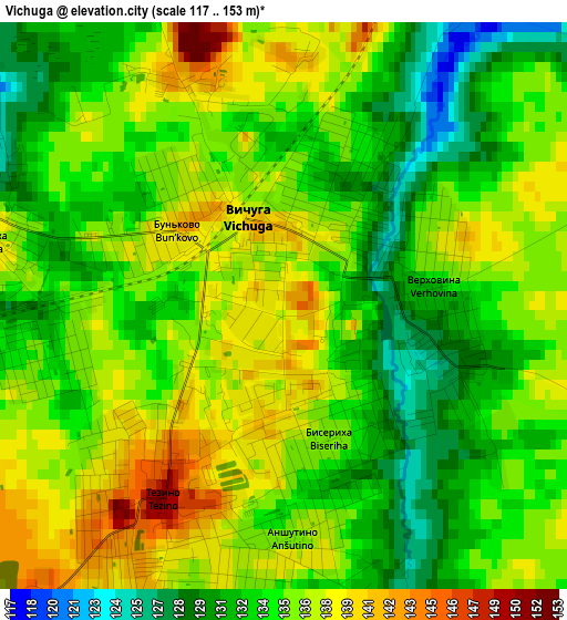
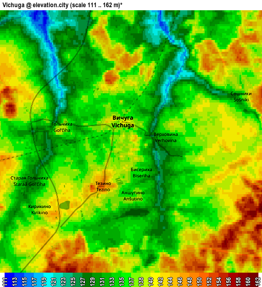
Below is the Elevation map of Vichuga, which displays elevation range with different colors. Scale of the first map is from 117 to 153 m (384 to 502 ft) with average elevation of 134.8 meters (=442 ft) [note 1]
These maps also provides idea of topography and contour of this city, they are displayed at different zoom levels. More info about maps, scale and edge coordinates you can find below images.
| \ | Map #1 | Map #2 | Topo.Map |
| Scale [m] | 117..153 m | 111..162 m | × |
| Scale [ft] | 384..502 ft | 364..531 ft | × |
| Average | 134.8 m = 442 ft | 136.5 m = 448 ft | × |
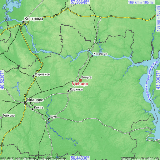
| Width | 5.29 km = 3.3 mi | 10.58 km = 6.6 mi | 169.4 km = 105.3 mi |
| Height | 5.29 km = 3.3 mi | 10.58 km = 6.6 mi | 169.3 km = 105.2 mi |
| ↑Max Latitude | 57.23655° | 57.260324° | 57.96645° |
| Latitude at center | 57.21276° | 57.21276° | 57.21276° |
| ↓Min Latitude | 57.188955° | 57.165135° | 56.44336° |
| ← Min Longitude | 41.886175° | 41.842229° | 40.52387° |
| Longitude center | 41.93012° | 41.93012° | 41.93012° |
| →Max Longitude | 41.974065° | 42.018011° | 43.33637° |
Nearby cities:
Cities around Vichuga sort by population:
• Kineshma elevation 109 m
27.9 km,  25°
25°
• Rodniki 147 m
17 km,  225°
225°
• Zavolzhsk 129 m
32.5 km,  22°
22°
• Navoloki 122 m
28.2 km,  4°
4°
• Staraya Vichuga 117 m
6.9 km,  333°
333°
• Kamenka 99 m
21.6 km,  337°
337°
• Kuznechikha 124 m
24.4 km,  89°
89°
• Lukh 109 m
29.8 km,  138°
138°
• Novopistsovo 102 m
13 km, 339°
• Plës 132 m
37 km,  317°
317°
• Kaminskiy 116 m
28.4 km,  256°
256°
• Zarechnyy 88 m
35.6 km,  36°
36°
Multilingual:
 En español:
Vichuga elevación 141 m.
 En France:
Vichuga élévation 141 m.


Sources and notes:
- [note 1] Map square and city borders are not equal. Map elevation data is calculated only from area inside that square.
- [src 1] Elevation data from geonames database provided with same terms of usage.
- [src 2] The elevation map of Vichuga is generated using elevation data from NASA's 3 arcsec (90m) resolution SRTM data.
- [src 3] Base (background) map © OpenStreetMap contributors tiles are generated by Geofabrik and OpenTopoMap.
Copyright & License:
This Vichuga Elevation Map is licensed under CC BY-SA. You may reuse any part from this page, if you give a proper credit by linking to this URL:
 More info on terms of use page.