Neklyudovo elevation
Neklyudovo (Nizhny Novgorod Oblast), Russia elevation is 76 meters and Neklyudovo elevation in feet is 249 ft above sea level [src 1]. Neklyudovo is a populated place (feature code) with elevation that is 123 meters (404 ft) smaller than average city elevation in Russia.
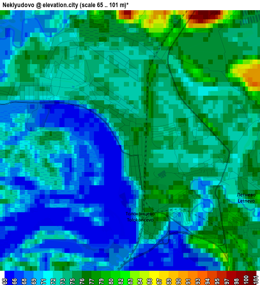
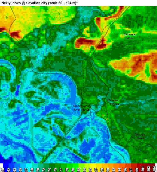
Below is the Elevation map of Neklyudovo, which displays elevation range with different colors. Scale of the first map is from 65 to 101 m (213 to 331 ft) with average elevation of 72.9 meters (=239 ft) [note 1]
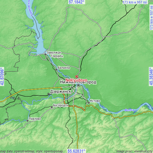
These maps also provides idea of topography and contour of this city, they are displayed at different zoom levels. More info about maps, scale and edge coordinates you can find below images.
| \ | Map #1 | Map #2 | Topo.Map |
| Scale [m] | 65..101 m | 60..104 m | × |
| Scale [ft] | 213..331 ft | 197..341 ft | × |
| Average | 72.9 m = 239 ft | 74.3 m = 244 ft | × |
| Width | 5.41 km = 3.4 mi | 10.81 km = 6.7 mi | 173 km = 107.5 mi |
| Height | 5.41 km = 3.4 mi | 10.81 km = 6.7 mi | 173 km = 107.5 mi |
| ↑Max Latitude | 56.438512° | 56.462799° | 57.1842° |
| Latitude at center | 56.41421° | 56.41421° | 56.41421° |
| ↓Min Latitude | 56.389892° | 56.365559° | 55.62831° |
| ← Min Longitude | 43.933265° | 43.889319° | 42.57096° |
| Longitude center | 43.97721° | 43.97721° | 43.97721° |
| →Max Longitude | 44.021155° | 44.065101° | 45.38346° |
Nearby cities:
Cities around Neklyudovo sort by population:
• Nizhniy Novgorod elevation 141 m
9.6 km,  170°
170°
• Novaya Balakhna 72 m
24.6 km,  290°
290°
• Bor 79 m
8.7 km,  136°
136°
• Bol’shoye Kozino 75 m
16.2 km,  265°
265°
• Linda 94 m
23.5 km,  17°
17°
• Lukino 76 m
21.6 km,  278°
278°
• Gorbatovka 78 m
22.5 km,  219°
219°
• Afonino 132 m
18.4 km,  156°
156°
• Zelyony Gorod 118 m
26.9 km, 167°
• Pervoye Maya 78 m
20 km, 270°
• Sitniki 75 m
7.1 km,  50°
50°
• Podnov’ye 106 m
14 km,  149°
149°
Multilingual:
 En español:
Neklyudovo elevación 76 m.
 En France:
Neklyudovo élévation 76 m.
 Auf Deutsch:
Neklyudovo höhe über dem Meeresspiegel ist 76 m.

Sources and notes:
- [note 1] Map square and city borders are not equal. Map elevation data is calculated only from area inside that square.
- [src 1] Elevation data from geonames database provided with same terms of usage.
- [src 2] The elevation map of Neklyudovo is generated using elevation data from NASA's 3 arcsec (90m) resolution SRTM data.
- [src 3] Base (background) map © OpenStreetMap contributors tiles are generated by Geofabrik and OpenTopoMap.
Copyright & License:
This Neklyudovo Elevation Map is licensed under CC BY-SA. You may reuse any part from this page, if you give a proper credit by linking to this URL:
 More info on terms of use page.